
HOUSTON — Hurricane Beryl made landfall around 3:55 a.m. Monday near Matagorda, Texas. As the Houston area is battered with heavy rain and flooding, the Category 1 storm is continuing its path northward.
Director of the National Hurricane Center (NHC) Dr. Michael Brennan joined KHOU 11 Chief Meteorologist David Paul and KHOU 11 Meteorologist Chita Craft Monday morning talking about Beryl's path in the Houston area over the next several hours.
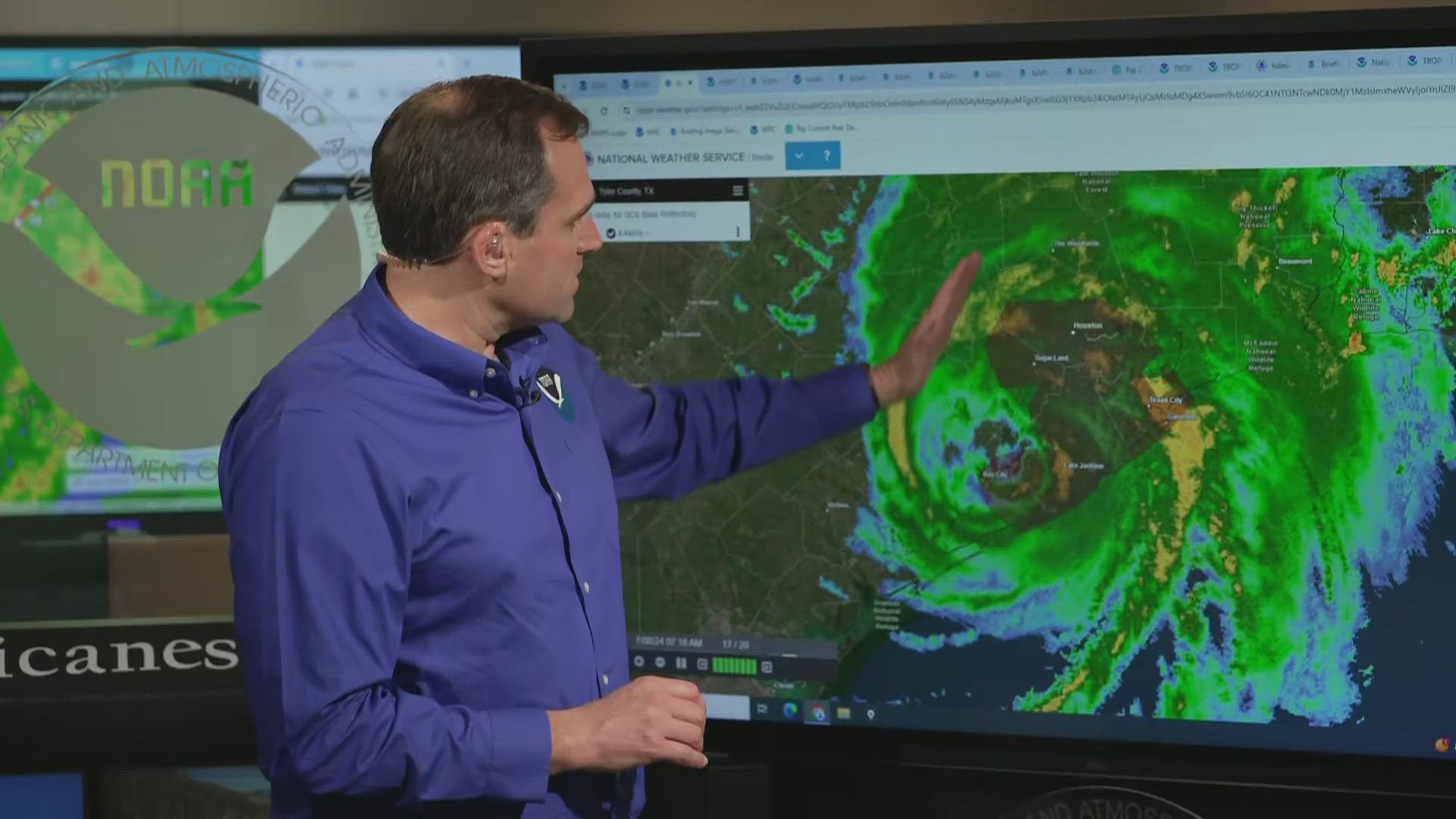
Dr. Brennan tells KHOU 11 that heavy rainfall is set to continue as the center of the storm is expected to move to the north and then the northeast later today.
"As that center stays, you know, to the near to the west of the Houston metro area, all that moisture on the east side is going to continue rotating in around it until the center passes to the north. So that heavy rainfall is going to continue. That's going to exacerbate the surge flooding that the water still piling into Galveston Bay with a strong onshore wind. So that combination of the surge and the rainfall is going to create some pretty dangerous conditions," Dr. Brennan said.
Threats of flash floods, tornadoes and high winds will also remain in effect for the immediate time being, but the storm's circulation is expected to wind now that it is over land, Dr. Brennan told KHOU.
"Part of the circulation still out over water, and actually some of the strongest winds we're seeing on radar back here in Matagorda, Brazoria counties along the coast in the in the sort of westerly flow to the south of the eye," Dr. Brennan said. "It'll take a little while for the circulation to gradually spin down. But you know, the peak winds do come down pretty quickly once you get over land and away from the immediate coastline, but the gusts are going to be pretty strong, and so you're going to still see those gusts up to or at hurricane force."