HOUSTON —
UPDATE: This page will no longer be updated. We are keeping updates on the tropics here.
____________________
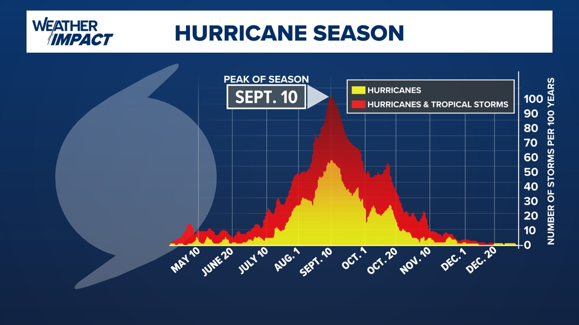
As we approach the official peak of hurricane season on September 10, there are several disturbances in the Atlantic basin that we are tracking.
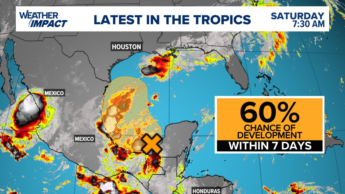
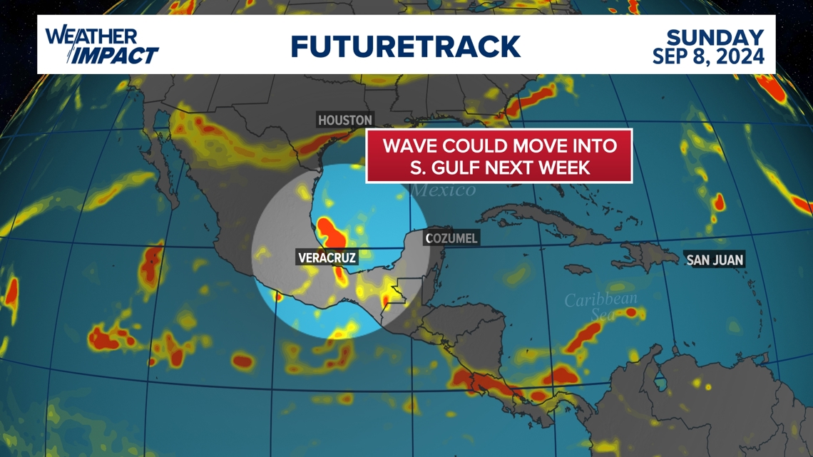
The one we are keeping an eye on is Disturbance No. 3 over the Yucatan peninsula. This tropical wave is moving westward and is producing disorganized showers and thunderstorms. We could see development as this system heads into the southern Gulf of Mexico. The National Hurricane Center is giving this system a 60% percent chance of development within the next seven days. and a 40% chance in the next two days.

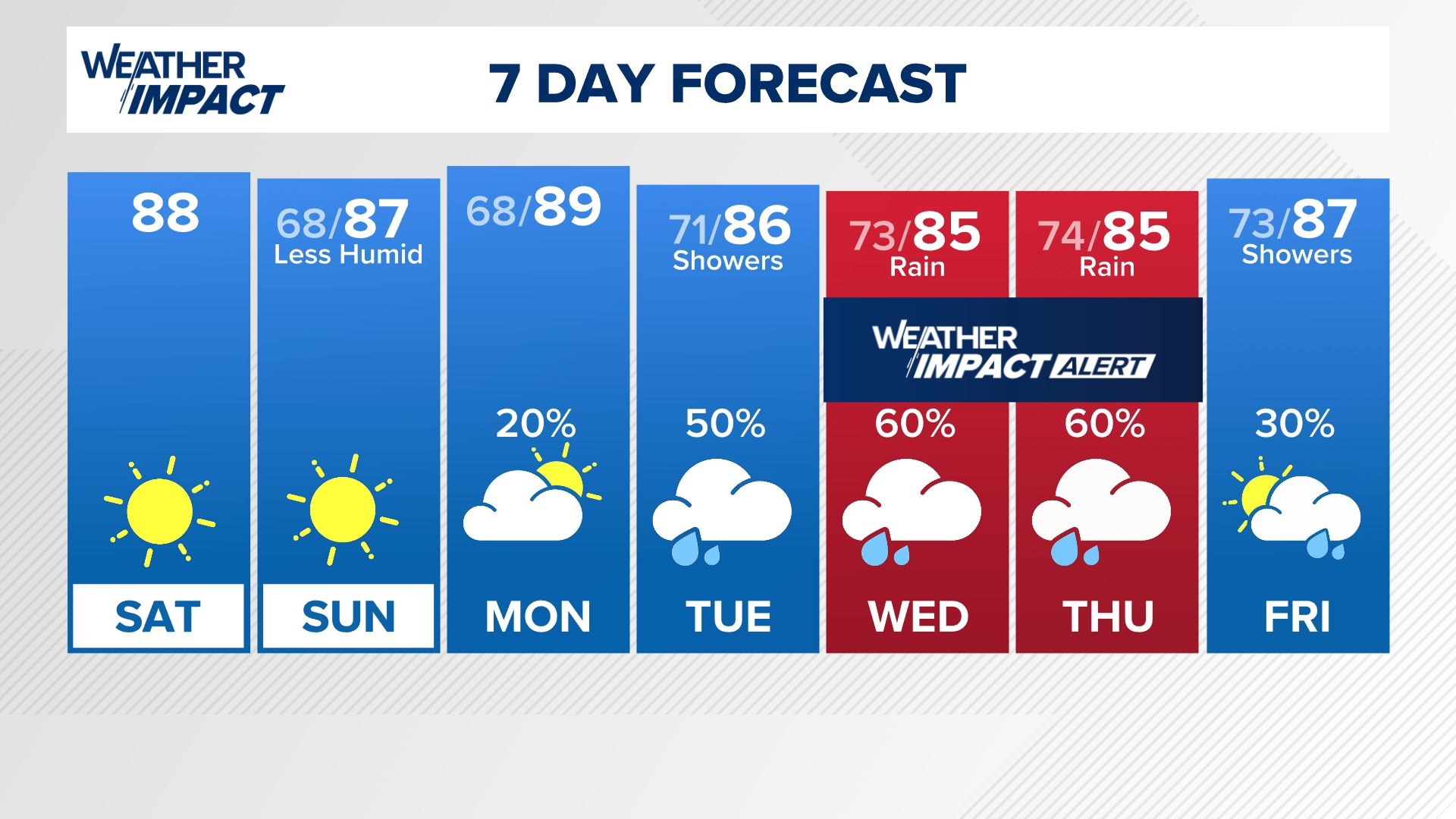
This weekend, a "fall" cold front will sweep through southeast Texas bringing a brief taste of "fall". While this will only be brief, the frontal boundary will quickly retreat back north of Houston. This will open the door for unsettled weather to return to southeast Texas beginning Tuesday afternoon and lasting through the end of the work week. Expect rain chances to return with heavier downpours along the coast.

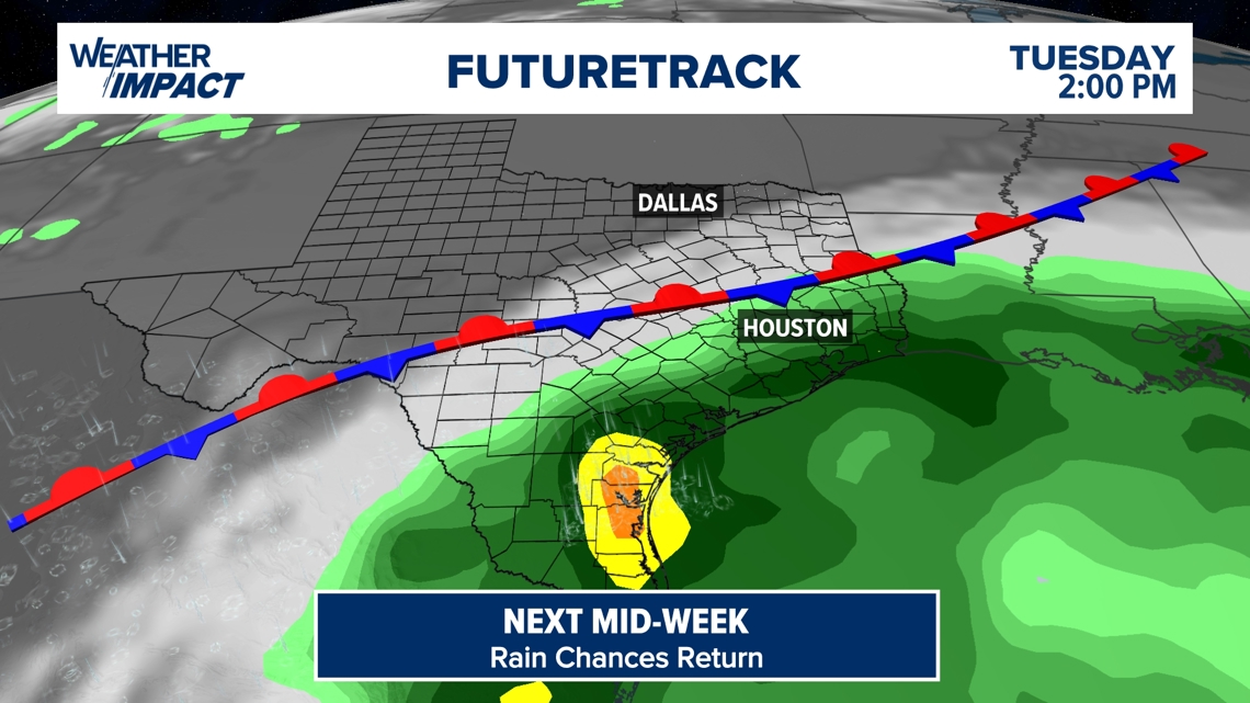
While there is still lots of uncertainty regarding Disturbance No. 3, it is something that we are going to have to keep an eye on. Despite development, rain chances will still ramp up for southeast Texas from Tuesday through the end of the work week, with heavier rain chances returning to the coast. It is also an important reminder that we are in the peak of hurricane season and that things could churn up quickly.

In the rest of the Atlantic basin, there are two other disturbances that are causing disorganized showers and storms. At the moment, there is a very low chance of development in the Atlantic Ocean.