HOUSTON —
UPDATE: Now that this has been designated as PTC 6, we will no longer update this page. Please check here for the very latest on this storm.
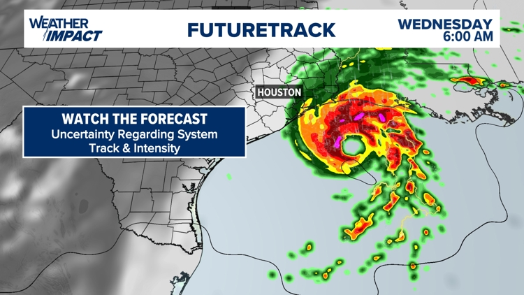
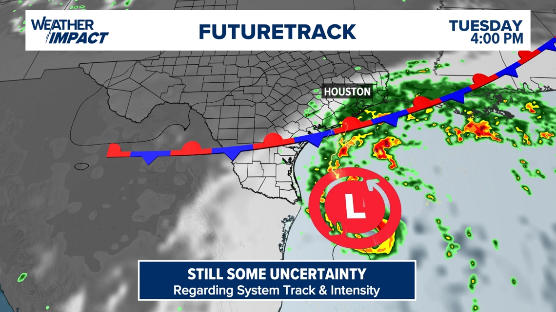
We're keeping a close eye on the Gulf of Mexico, where on Sunday, Potential Tropical Cyclone Six (PTC 6) formed. According to the latest update from the National Hurricane Center, the storm is expected to become a tropical storm by Monday and a hurricane before landfall.
The National Hurricane Center issued its first advisory for PTC6 on Sunday at 4 p.m. The system is still expected to strengthen on Tuesday. Its exact track is uncertain, but it is expected to push into the upper Texas and Louisiana coasts. There is a risk for life-threatening storm surge and damaging winds along the coast. Coastal flooding is the primary threat while the inland flood threat remains uncertain.
Tropical Storm Watches have been issued for a portion of northeastern Mexico. More may be needed for southern Texas soon. Now is the time to make sure you've got your hurricane plans in place.
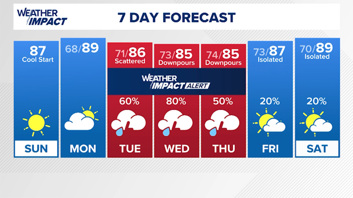
The KHOU 11 Weather Team has issued a Weather Impact Alert for Tuesday through Thursday.

According to the National Hurricane Center, strengthening is possible as it moves toward the Texas and Louisiana costs. Flooding and storm surge remain a concern beginning late Tuesday.

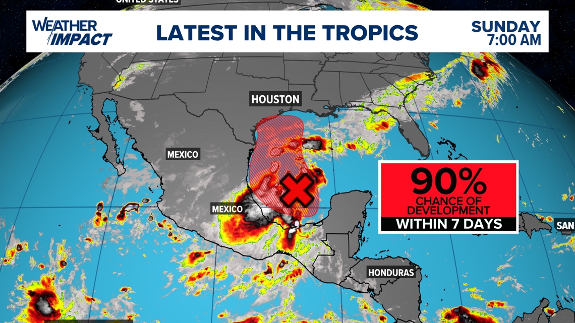
A fall front cooled us down this weekend. The frontal boundary will quickly retreat back north of Houston. This will open the door for unsettled weather to return to southeast Texas beginning Tuesday. Tropical Storm watches may be needed for portions of the northeastern coast of Mexico and southern Texas, according to the NWS.

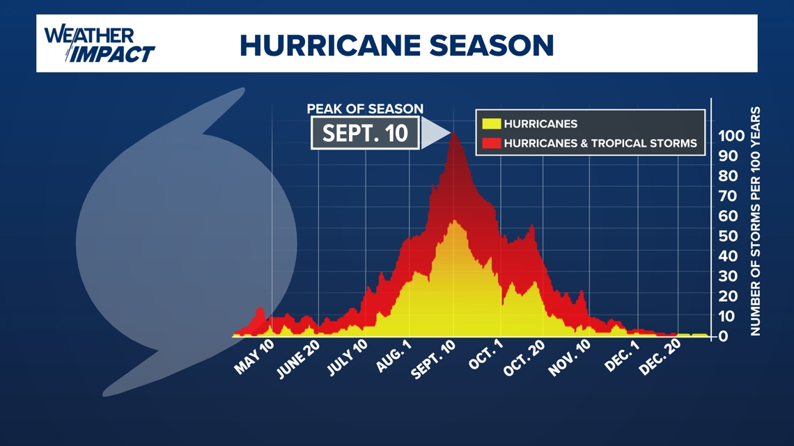
While there is still lots of uncertainty regarding this tropical wave, it is something that we are going to have to keep an eye on. Despite development, rain chances will still ramp up for southeast Texas from Tuesday evening through the end of the work week, with heavier rain chances returning to the coast. It is also an important reminder that we are in the peak of hurricane season and that things could churn up quickly.