
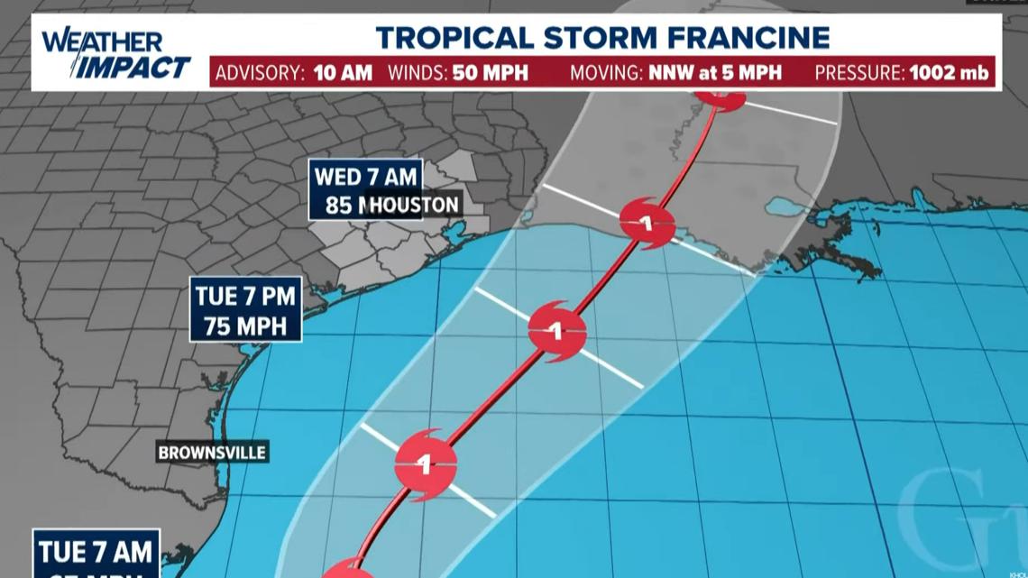
HOUSTON — We're keeping a close eye on the Gulf of Mexico after Potential Tropical Cyclone 6 strengthened into Tropical Storm Francine Monday morning. According to the latest update from the National Hurricane Center, the storm is expected to intensify with storm surge and hurricane watches issued for the Louisiana Coast.
With the 10 a.m. update, the National Hurricane Center's exact track for Francine remained uncertain. Overnight, it did shift east and is expected to push into the upper Texas and Louisiana coasts. It had maximum sustained winds of 50 mph and was moving to the NNW at 5 miles per hour. There is a risk of life-threatening storm surge and damaging winds along the coast. Coastal flooding is the primary threat, while the inland flood threat remains uncertain.
Right now, Francine in the southern Gulf of Mexico, is producing disorganized showers and thunderstorms.
Tropical Storm Watches have been issued for a portion of northeastern Mexico and extreme South Texas. Now is the time to make sure you've got your hurricane plans in place.
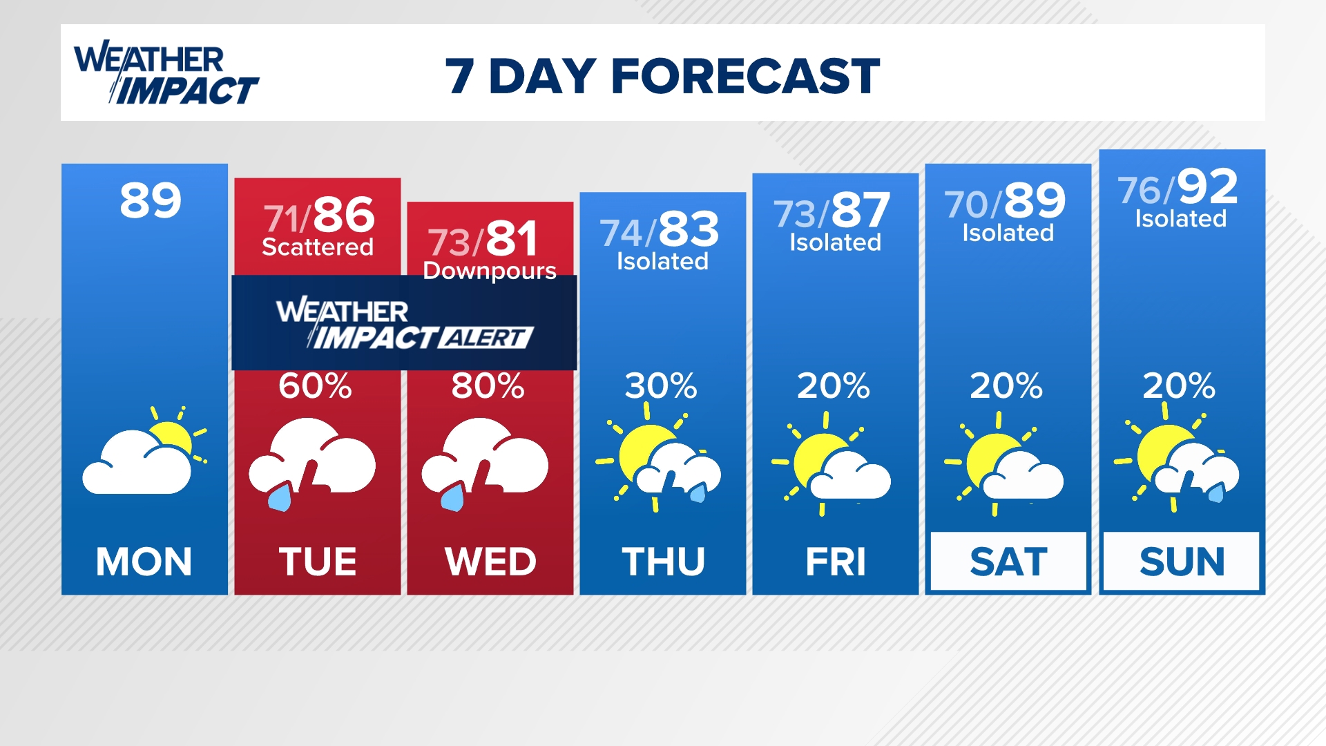
The KHOU 11 Weather Team has issued a Weather Impact Alert for Tuesday through Wednesday.

Forecast cone

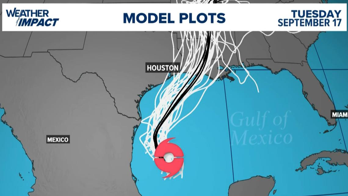
Spaghetti models

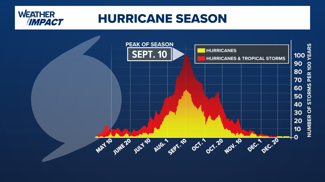
It is also an important reminder that we are in the peak of hurricane season and that things could churn up quickly.

Tracking the storm