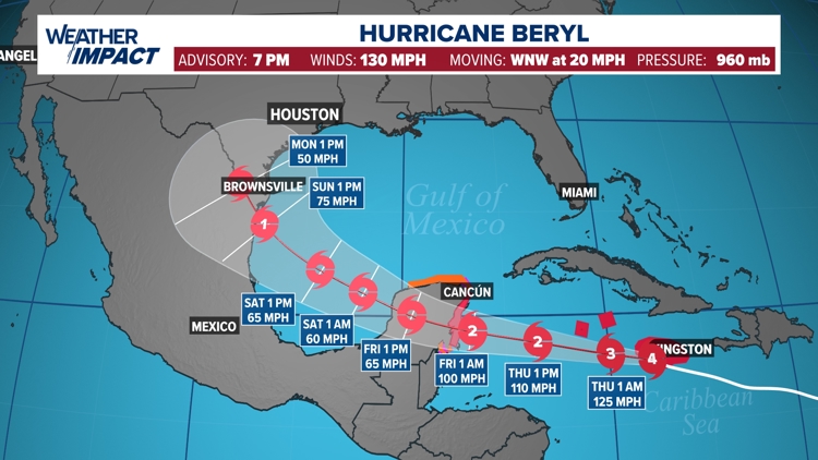
HOUSTON — Models are coming into agreement as to where Hurricane Beryl will head over the next couple of days.
They all suggest the storm will continue on its path through the southwest Caribbean and go over the Yucatan Peninsula on Friday. That's where it’ll lose steam once it interacts with land.
Models stay in agreement that it’ll make it into the southern Gulf of Mexico, but by Saturday, you’ll notice the models start to spread out. They spread out even further on Sunday and then Monday.
“That’s just a function of going further out in time in the forecast and the uncertainty just widens,” said KHOU 11 Chief Meteorologist David Paul. “That’s why you see the cone from the hurricane center widen out as you get to days four and five.”


That’s also why you should check the forecast multiple times a day. There’s still a lot of uncertainty as to where this storm will impact the Gulf Coast, as indicated by the forecast cone. When you look at the cone, don’t focus on the center line. All points within the cone have equal chances for landfall. And the further north of the center the storm goes within the cone, the more of an impact we’ll see in Southeast Texas.
If it does move to the right of the center line, we can also expect to be on what’s known as the “dirty side” of the storm. Meteorologist Kim Castro explains what that is.