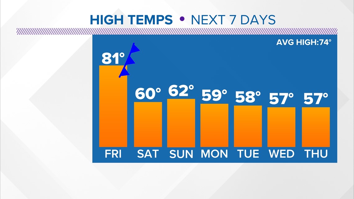
HOUSTON — Another beautiful October day here in the middle of November. Highs today more in line with what we would find in mid-October, in the lower to middle 80s. We 'should' be locking in highs in the mid-70s. Oh just wait, we go from one extreme to the other in short order!
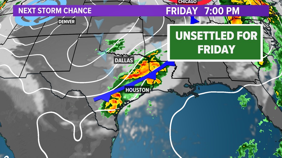
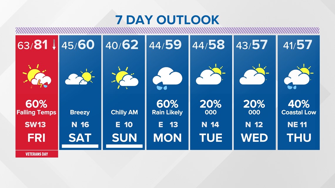
While highs this afternoon will be firmly in the 80s Friday will be a bit of a transition day to a much colder weather regime. The forecast 'high' is still in the lower 80s, HOWEVER that high comes right around lunch time before temperatures plummet by the evening. Why? A strong cold front is expected to move through during the afternoon shifting our winds and transporting a drastically colder air mass into the region.

Here's a look at the timing for the front.

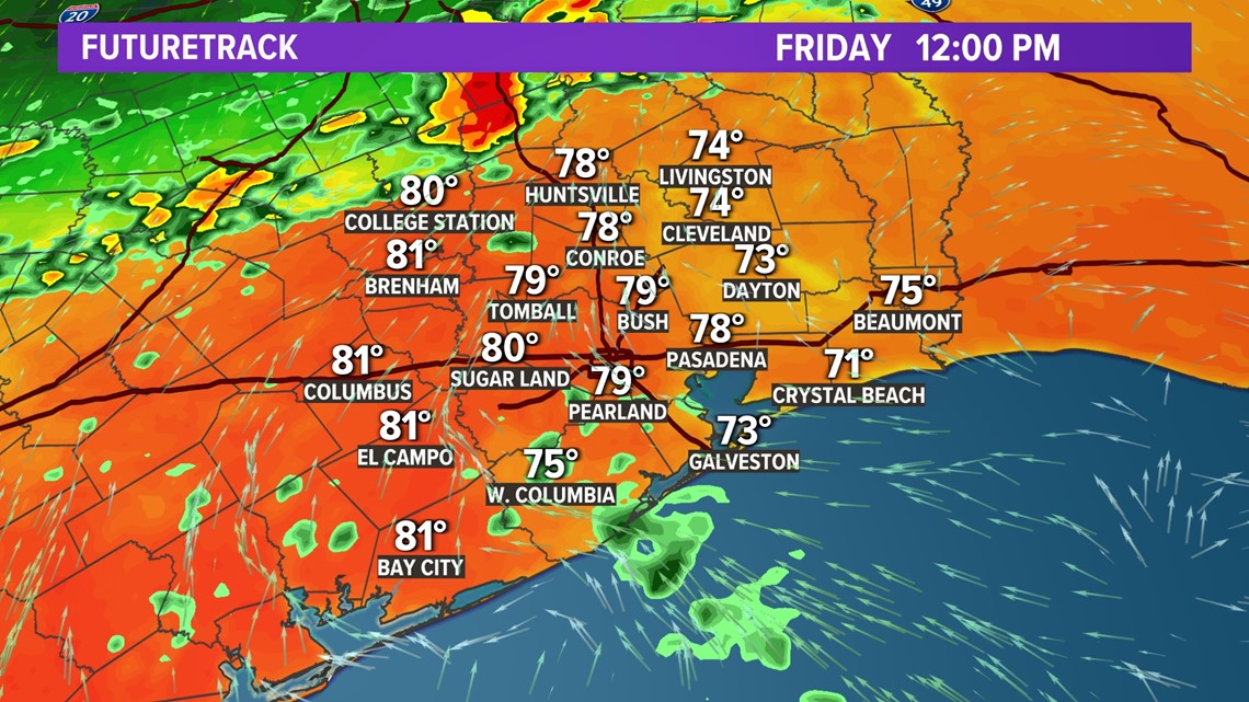
At the lunch hour we're warm, maybe with an isolated shower. These are likely close to our highs for the day.

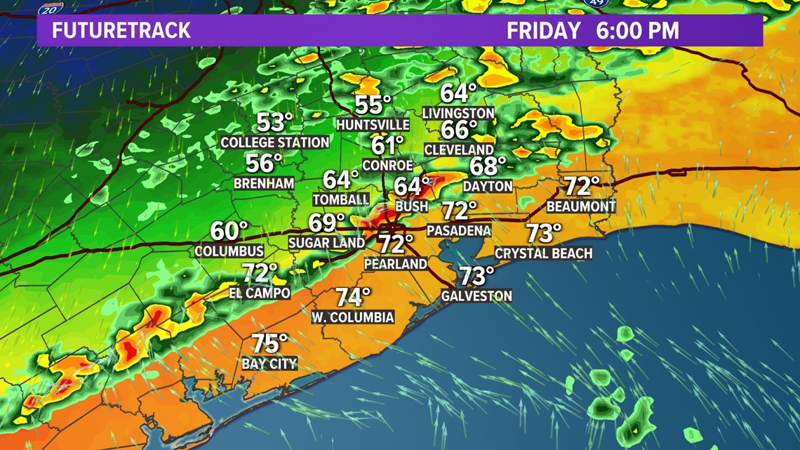
The evening commute on Friday may be tricky in some places as a line of showers and thunderstorms develops and moves through along the cold front. The Storm Prediction Center gives a low threat of severe weather with a Level 1 threat.
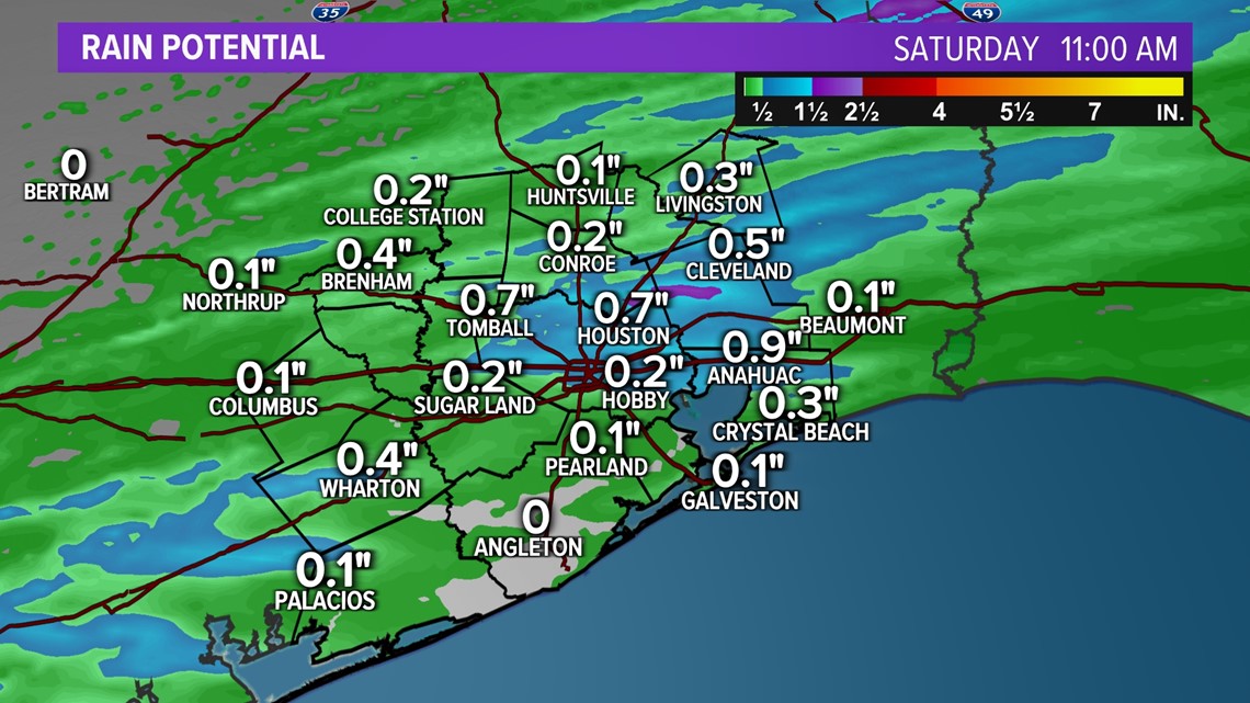
Showers linger into the first half of the overnight before clearing offshore. Rainfall totals won't amount to much with the frontal passage, we're looking mainly at under a 1/2" in most spots.

Once the cold air arrives Friday night it's sticking around for a while. Our trend is down into the 50s before leveling off by the middle of next week.

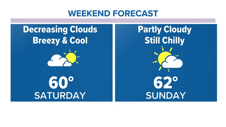
Weekend plans? We expect rain to not be a problem Saturday as any risk is before sunrise. It will be breezy and much colder though. Similar Sunday without the breeze.


Morning lows Sunday will be in the mid-30s north of the city! More rain works in to the forecast on Monday that may linger into Tuesday.
We're headed into a cooler and somewhat unsettled period through next week.

Check traffic
How is the parade affecting traffic? Take a look at the Houston traffic map.