_____
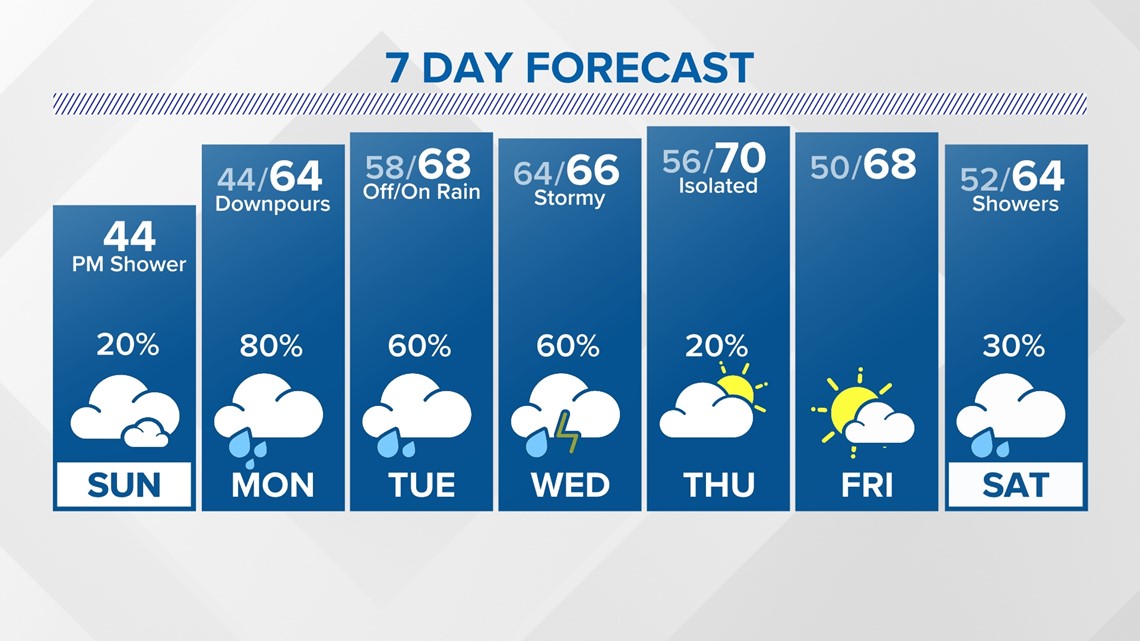
From extremely cold weather to extremely wet weather, the forecast this week calls for periods of heavy rain with an increased flooding risk for Southeast Texas.

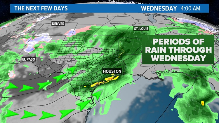
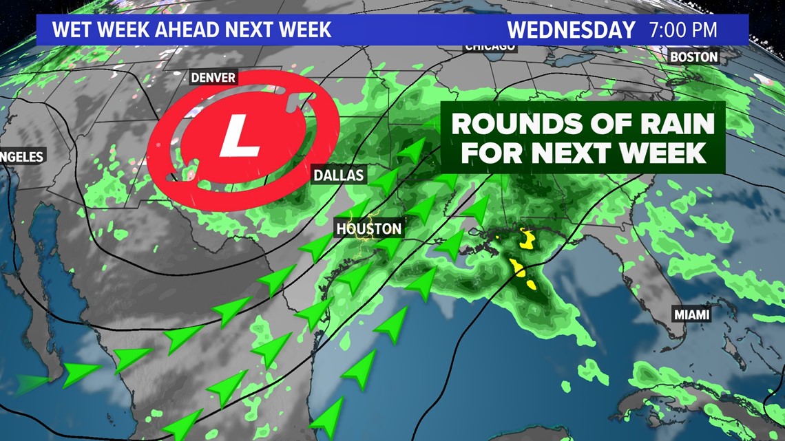
A dip in the jet stream will send a series of disturbances toward Southeast Texas fueling the chance for rain and thunderstorms beginning on Monday and lasting through Wednesday.
The problem with this week's weather setup is the amount of rain we are expected to see each day.
Weather models are indicating that this could be a significant rainfall event for Southeast Texas. There is the potential for 4 to 8+ inches of total rainfall accumulations through Wednesday, January 24.

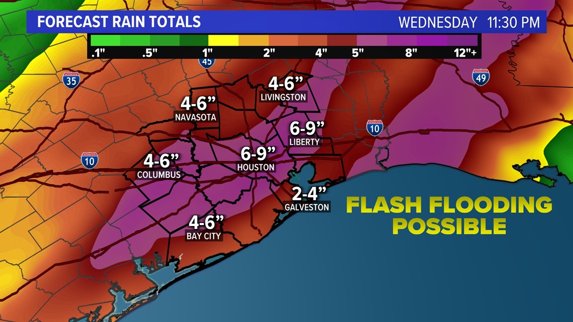
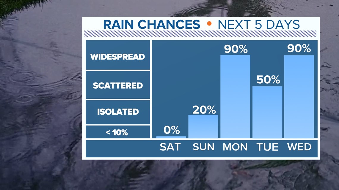
Our first disturbance next week will arrive late Sunday and last through Monday. We could see 3 to 4 inches of rainfall on Monday alone.

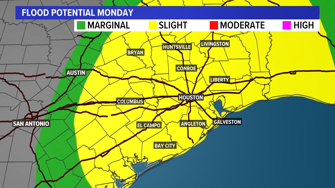
If too much rain falls in a short amount of time, the flooding threat will increase for the Houston area. The Storm Prediction Center has placed all of southeast Texas under a slight risk (2 out of 4) for flooding potential. The chance for rain will last through Friday.

The Pacific jet stream is taking a more southern track bringing moisture and disturbances toward southeast Texas. This is typical of the current El Niño climate pattern, where conditions along the Gulf Coast are wetter than usual with increased flooding. Every day next week has the chance for widespread rain, at times being heavy.

