
HOUSTON — The fall/winter severe weather season is underway across the Deep South and a strong cold front will bring the chance for strong storms to Southeast Texas this afternoon.
The greatest threat for severe weather will be north and east of the Houston metro area, but any spot is fair game to see a strong storm or two.
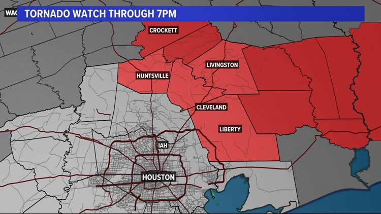
A Tornado Watch was issued for Polk, San Jacinto, Walker, and Liberty counties until 7 p.m. but it was canceled just before 4 p.m.
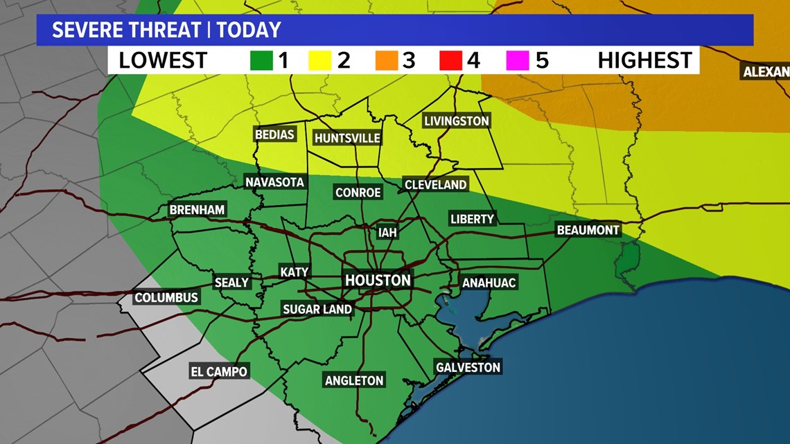
The Storm Prediction Center, or SPC, has placed much of Southeast Texas under a level 1 out of 5 severe threat (5 being the worst).


However, Grimes, Walker, Polk, San Jacinto, and northern Montgomery counties are in a level 2 threat.

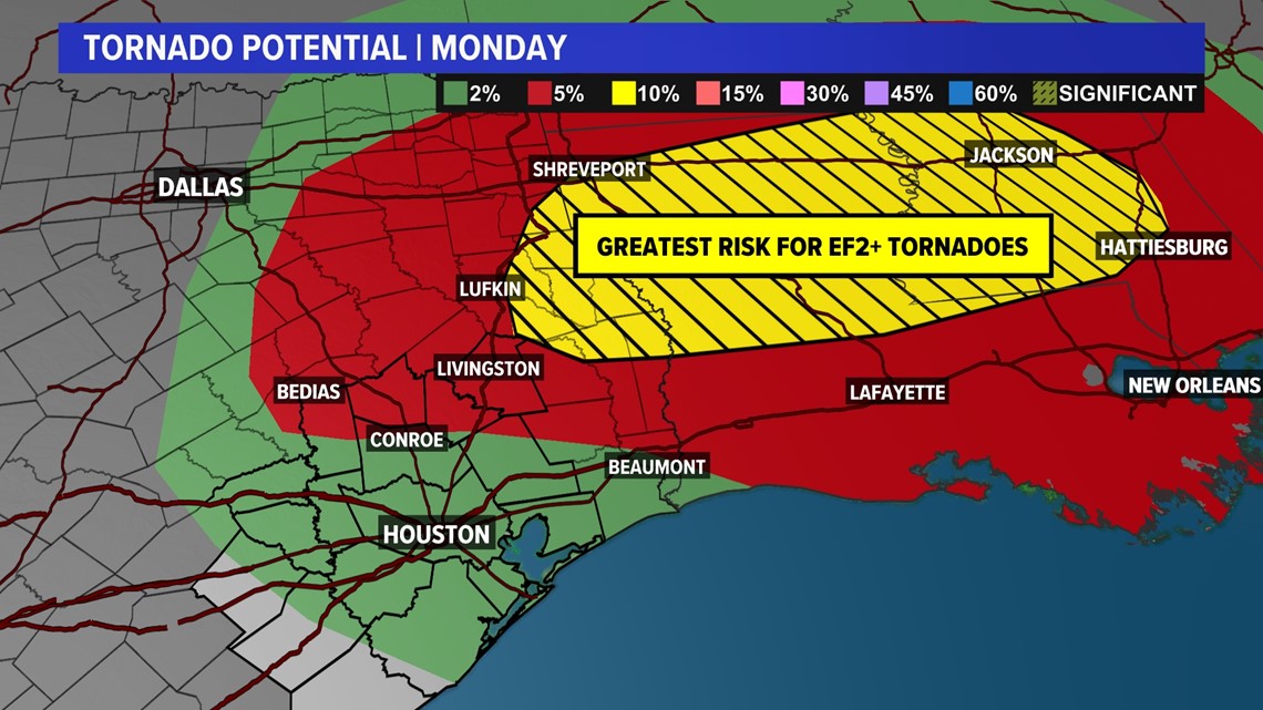
Overall, the greatest chance for a severe weather outbreak will remain through Louisiana and Mississippi.


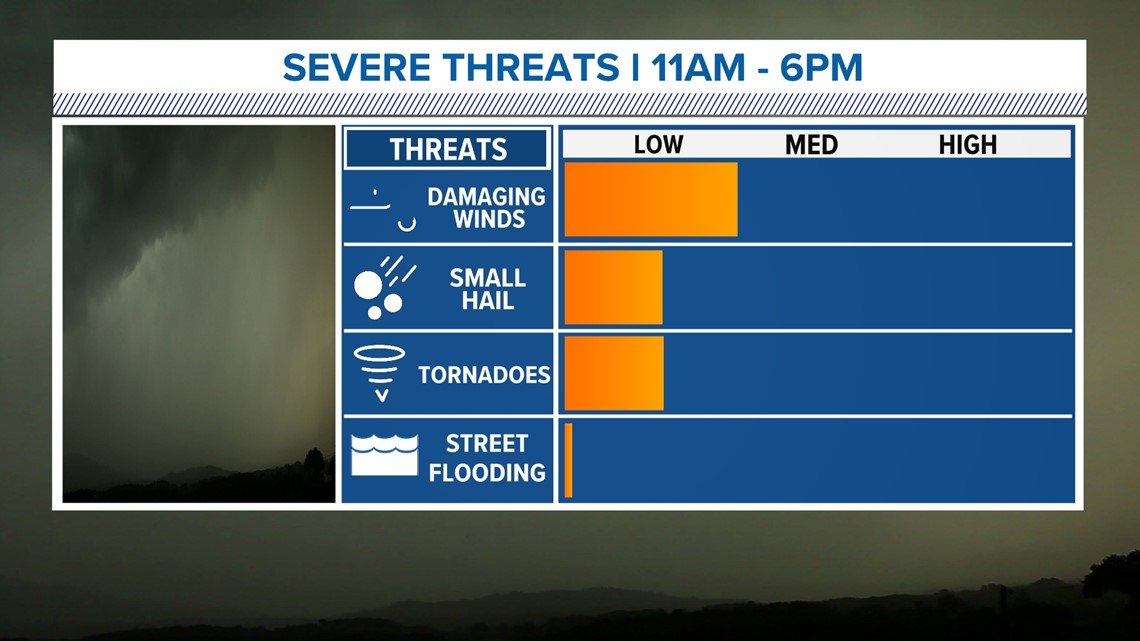
The main threats with any storms that do become severe will be the potential for wind damage, a fast-moving tornado, and large hail.
The timing for any storms will be from late morning through 6 p.m. before the worst of the weather moves to the east.

The greatest tornado threat is located across extreme East Texas, Louisiana, and Mississippi, where the level 3 severe weather threat is. Long-track and violent tornadoes are possible in these locations.

For Tuesday, the weather will turn very windy and colder in the wake of this cold front. Winds could gust around 30 to 40 mph for some locations through the afternoon.
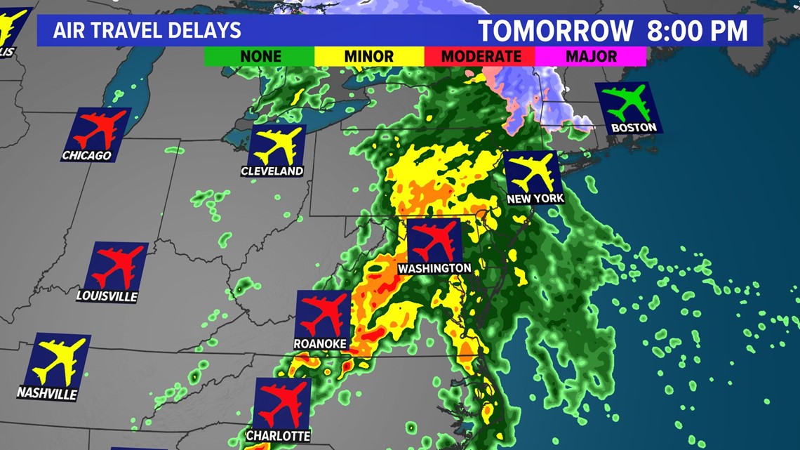
This storm system will continue to move east, making for difficult travel and potential delays up and down the East Coast for Tuesday. Plan ahead if you're traveling by air on Tuesday.

What do the SPC threat levels mean?
In order of risk and severity, here are the five risk categories and what each of them means, according to the SPC:
- Marginal (Dark green): This initial level means isolated severe thunderstorms are possible. Storms would likely be limited in how long they last, how much area they cover and how intense they become.
- Slight (Yellow): A slight risk means scattered severe storms are possible, though they'd likely be short-lived and not have widespread coverage over an area. While they might not be as persistent, these storms could still produce isolated intense conditions.
- Enhanced (Orange): Under enhanced conditions, numerous severe storms are possible. This level is marked by more persistent and widespread storms, a few of which could be intense.
- Moderate (Red): Jumping to a moderate risk level means more widespread severe storms are likely, and they could be long-lived and intense.
- High (Magenta): An area where a severe weather outbreak is expected from either numerous intense and long-tracked tornadoes or a long-lived derecho-producing thunderstorm complex that produces hurricane-force wind gusts and widespread damage. This risk is reserved for when high confidence exists in widespread coverage of severe weather with embedded instances of extreme severe (i.e., violent tornadoes or very damaging convective wind events).
What defines severe weather?
The National Weather Service defines a severe thunderstorm as any storm that produces one or more of the following elements:
- A tornado.
- Damaging winds or speeds of 58 mph (50 knots) or greater.
- Hail 1 inch in diameter or larger.
The SPC further defines significant severe thunderstorms as any storm that produce one or more of the following elements:
- A tornado produces EF2 or greater damage.
- Wind speeds of 75 mph (65 knots) or greater.
- Hail 2 inches in diameter or larger.
What is the SPC?
(Wording from the SPC website)
The Storm Prediction Center (SPC) is part of the National Weather Service (NWS) and the National Centers for Environmental Prediction (NCEP). Our mission is to provide timely and accurate forecasts and watches for severe thunderstorms and tornadoes over the contiguous United States. The SPC also monitors for hazardous winter weather and fire weather events and issues specific products for those hazards. We use the most advanced technology and scientific methods available to achieve this goal.
Follow the KHOU 11 Weather Team for updates:
