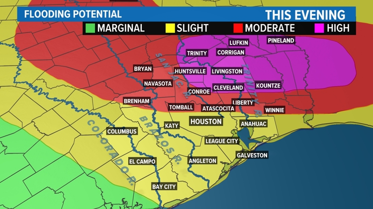
HOUSTON — The Storm Prediction Center has issued a High Risk for excessive rainfall and flooding for areas northeast of Houston.
The last time that a High Risk for excessive rainfall was issued for portions of Southeast Texas was back in 2021 when Hurricane Nicholas was threatening the coast. This threat is the highest threat risk that the Storm Prediction Center can issue on the excessive rainfall threat scale (4 out of 4).
For Thursday evening, the high risk includes areas northeast of Houston and includes portions of the San Jacinto and Trinity Rivers.
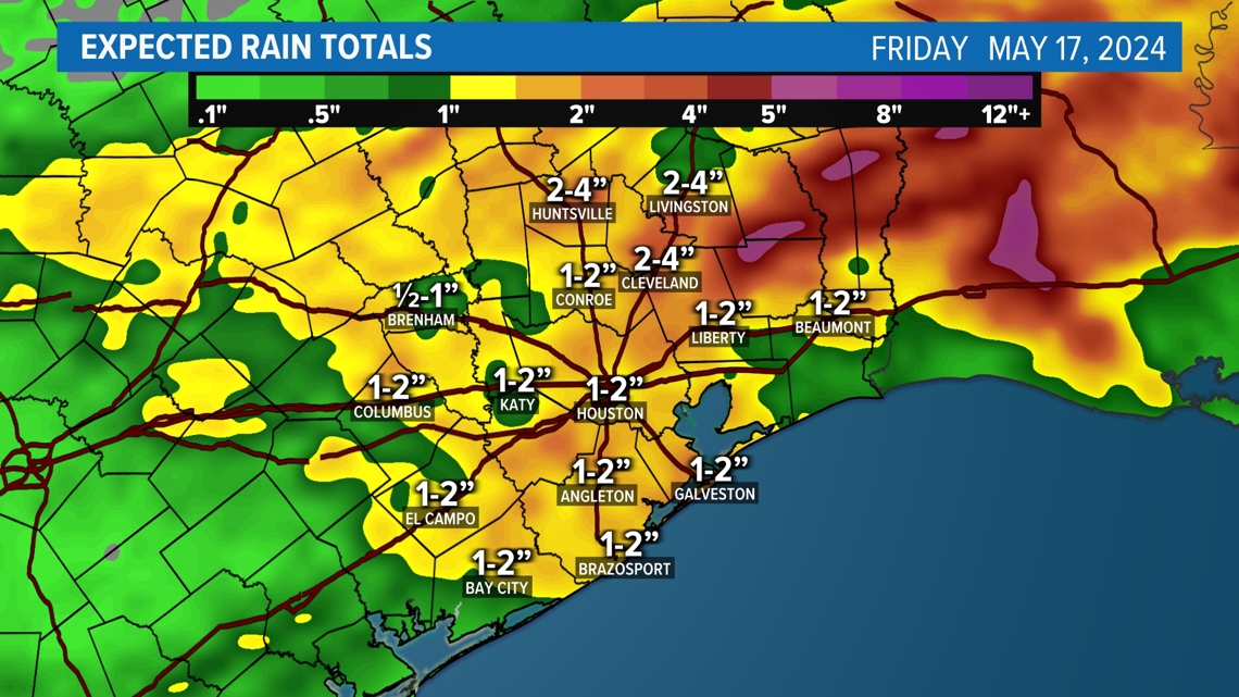
Cities and areas included in the High-risk area are Huntsville, Livingston, Cleveland, Big Thicket Lake Estates, and Corrigan. This area is forecasted to receive two to four inches of rainfall through Friday evening.


With grounds already saturated from recent rains, it will not take much to trigger flooding concerns along rivers and streams.


