
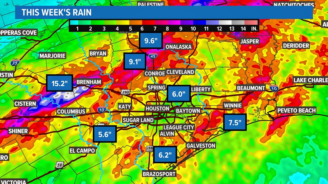
HOUSTON — Torrential rain that fell Monday through Wednesday has pushed major rivers well past their flood stage. The heaviest rain that fell north of Houston is flowing downstream and threatening a number of areas across Southeast Texas.
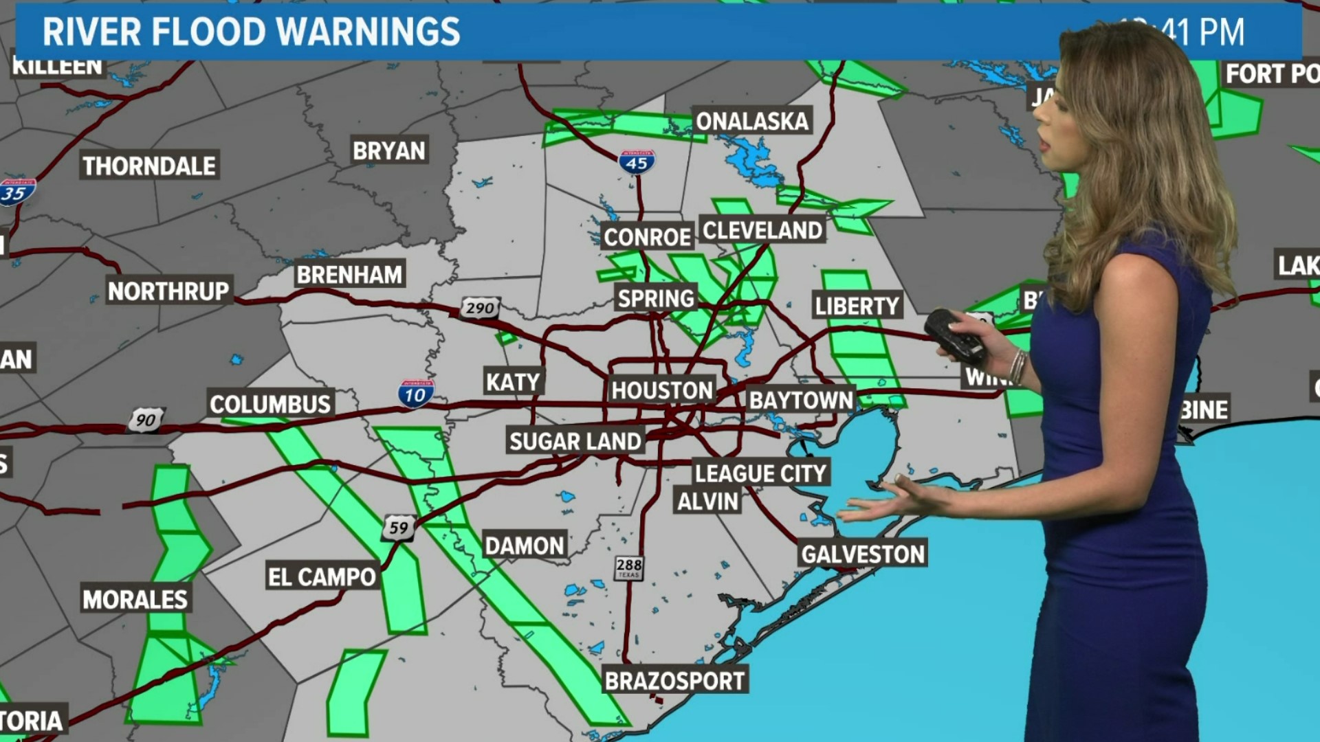
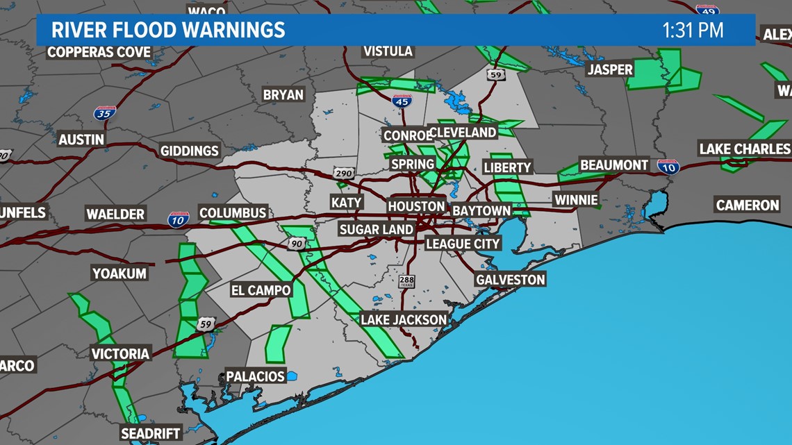
Here are the Flood Warned areas:

RELATED: High water, flooded roads lead to rescues, submerged vehicles across Houston area, officials says
Radar indicated rainfall totals are anywhere from 10-15" for our far northern counties including Washington, Walker, Grimes, Montgomery and Waller.

RELATED: Southeast Texas flooding updates: Disaster declarations issued for Montgomery, San Jacinto counties
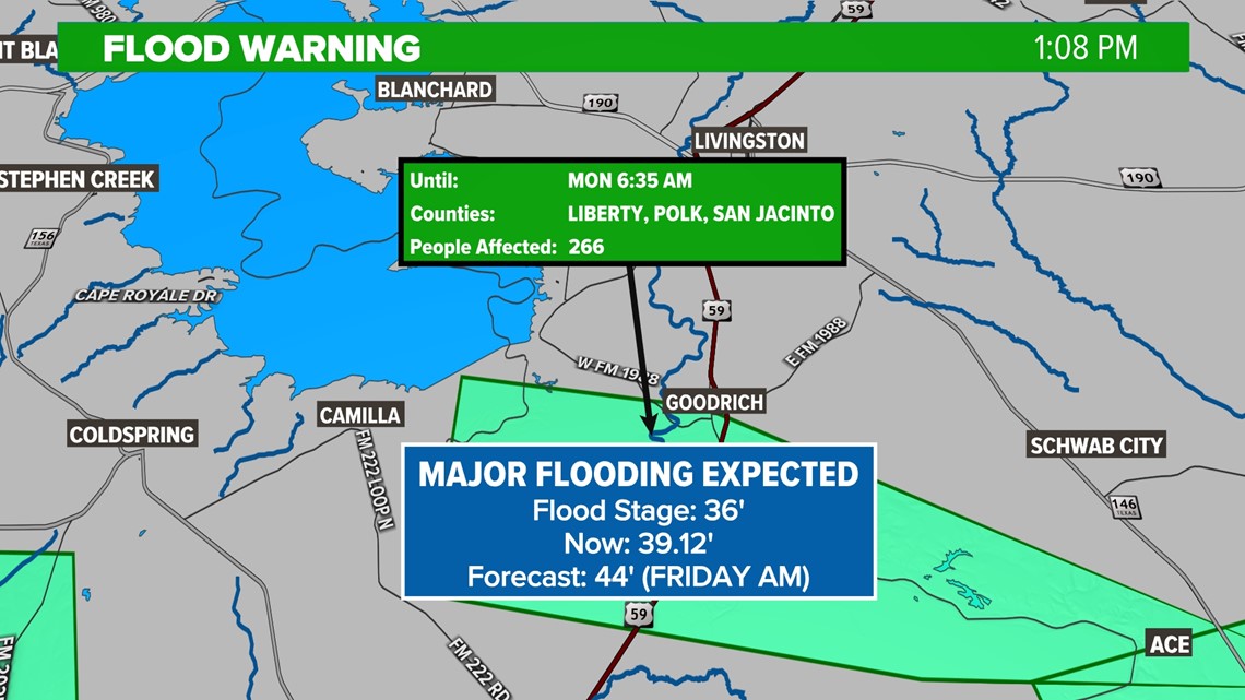
We're actively monitoring vulnerable communities like Goodrich, which is seeing runoff flooding from the Trinity River. Moderate flooding is occurring and major flooding is expected. Here's why: The flood stage at Trinity near Goodrich is 36', it's already well over that and expect to rise to 44' as it gets more overflow from heavy rain upstream. The Flood Warning is until Monday at 6:35 AM.

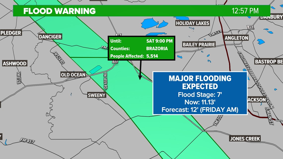
Sweeny is another area of heightened concern with a warning that is in effect until Saturday at 9:00 PM. Outflow from the San Bernard River threatens this community. Flood stage is 7', it's already past 11' and expected to get to 12'.

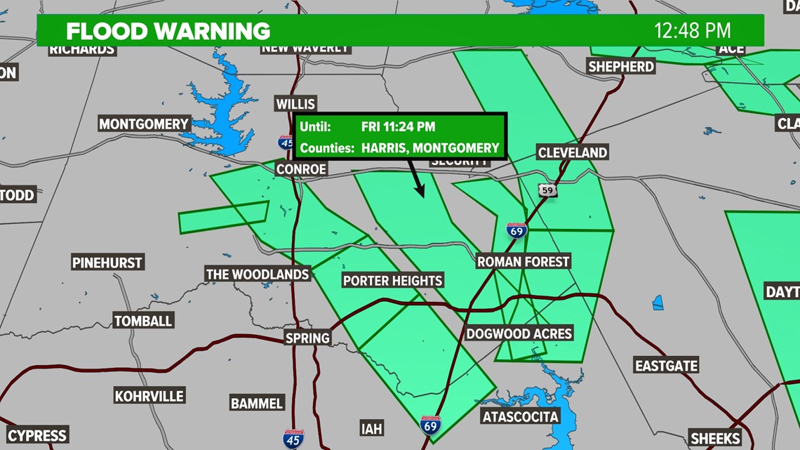
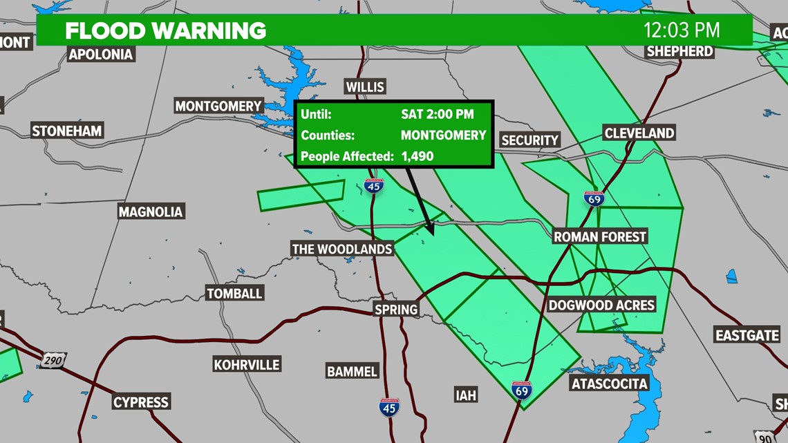
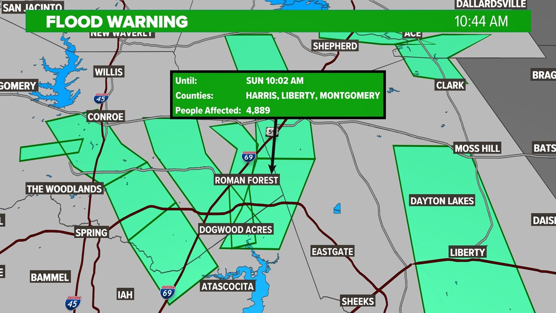
Harris & Montgomery Counties have Flood Warnings that last from now until Friday, Saturday or Sunday.


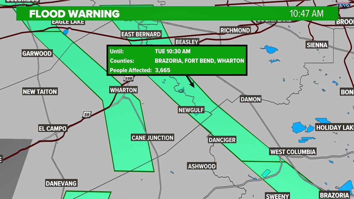
Brazoria, Fort Bend, and Wharton have warnings up until Tuesday morning.

The Brazos River, Colorado River, Trinity River and San Bernard Rivers all flow down to Southeast Texas which makes upstream heavy rain a big flood concern the KHOU Weather Team is monitoring closely.