HOUSTON — We set a new record high temp for the date of 81 degrees at Bush airport. Well above the normal high of 63.
Expect another mild, cloudy, misty, drizzle and foggy night. Fog and mist will be with us for the Thursday morning rush.
A weak cold front will shift winds to the north Thursday afternoon and cool us off into the 50s by Friday morning.
WEATHER ALERTS ON YOUR PHONE: Download the new KHOU 11 app
TRACK THE WEATHER: Local weather radars
Visibility will be significantly reduced on the roads for your morning commute, please take your time and be careful out there. Remember: don't use your high beams/brights as that will only make visibility conditions worse.
A Dense Fog Advisory will remain in effect until 10 a.m. Wednesday for all of the Houston area. Visibility is less than 1/4 mile in many areas.
HOUSTON WEATHER FORECAST
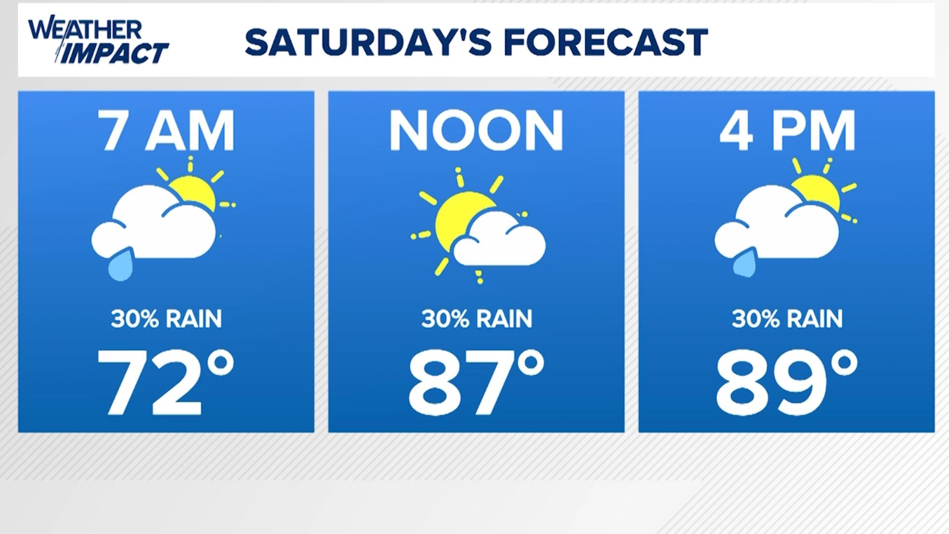
THURSDAY: Foggy start in the morning, 60s. Cloudy afternoon with a 30% rain chance. Highs in the 70s. Turning cooler Thursday night with temps dropping in to the 60s and 50s.
FRIDAY: Mostly cloudy and cooler with morning lows in the 50s and highs in the upper 60s or low 70s. A few showers expected as well.
THIS WEEKEND: Cold Warm on Saturdy before a strong cold front moves in Saturday night into Sunday. Saturday remains cloudy, 60% rain chance. Sunday we start getting much colder withe temps in the 40s and 50s and a north breeze and cloudy skies for the marathon.
Check back for more updates, and you can always follow us on Twitter and Facebook, as well as download the KHOU 11 Weather App in your app store.