HOUSTON — We've got a lot going on this coming week -- a little something for everybody. We'll have above normal temperatures, rain and possibly a big dip in the mercury by next weekend.
First, the rain.
Saturday began very differently than it ended. We awoke to gorgeous weather and not a cloud in the sky and we ended the day with gloomy skies and nothing but clouds.
Moisture is increasing, albeit very marginally, ahead of a weak, Pacific based cold front --- "Pacific" being code language for little change in temps behind it. So while I'm not expecting a cool down behind this front, it will help squeeze out showers ahead of it.
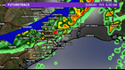
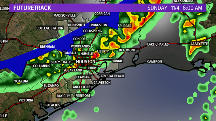
Therefore look for an 80% chance of showers beginning pre-dawn in Houston and lasting through about 11 a.m. After that, the rain will end and the sun should come out. All in all, Sunday isn't looking all that bad due to most of the rain coming through while you sleep.
For those concerned about severe weather, don't be. This is not going to be a Halloween evening situation where we had discrete super cell, tornadic storms ahead of the front followed by a nasty squall line. This will be rain showers with perhaps a few rumbles of thunder.
Next Week:
Next week will begin with above normal temperatures --- perhaps much above normal with one or two days soaring into the low to mid 80s. There will be not one but two cold fronts that make their way in. The first of which is a snoozer and will aggravate rain chances and the second one could bring in some of the coldest air so far this season --- could.
Look for a slight chance of rain on Monday as Sunday's cold front peters out over the northwest gulf. Then bigger rain chances appear for Thursday and or Friday but likely not both days. The biggest rain chances will coincide with the arrival of the strong cold front and right now there are significant timing differences between the GFS and Euro as to when that front arrives. GFS shows a Thursday arrival while the Euro shows a Friday arrival.
What about this big dip in the mercury?
Well, it's early and there is significant uncertainty in the forecast. So much depends on what happens with the front and whether we'll have an overrunning situation shape up where thick clouds blanket the area to keep us extra refrigerated.

I can tell you that there is ample model support for this cold snap with both the GFS, Euro and Canadian models showing significantly colder temperatures for both overnight lows and daytime highs. The European model is by far the coldest showing several days with highs in the 40s and lows in the mid 30s while the GFS is warmer with highs in the mid to upper 50s Friday into Saturday and overnight lows in the 40s.
We'll have to watch the pattern evolve over the next few days to see what transpires. Again, there is significant forecast uncertainty so you'll likely continue to see the extended forecast change, perhaps abruptly, in the days ahead.