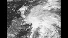
HOUSTON — We have our first named storm of the 2018 Atlantic Hurricane season: "Subtropical Storm Alberto". This subtropical storm is going to ruin the beach weekend for a lot of vacationers looking to take advantage of Memorial Day weekend from Mississippi to the Carolinas. When it strikes the central and eastern Gulf coastline later this weekend, it'll bring heavy rain and flooding from Louisiana to Florida. Winds are currently blowing at 40mph but at its peak the system is only expected to strengthen to 65mph sustained wind due to the fact that it is a subtropical system. Rain should be Alberto's calling card, but here in Houston, we'll remain mostly sunny and dry.
What is a, "subtropical storm"? Wind-wise, it's defined same as a tropical storm (39-73mph) but it has some characteristics of both a tropical and an extra-tropical low pressure area. (An extra-tropical storm is one with a cold front and warm front, like we'd see on a winter's day.)
There are three other things that define the character of a subtropical storm:
1) The wind field is much more spread out in a subtropical storm. Instead of max winds being focused in the center, like they are in a tropical system, the strongest winds can extended hundreds of miles from the center.
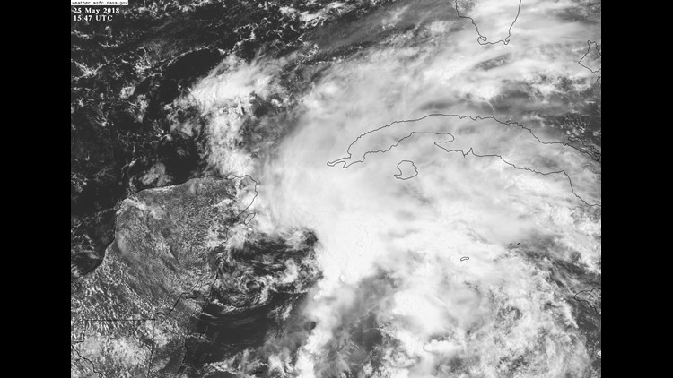
2) The heaviest rain tends to stay on the east and north quadrants of the storm with precipitation falling hardest outside of the center of circulation (unlike a fully tropical system, where the rain is focused closer to the center. (This often gives subtropical storms a, "shrimp-like" appearance on satellite, instead of the more familiar, "circular saw" look of a major hurricane.)
3) Subtropical systems tend to strengthen much more slowly than fully tropical systems. Because the energy is spread out so far away from the center, it's very difficult for a subtropical system to ever strengthen into a hurricane. Sometimes however, subtropical storms can transition into fully tropical storms, then quickly become a hurricane. This is always something to watch out for when they are long-lasting over warm, open waters.
Impacts to Texas: Elevated surf conditions at the otherwise sunny beaches, which will lead to dangerous rip currents. Surfers may enjoy some long-period swell with the west wind, "brushing" the waves, keeping them smooth. Our weather will also become quite hot, as we find ourselves on the dry, clean side of the subtropical storm. Highs will push to near 97° by Monday as winds blow offshore, from the land. There will be no real sea breeze to cool us off.
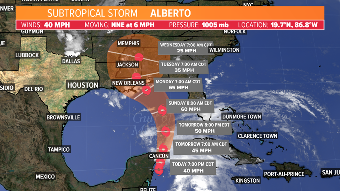
If you are traveling to the central/eastern Gulf Coast: Heavy, flooding rain and gusty winds from eastern Louisiana through South Florida and up the coast through the Carolinas are to be expected. 7"-12" of rain could fall in lower Alabama and Mississippi. Significant flooding and tornadoes are likely too.
Does all this sound complicated and technical? It is. In fact, until 1972, weather scientists had been uncertain of how to distinguish and define the differences between fully tropical and subtropical storms. This was partially due to the lack of satellite imagery common in weather observations before the 1960s. It took about a decade to view enough subtropical storms from space to easily define them. They were officially recognized by the National Hurricane Center in the early 1970s. - Meteorologist Brooks Garner