
HOUSTON — We’re gearing up for more rain into Thursday that could worsen flooding issues. Harris County has been included in that threat. Isolated thunderstorms overnight will lead to areawide storms this morning.
With any storms that develop, damaging wind gusts, and isolated tornados and some hail are all possible. The most widespread threat, however, will be the chance for isolated street flooding and river flooding.
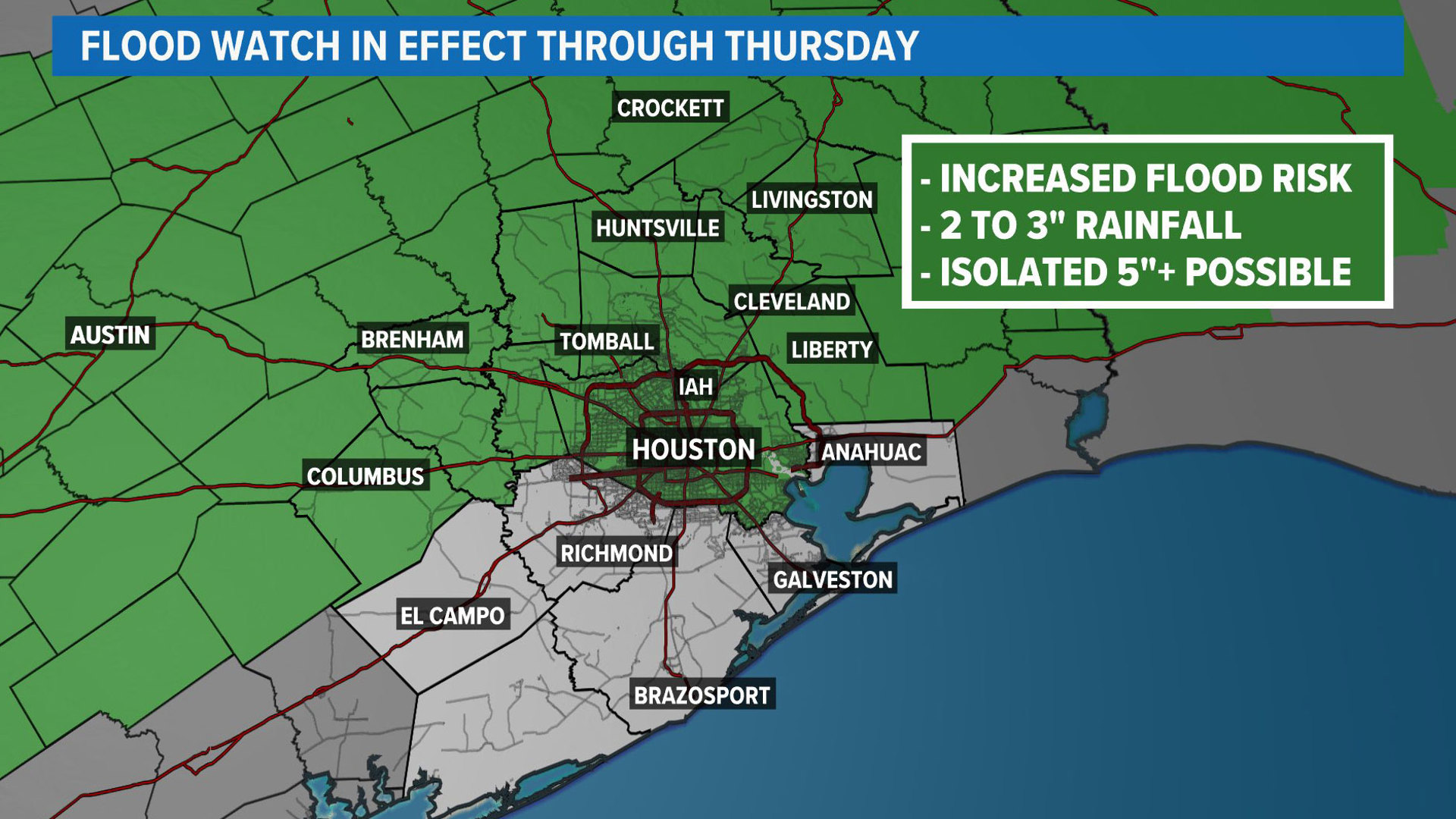
Current watches and warnings
- A Flood Watch is in effect for the following counties: Harris, Houston, Trinity, Madison, Walker, San Jacinto, Polk, Burleson, Brazos, Washington, Grimes, Montgomery, Liberty, Colorado, Austin, Waller.
- A Severe Thunderstorm Warning in effect for parts of Harris, Montgomery, San Jacinto, Liberty and Polk counties until 7:45 a.m. At 7:08 a.m., severe thunderstorms were located along a line extending from 6 miles east of Goodrich to 9 miles east of Cleveland to Roman Forest, moving east at 50 mph with 60 mph wind gusts.
- A Flash Flood Warning for northwestern Polk County, northwestern San Jacinto County, southern Trinity County and east central Walker County until 8:30 a.m. At 6:23 a.m., Doppler radar and automated rain gauges indicated thunderstorms producing heavy rain across the warned area. Between 5 and 8 inches of rain have fallen. Additional rainfall amounts of 1 to 2 inches are possible in the warned area. Flash flooding is ongoing or expected to begin shortly.
- A Flash Flood Warning is in effect for northeastern Montgomery County, Polk County, San Jacinto County, and southeastern Walker County until 8 a.m. Doppler radar indicated thunderstorms producing heavy rain across the warned area. Between 2 and 4 inches of rain have fallen. Additional rainfall amounts of 1 to 3 inches are possible in the warned area.
- A Flash Flood Warning is in effect for northeastern Grimes County, northwestern Montgomery County and Walker County until 8:30 a.m.
Check live radar
Heavy rain and a few stronger storms are possible. These storms will arrive from the west and could produce very heavy rainfall, damaging wind gusts, and even an isolated tornado.


As a result, the Weather Prediction Center from NOAA has placed areas north of the city under a level 3 out of 4 for flash flood potential. This area is very saturated from the heavy rain over the weekend, so any additional rainfall will easily lead to flooding.

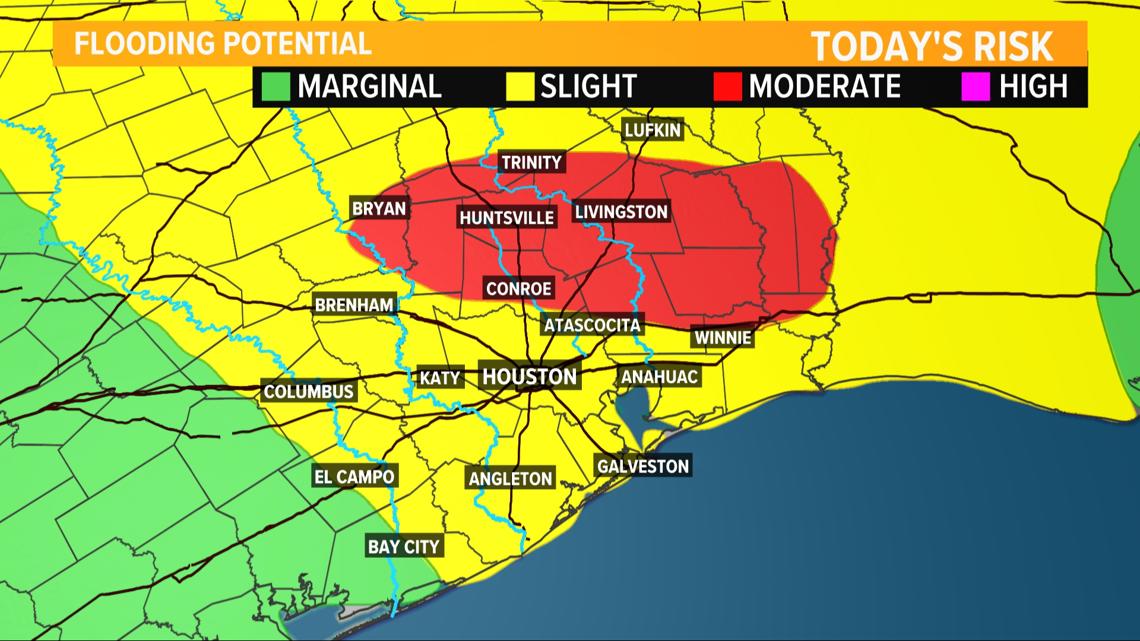


Additionally, the Storm Prediction Center has highlighted some of Southeast Texas under a slight risk (level 2 out of 5) for the chance to see severe storms with damaging wind gusts being the primary concern.


More storms are possible on Friday as well, before drier conditions arrive for the weekend. By next week, a summer preview will arrive with a string of 90 degree days possible after Monday.


Follow the KHOU Weather Team for live updates on the weather in your area:
- Kim Castro on social media: Facebook | X | Instagram
- Pat Cavlin on social media: Facebook | X | Instagram
- Chita Craft on social media: Facebook | X | Instagram
- David Paul on social media: Facebook | X | Instagram
- Chris Ramirez on social media: Facebook | X | Instagram
- KHOU 11 on social media: Facebook | X | Instagram | YouTube