

HOUSTON — It's been a stormy night across the Houston area. These are the latest watches and warnings in effect.
CURRENT WATCHES AND WARNINGS:
- TORNADO WATCH in effect for Polk, San Jacinto and Trinity counties until 1 a.m.
- SEVERE THUNDERSTORM WARNING in effect for east-central Grimes County, northwestern Montgomery County, southeastern Walker County, southwestern Polk County, central San Jacinto County and south-central Trinity County until 12:15 a.m.
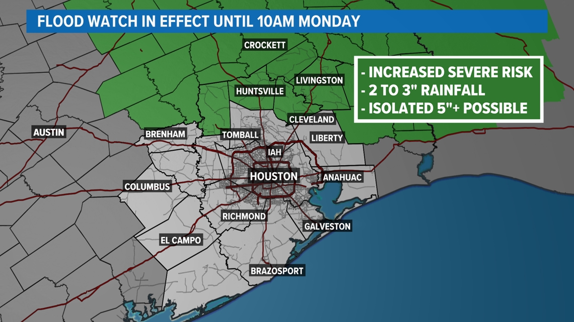
- FLOOD WATCH in effect for Grimes, Polk, San Jacinto, Trinity and Walker counties until 10 a.m. Monday.
There is a FLASH FLOOD EMERGENCY now in effect for Trinity County. According to the National Weather Service, there is life-threatening flooding between the towns of Trinity and Groveton.

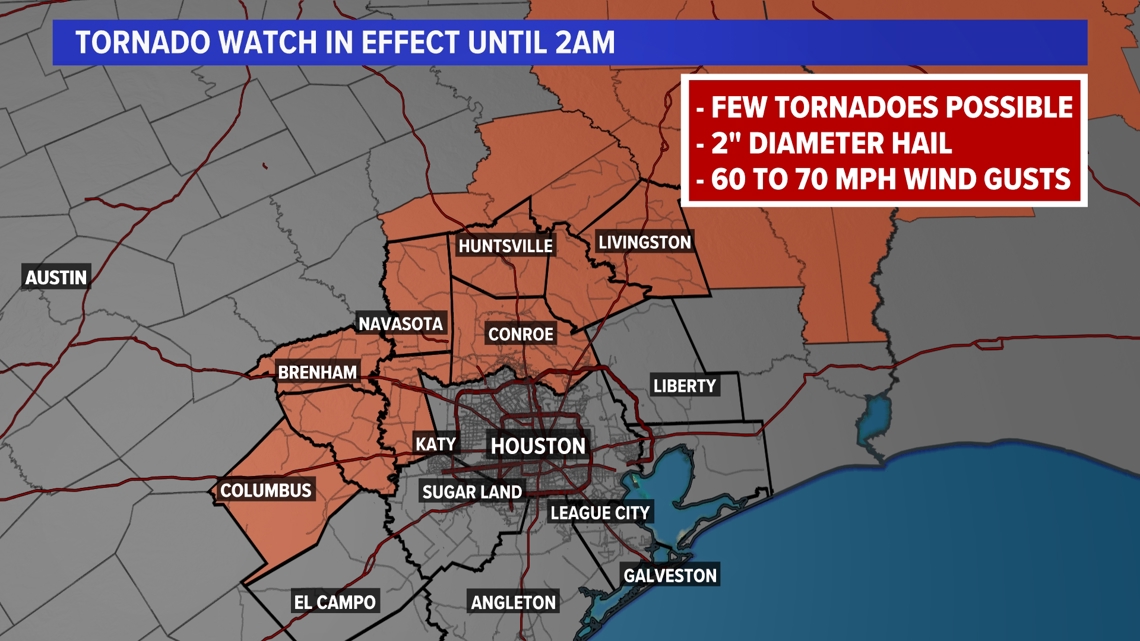
The tornado watch indicates where conditions may be favorable for tornado development this evening. Additionally, large hail and damaging wind gusts to 70 mph are possible as well.

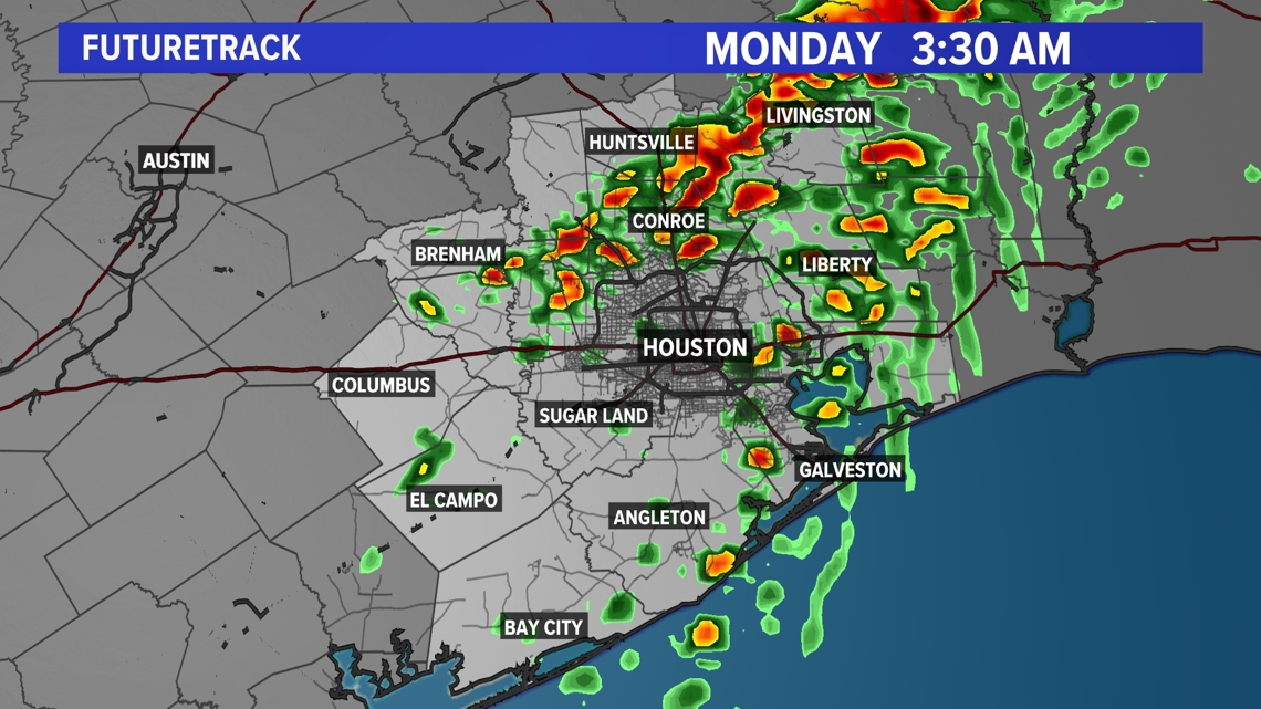
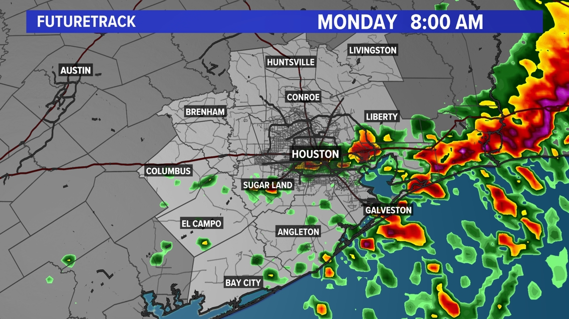
Sunday evening storms have the potential to become severe with 2-3" of widespread rainfall. Some areas could receive up to 5". Flooding could occur in poor drainage and urban areas.

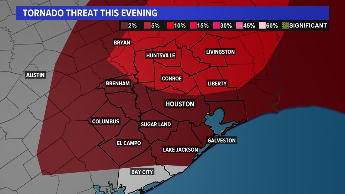
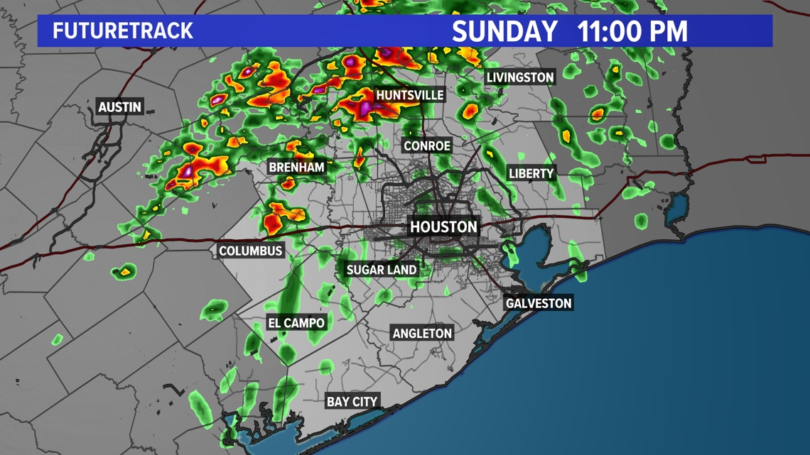
Expect isolated storms to pop up later Sunday evening. Storms north of Houston have an increased risk for producing a few tornadoes. Storms will become more widespread into the overnight hours, with damaging wind, flooding and hail being the primary concerns.


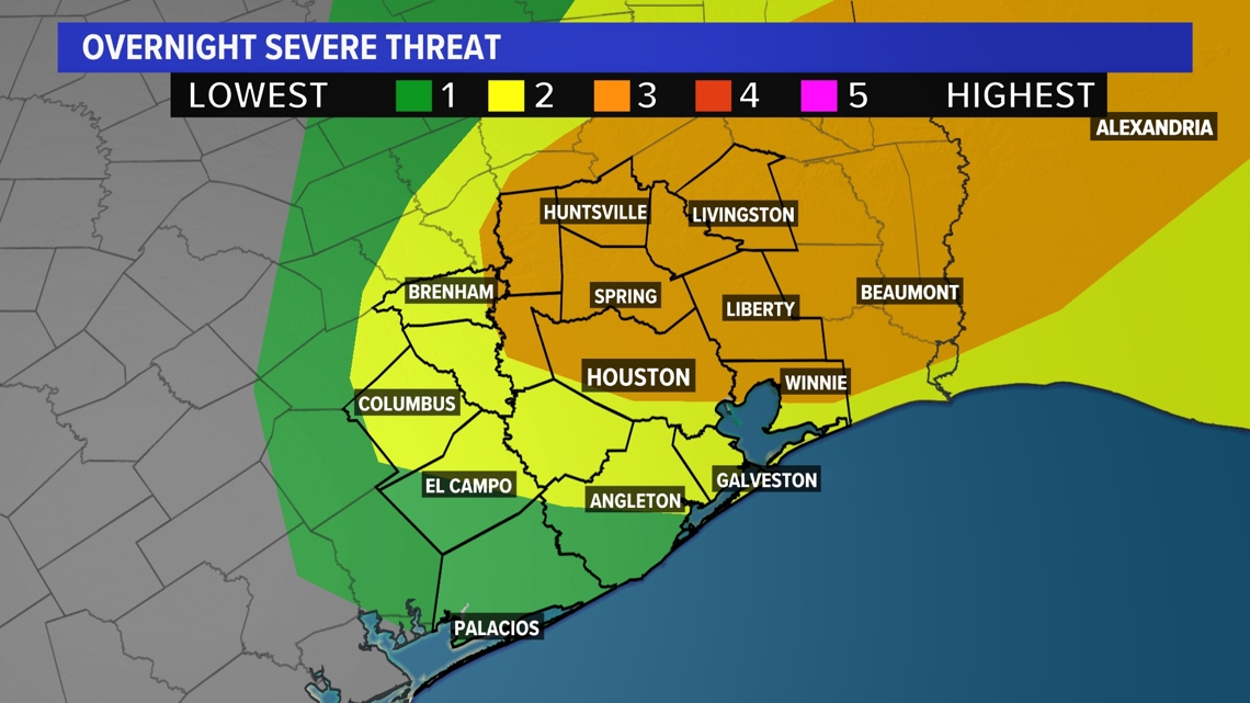
The Storm Prediction Center (SPC) has also placed the city under a level 3 severe threat. The severe potential is there for all of Southeast Texas, but highest for areas north of I-10.

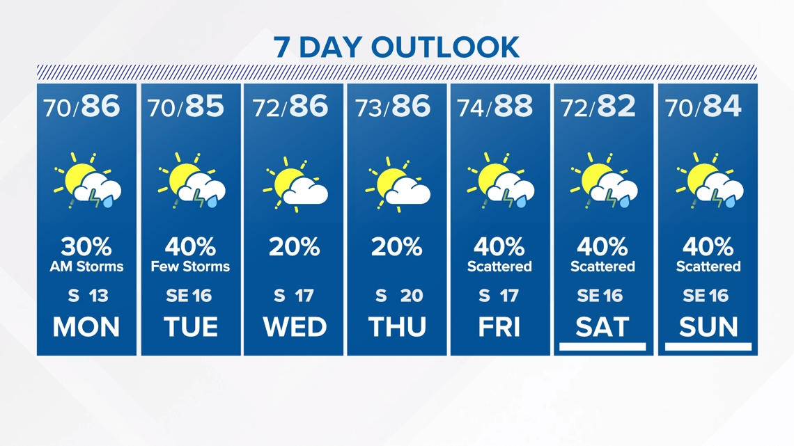
For the next seven days, expect muggy and warm temperatures with afternoon highs in the upper 80s. Scattered showers and storms stay in the forecast through Tuesday. Highs will make a run at 90 degrees by Friday, with drier weather and more breaks in the cloud cover.

Follow the KHOU Weather Team for live updates on the weather in your area:
- Kim Castro on social media: Facebook | X | Instagram
- Pat Cavlin on social media: Facebook | X | Instagram
- Chita Craft on social media: Facebook | X | Instagram
- David Paul on social media: Facebook | X | Instagram
- Chris Ramirez on social media: Facebook | X | Instagram
- KHOU 11 on social media: Facebook | X | Instagram | YouTube