
HOUSTON — Houston and Southeast Texas have been in a wet weather pattern for almost a month, bringing rounds and rounds of rain and thunder. So what's going on? How can it be so stormy for so long?
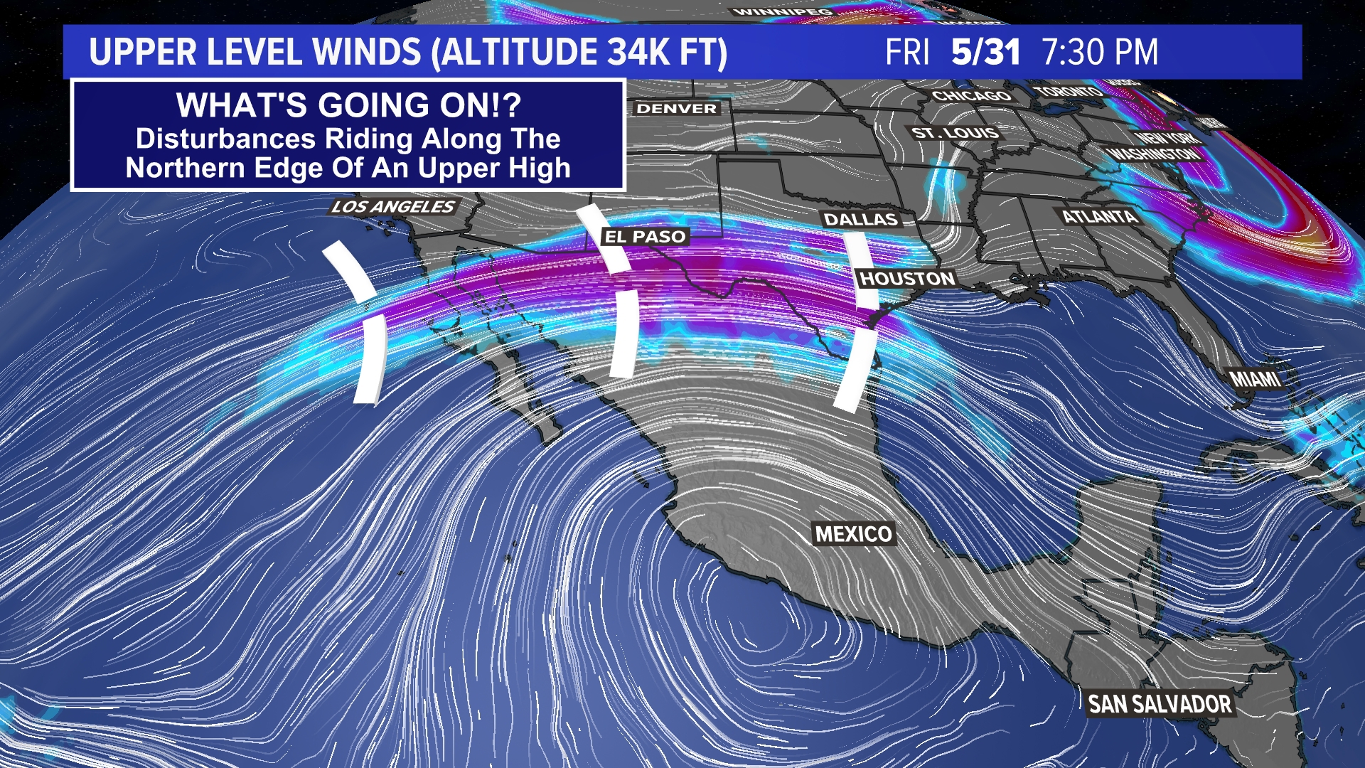
The answer can be found by looking at the upper-level wind pattern across North America. See that big circle of winds centered over the Pacific coast of Mexico? That's the center of a huge ridge of high pressure.
If you're living under the center of that ridge in Mexico, you've had hot and dry weather for the past several weeks. In fact, Houston was centered under just such a high last summer that led to a bad drought. We wondered if it would ever rain again... remember?

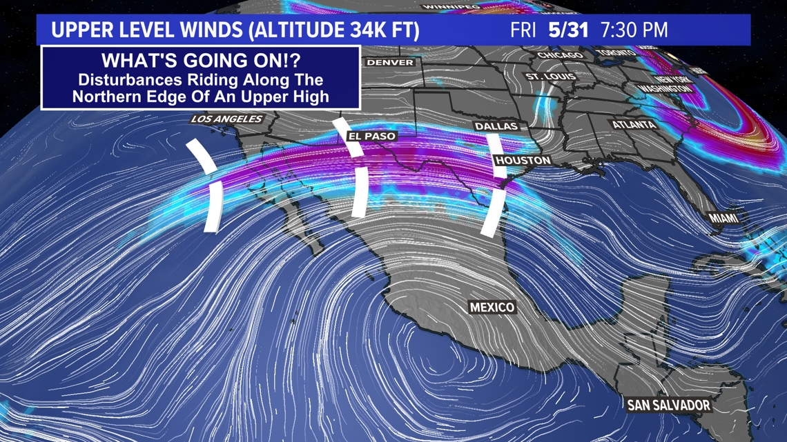
Well, this year a similar ridge has set up, only instead of being under the hot dry center of the ridge, Houston finds itself on the outside edge of the ridge. This part of the ridge is often called 'the ring of fire.' Not because it's hot, but because it can be very rainy and stormy on the edge of a ridge.
This pattern has been stuck in place for several weeks. This is why we've had rounds of rain and storms racing in from west to east across our area. Pieces of energy (dashed lines in the image above) ride along the upper winds from west to east. Each one brings a chance for rain and storms with it.
This type of weather pattern can get 'stuck' for months on end. This particular pattern, however, is forecast to last only a few more days and should break down and bring an end to our daily rain chances by the middle of next week.