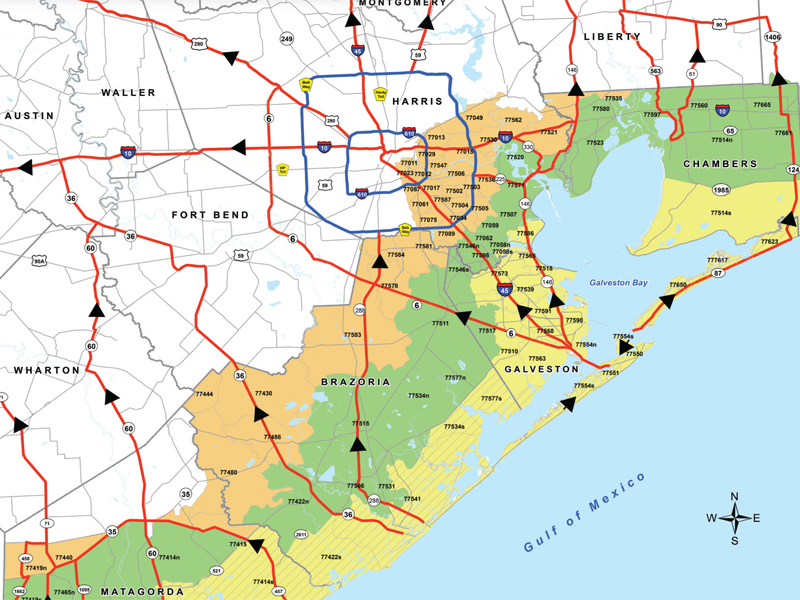
Hurricane Central Contraflow Maps and Travel
HOUSTON - Harris County published maps of evacuation contra-flow plans and urge residents to be prepared if an evacuation is implemented.
The Texas Department of Transportation designed a contra-flow plan to portions of I-10, I-45, U.S. 59 and Highway 290.
Contra-flow allows state and local officials to shut down designated inbound lanes and turn them into additional outbound traffic lanes. People evacuating will be directed to designated routes depending on which part of town they live in.
Harris County Evacuation Zones
Contraflow Maps
Evacuation Resources


