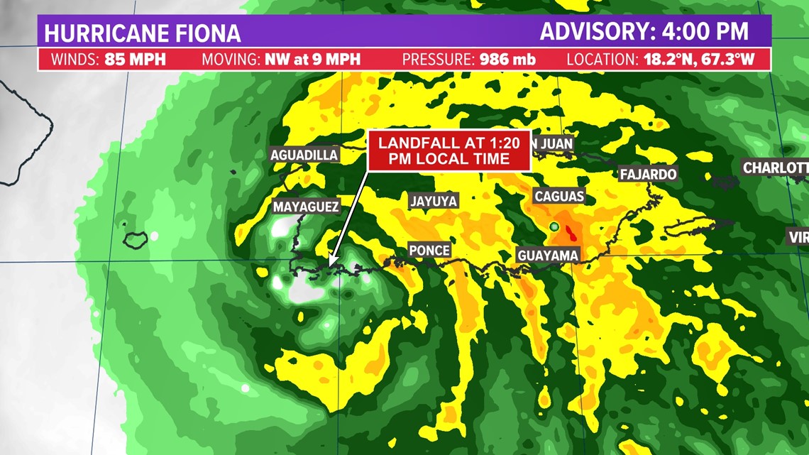
HOUSTON — Hurricane Fiona made landfall near Punta Tocon on the southwest side of the island just before 1:30 pm local time on Sunday as a category 1 hurricane.


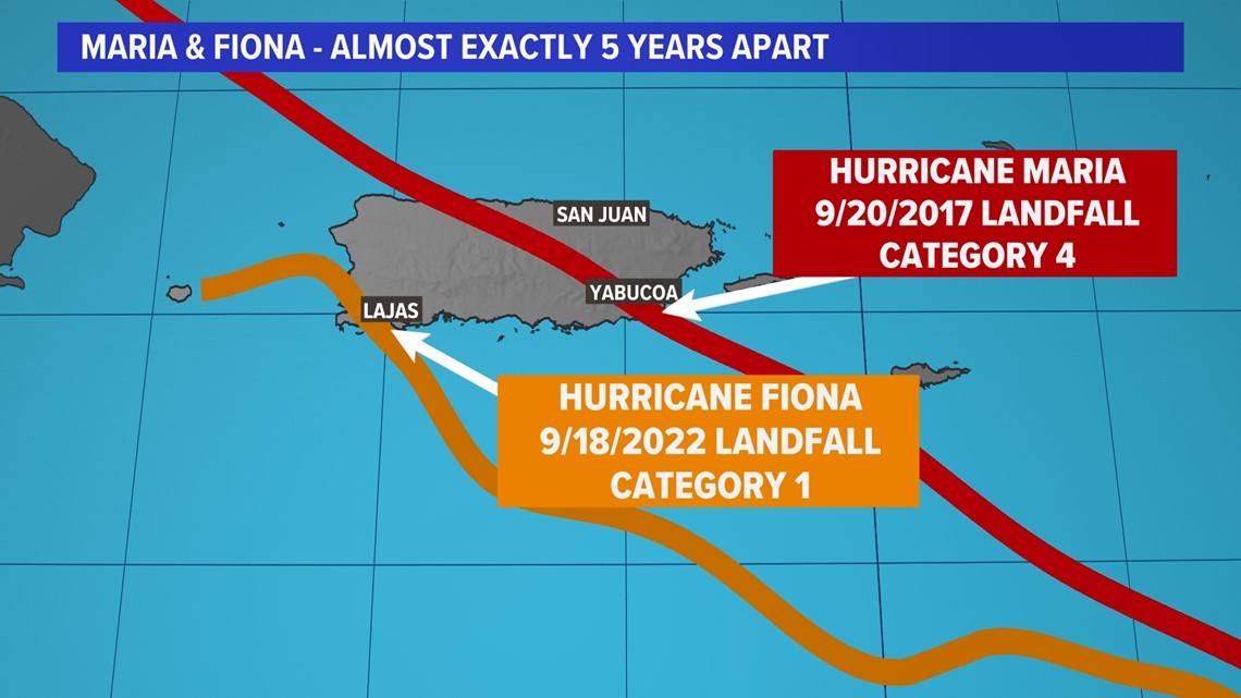
Today's landfall comes nearly 5 years to the day after Hurricane Maria made landfall as the worst storm in the island's history. The center of Fiona moved over the west end of Puerto Rico, roughly 75 miles away from where Maria came onshore.


Despite the fact that Fiona is considerably weaker than Maria, the western track has put nearly the entire island under the worst part of the storm. Fiona has caused catastrophic flooding and power grid failure that wiped out electricity to all 1.4 million residents.


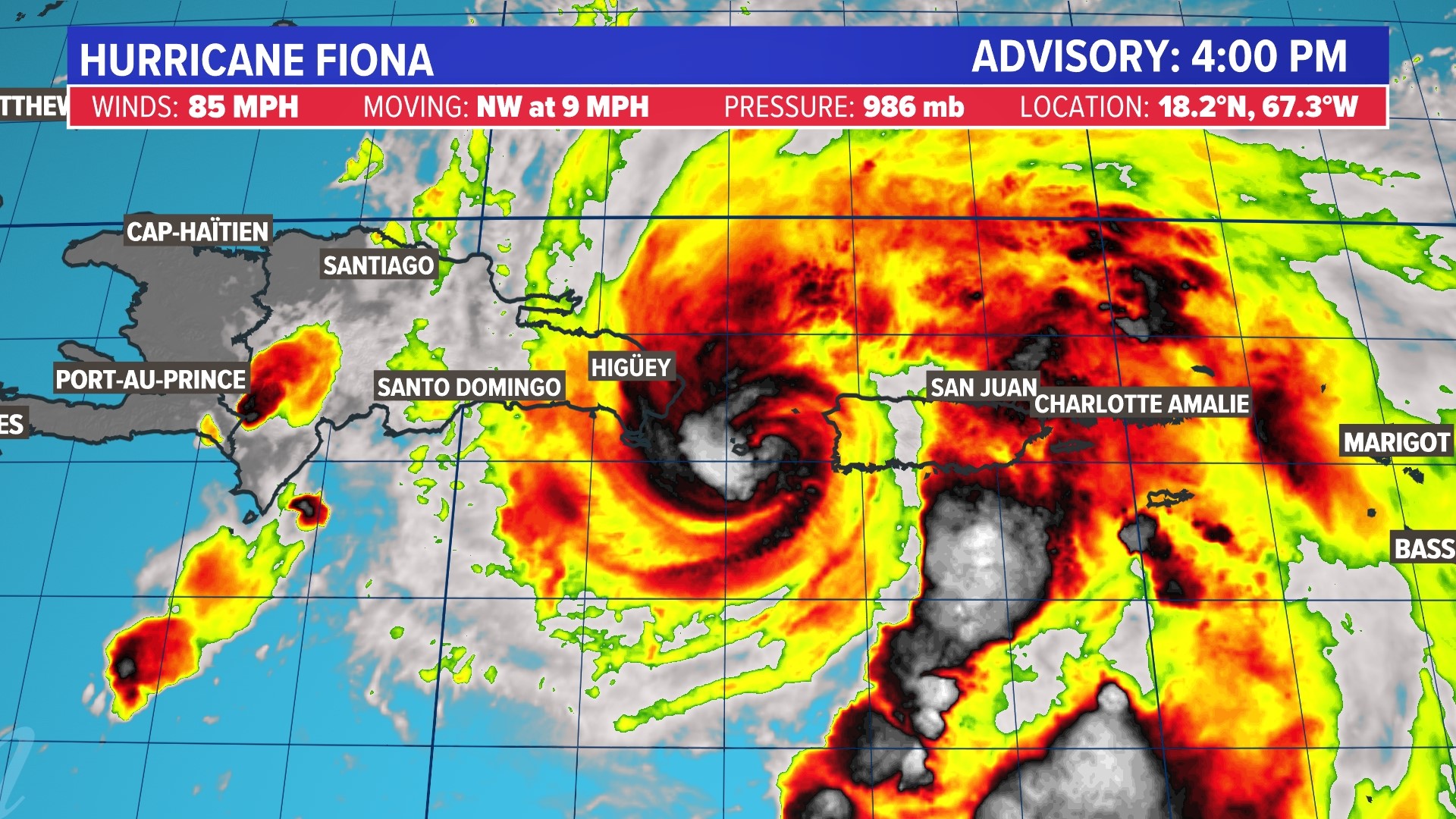
As of this evening, the center of Fiona was moving through the Mona Passage, the strait that connects the Western Atlantic Ocean and the Caribbean Ocean. Heavy rain and wind is expected to continue across Puerto Rico and the Dominican Republic overnight.


Early this week, Fiona is expected to reach category 2 strength as it moves to the east of the Turks and Caicos.


Fiona is forecast to reach major category 3 hurricane status on approach to Bermuda later this week, before moving out to sea.


The reason Fiona was able to curve away from the U.S. is the same reason Southeast Texas will see near record heat later this week. A large ridge of high pressure will become established over the central U.S. That ridge will extend all the way to the East Coast, acting to deflect Fiona out to sea.


Even though direct impacts aren't expected along the East Coast of the United States, huge surf is expected through the end of the week. Forecast wave heights from the Mid-Atlantic to New England will average 5 to 10 feet, with occasionally higher crests.


Tropical storm Fiona key stats


Tropical storm Fiona forecast cone


Keep an eye on the tropics with this interactive map
Never miss an update. Follow the KHOU 11 weather team:

