
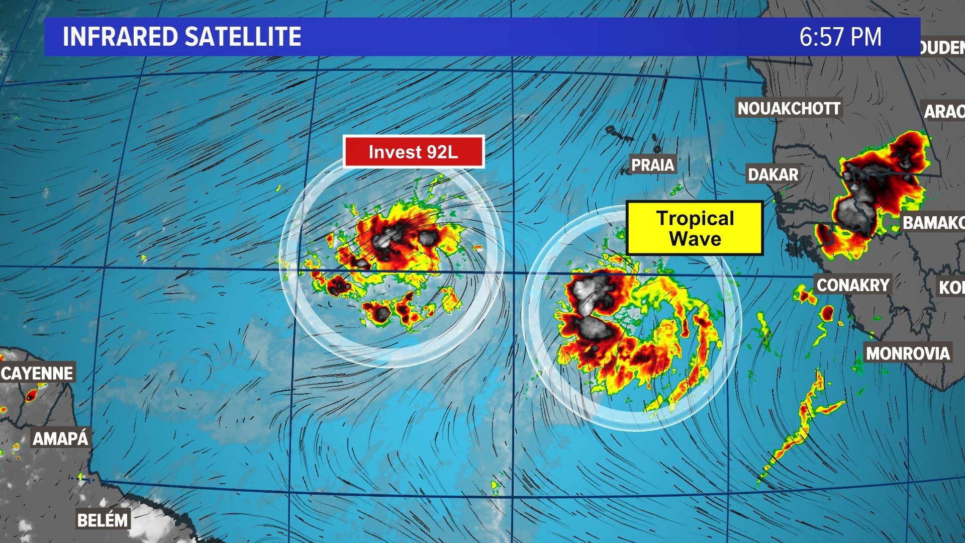
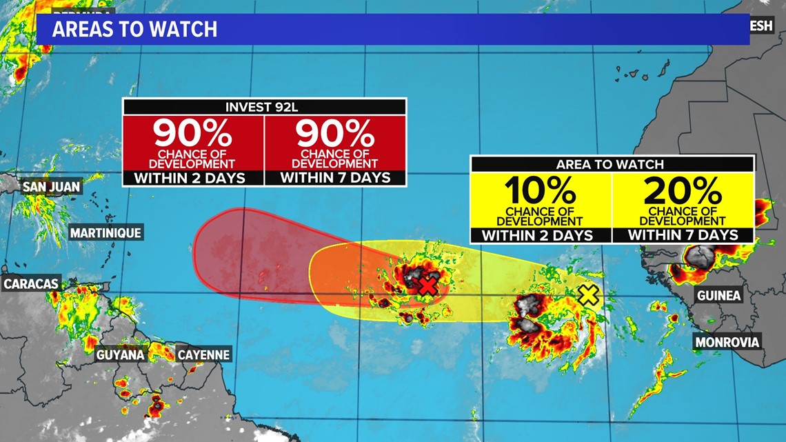
The National Hurricane Center (NHC) has now tagged two potential areas for development in the Main Development Region (MDR) of the Atlantic. The first feature is known as Invest 92L and is expected to become named Bret over the next few days. The second area is a tropical wave a few hundred miles behind 92L, with low odds for development over the next week.
Any type of development in this part of the world during the month of June is exceptionally rare. Typically, water temperatures are too cold to support storms and the atmosphere is too hostile thanks to dry, Saharan dust.

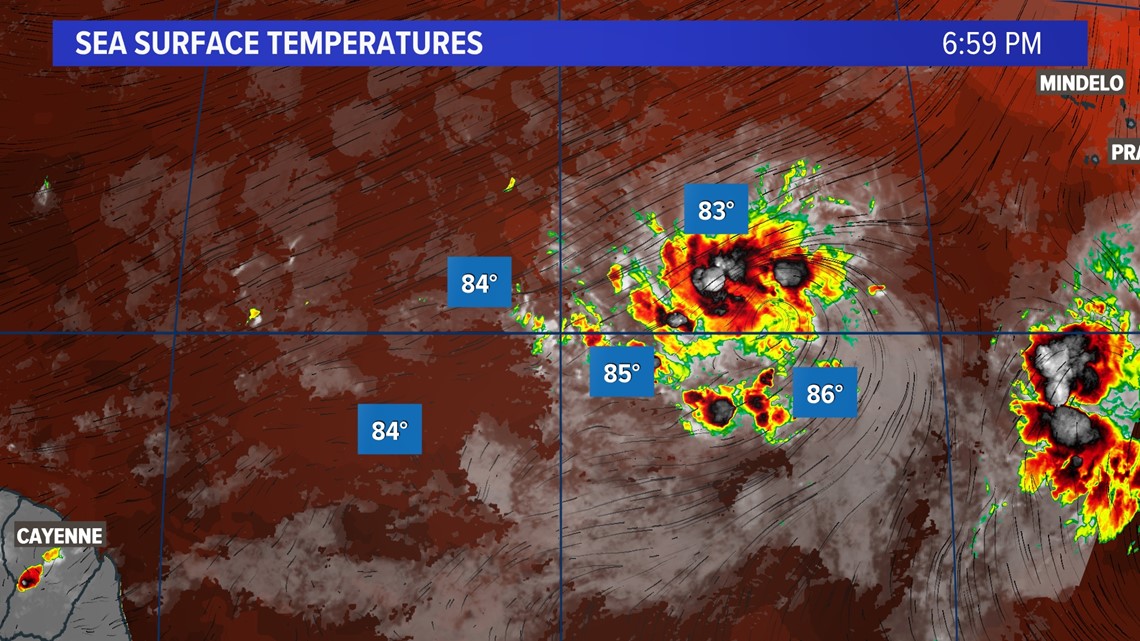
However, this year, dusty conditions are significantly lower and water temperatures are running well above normal, making for ideal conditions for storms to form.

Generally, in the month of June, tropical development is more favored through the Caribbean, the Southeast Coast of the U.S., and occasionally the Gulf of Mexico.

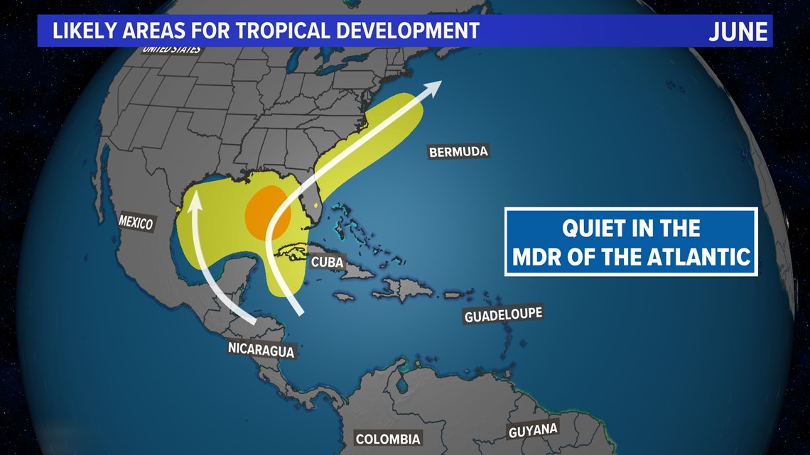
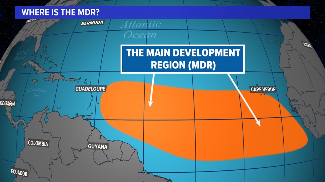
Development doesn't typically shift to the MDR (the area of the Atlantic Ocean between the Lesser Antilles and the West Coast of Africa) until at least July and August.

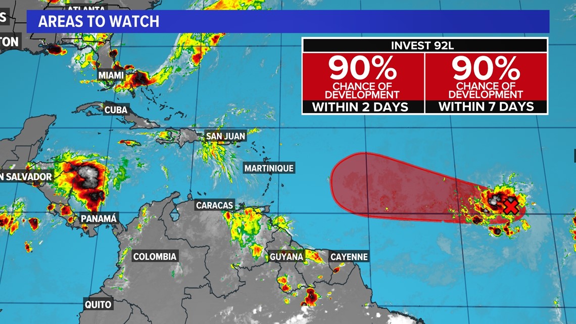
INVEST 92L
Development of this feature seems imminent, as the NHC has now upped the probability of formation to 90%. Right now, this tropical wave is showing better signs of organization around a tightening center of circulation.

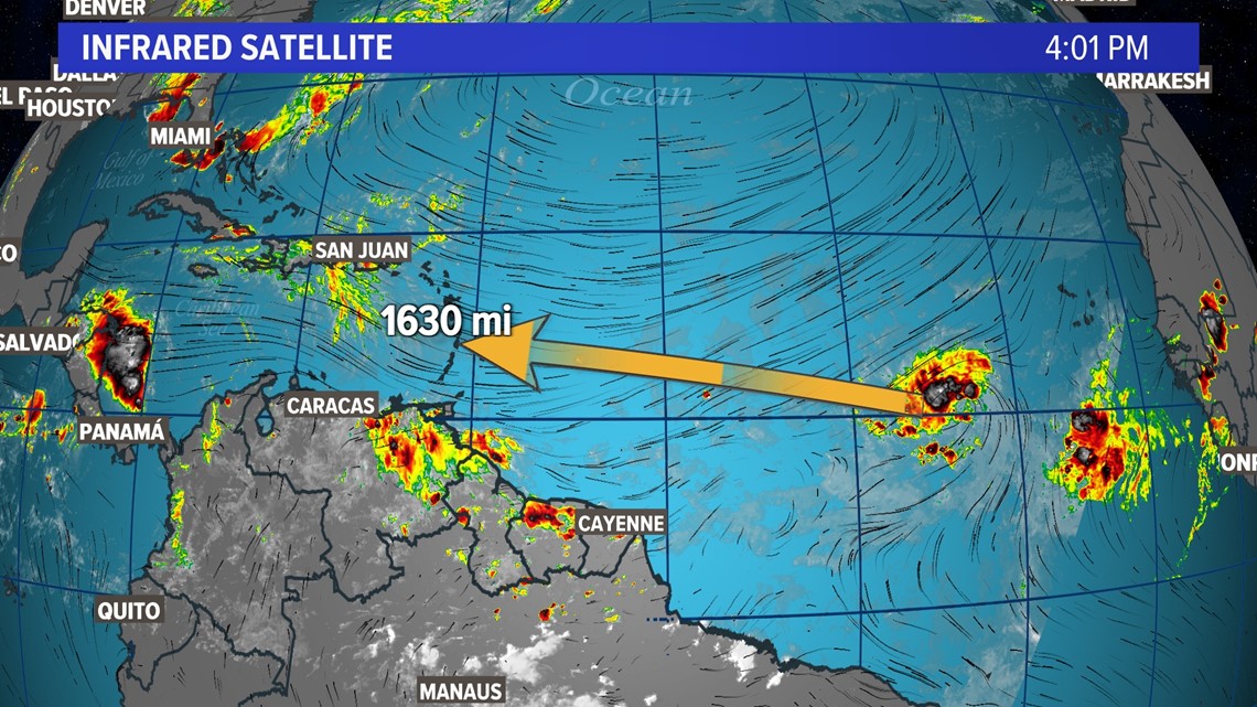
With warm water and over 1600 miles of real estate to develop, not much will keep this wave from turning into a named storm this week.

The big question will then become: where does it go? Because the wave has been tagged as an invest, we are able to see computer model plots of potential trajectories. We call these spaghetti plots.

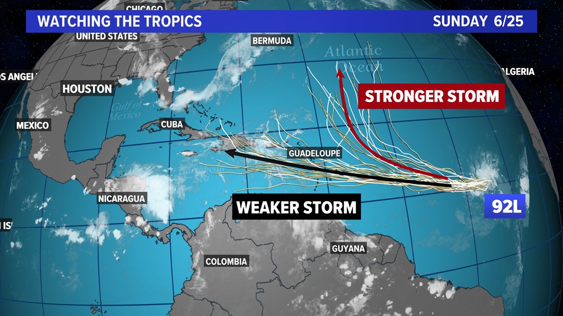
At the moment, the model plots are in good agreement for at least 3 to 5 days that the system will continue moving west-northwest over open water. However, by the end of the week the models diverge. Some models bring the storm north and out to sea, while others pull it west into the Caribbean. The latter solution seems to be looking more likely. While we are still at least 5 days out from any potential impacts to land, it is something that will need to be watched carefully if it moves into the Caribbean.