HOUSTON —
Editor's note: This page will no longer be updated. For the latest Tropical Storm Ian updates, check this new page.
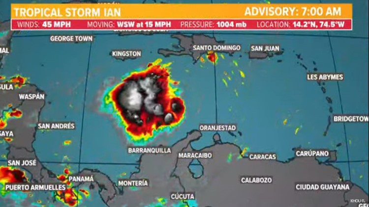
What was Tropical Depression Nine strengthened to become Tropical Storm Ian in the Caribbean Friday night. The storm is expected to move into the Gulf of Mexico before making an impact on Florida next week.
With the 7 a.m. Saturday update, the storm had maximum sustained winds of 45 miles per hour and was moving to the west-southwest at 15 miles per hour.
It is expected to skirt by Jamaica Saturday and Sunday as a moderate tropical storm before hearing to the Cayman Islands where it will be near hurricane strength.
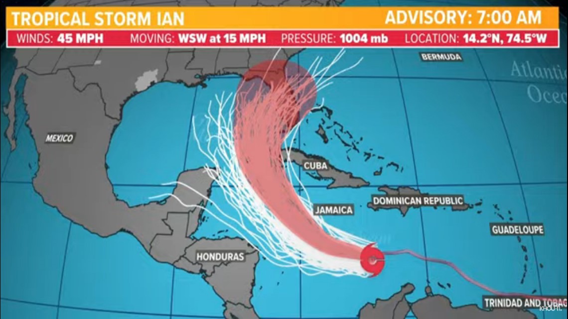
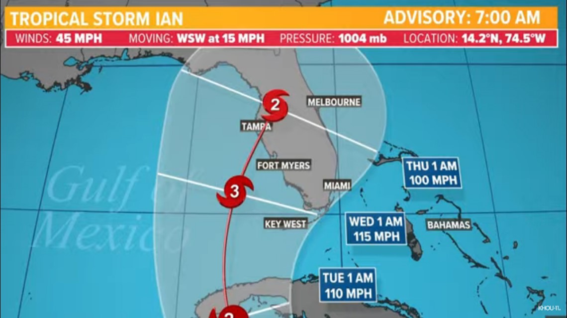
According to the National Hurricane Center, Ian is expected to move over western Cuba as a hurricane early next week and will then move towards Florida, possibly as a Category 3 storm. People in Cuba, the Florida Keys and all along the state of Florida should be prepared.
Houston isn't expected to feel any direct impacts from Ian.
Tropical Storm Ian spaghetti models

Tropical Storm Ian forecast cone

Tropical Storm Ian live tracker
What is an invest?
The active storms all began as 'invests.' An invest is a tropical wave, or area of disturbed weather in the tropics, that hasn't developed any type of organization yet, but is expected to in the coming days.

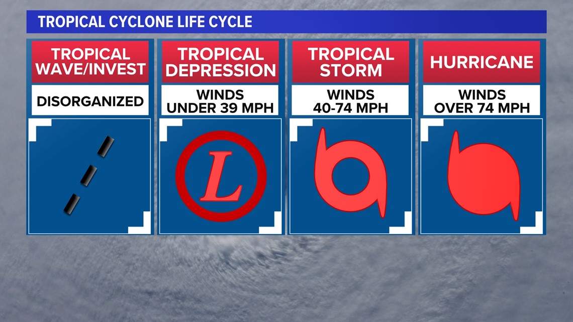
Typically, if conditions are favorable enough, a tropical wave will evolve into a tropical depression and then ultimately a tropical storm or hurricane. Tropical waves are given the distinction of "invest" so that the National Hurricane Center can run model simulations on where they may go. Currently, models take this invest through the Caribbean, gradually organizing it over several days.
Hurricane Fiona update
AP update at 11:57 p.m. Friday: Strong rains and winds are lashing the Atlantic Canada region as Fiona closes in as a big, powerful post-tropical cyclone. Canadian forecasters are warning it could be one of the most severe storms in the country’s history. Fiona is expected to make landfall in Nova Scotia before dawn Saturday after transforming from a hurricane into a post-tropical cyclone. But forecasters caution that despite the change, Fiona still could have hurricane-strength winds and will bring drenching rains and huge waves. Officials say more than 207,000 Nova Scotia Power customers already are affected by outages.

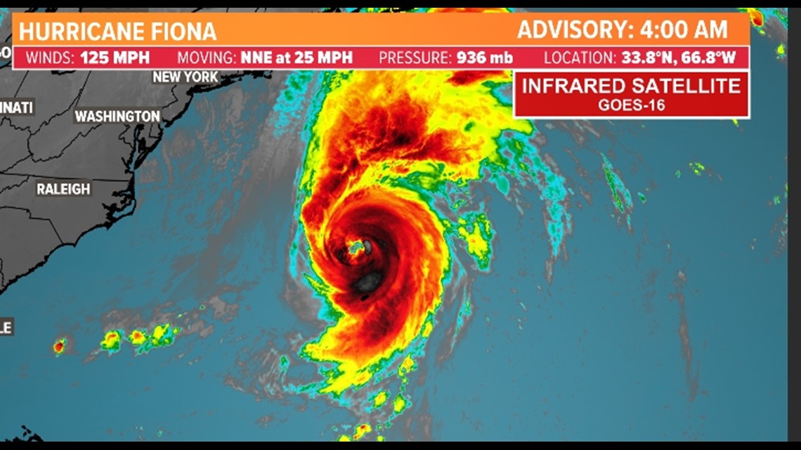
Fiona is a Category 3 hurricane as it approaches Bermuda on Friday, the NHC said. It may impact Nova Scotia and Newfoundland this weekend.


