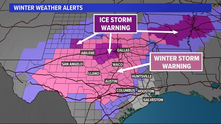
TEXAS, USA — An ice event is unfolding across Central and North Texas as a Winter Storm Weather Warning is in effect for parts of the state through Wednesday morning.

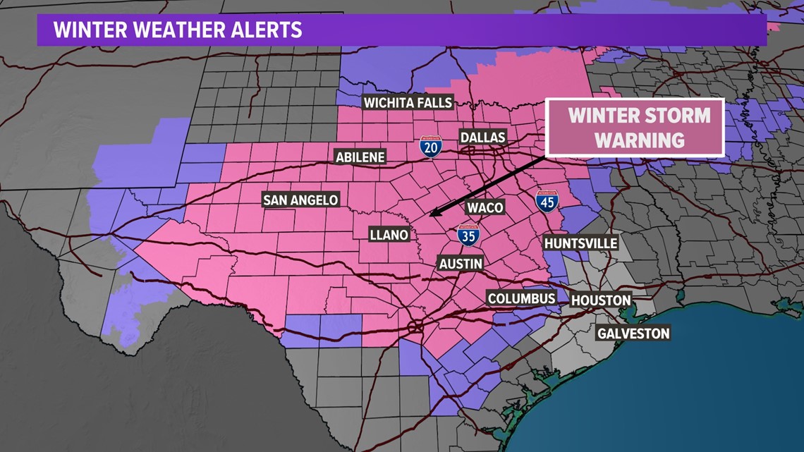
If you're traveling out of South or Southeast Texas this week, highways I-35 and I-45 should be your biggest concern. Those in the northern part of the state should monitor I-20 as well.

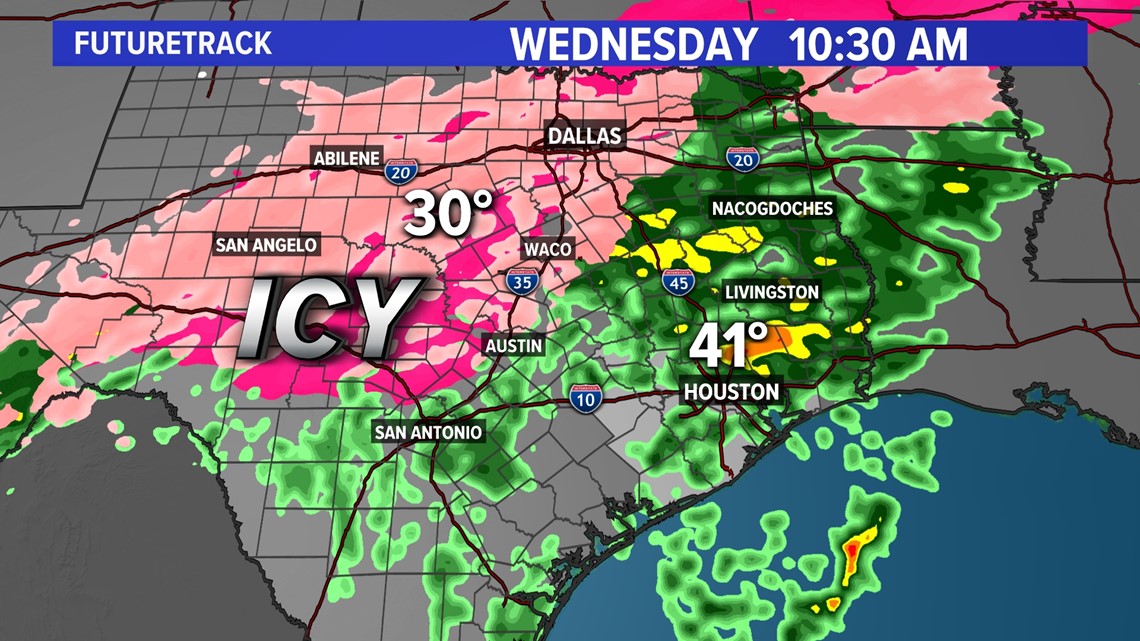
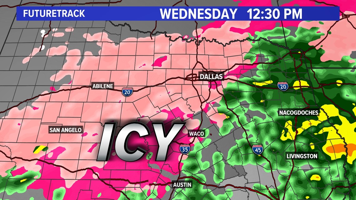
Freezing rain and sleet began in several parts of the Red River Valley on Monday and could last several days.
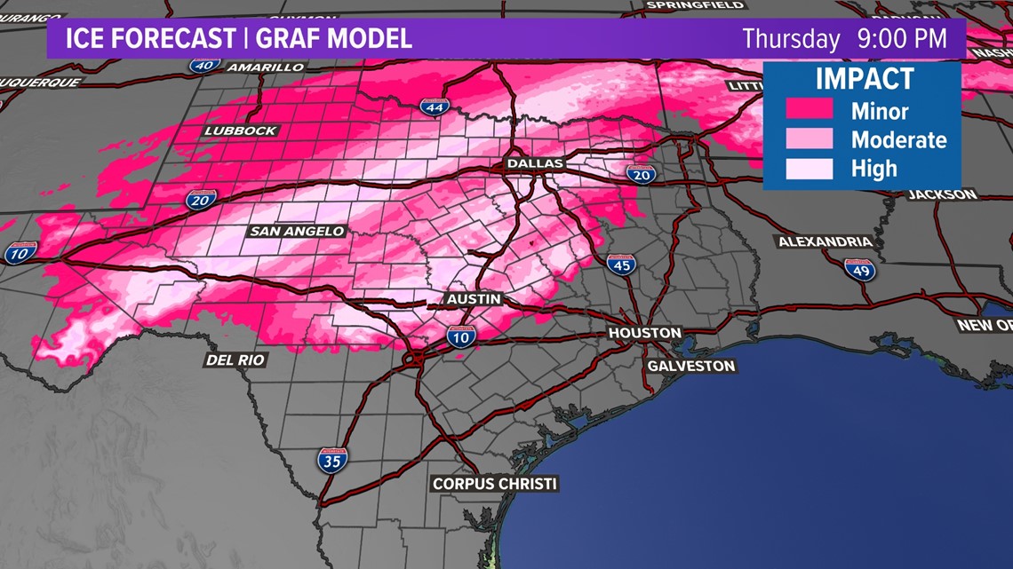
Part of this winter storm was caused by a cold front that stalled off the Texas coast, allowing for cold air to filter through the state, bringing in below-average temperatures for millions of Texans. Residents west of I-35 could see ice accumulations of more than half an inch through Thursday.

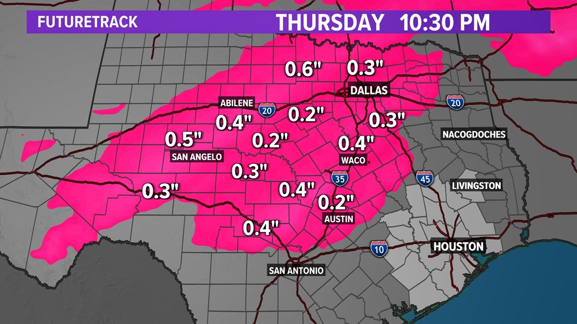

Accumulation of ice on roadways, especially bridges and overpasses, will cause hazardous travel conditions through Tuesday night. Power outages are also expected due to the ice, as every 0.25 inches of ice adds approximately 500 pounds of weight to a powerline span.
Winter Storm Timeline
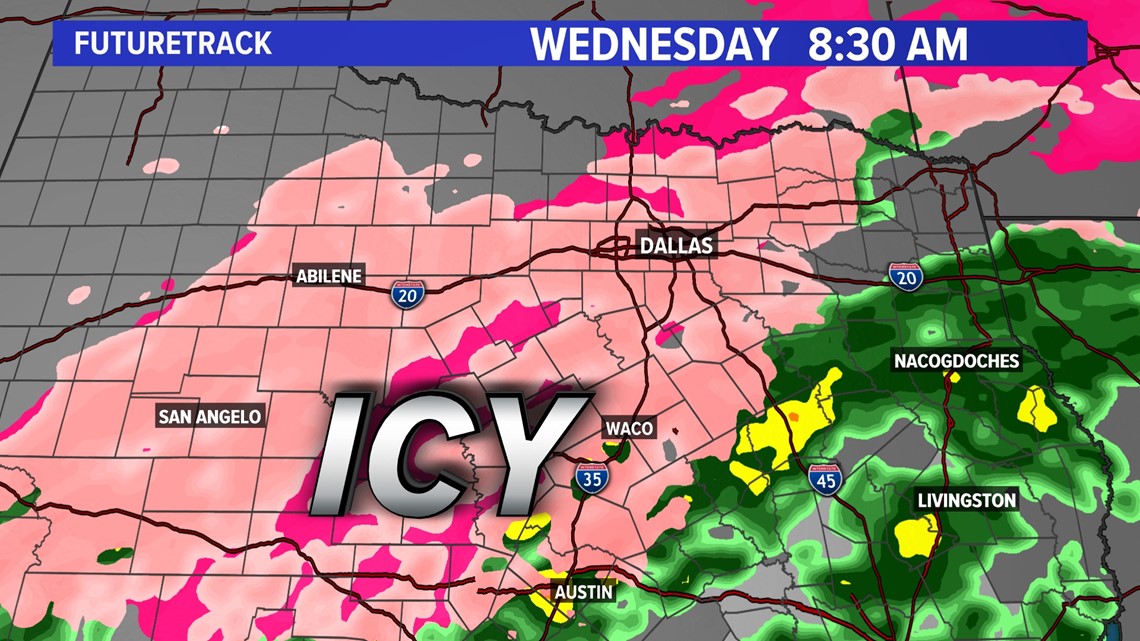
- Tuesday night into Wednesday morning
Lingering freezing rain or drizzle will be possible for most of North Texas. How widespread the rain will be or how heavy is still uncertain and icy roads remain likely.

- Wednesday afternoon and night
Temperatures could finally rise above freezing, which would help transition any freezing precipitation into cold rain and possibly some sleet.