

HOUSTON — What's hotter than hot? We don't know, but whatever it is, that's how you can describe the weather in the Houston area this month.
May has felt like the inside of a toaster.
We're only halfway through and we've already broken heat records.

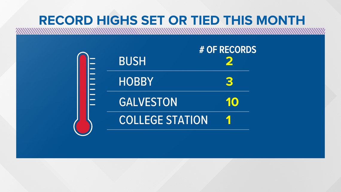
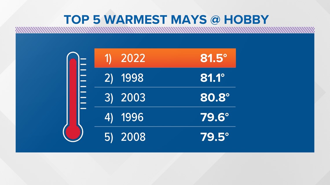
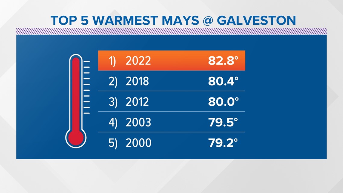
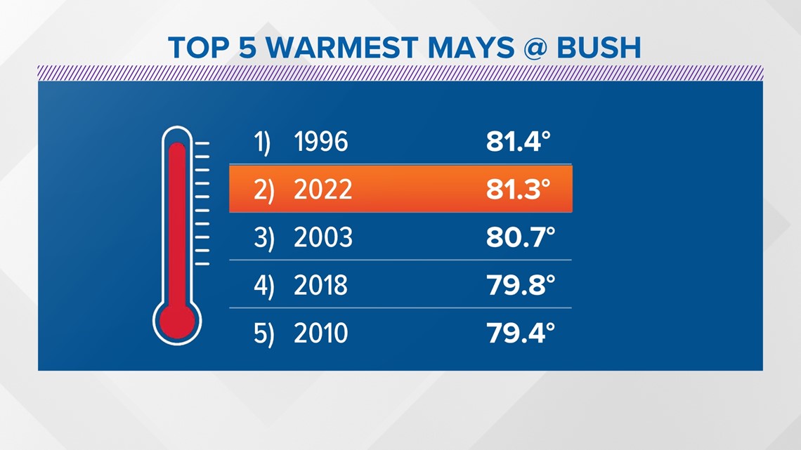
So far, this has been the hottest May on record for the Galveston and Hobby areas and the second hottest May on record so far for the Bush area.


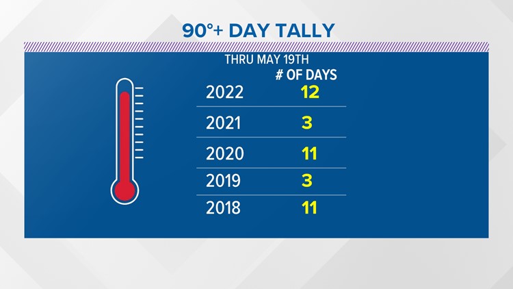
As of May 19, we've recorded 12 days of 90+ degree high temperatures.
The average number of 90+ degree days for May is eight.
As the hot, dry days pile on, the drought is getting worse in Texas. The latest drought monitor, which was released on Thursday, shows it.
Here's a look at why things are looking so bad right now.
Drought monitor
Compared to last week's drought monitor, the maroon color has expanded. That shows that the exceptional drought has worsened, as have extreme and severe drought conditions across the state — shown in red and orange.
In the Houston area, and East/Southeast Texas in general, the conditions held close to steady since last week.

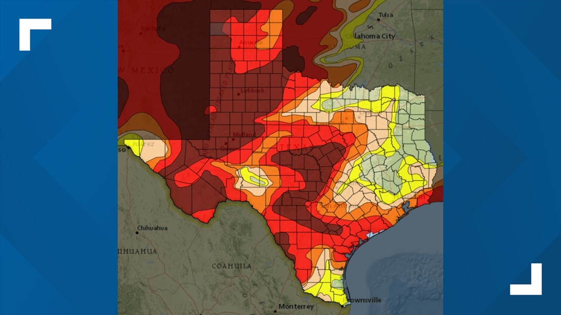
Compared to 2011, it's not too bad, but both of the years have something in common: They are La Niña years. That means that the sea surface temperatures in the Eastern Tropical Pacific are running about half a degree cooler or more compared to the average.
A bit of good news, we will see a shift in the overall heat pattern this weekend. We're expected to go from hot and dry to seasonable and wet. Emphasis on the wet!
Rain will enter into the forecast Sunday with temperatures dropping much closer to average, which is in the middle 80s.
The cold front responsible for the rain and less hot temperatures will stall along the coast for several days, leading to a prolonged period of unsettled weather into the middle of next week.
Follow the KHOU 11 Weather Team to get the latest updates on the local forecast:
