HOUSTON — After being under a “La Niña Watch” for the past few months, the Climate Prediction Center released Thursday that there is a 71% chance that La Niña will emerge in September-November and persist through January-March 2025. According to the Climate Prediction Center, our next La Niña period is expected to be “weak” and "short-lived."
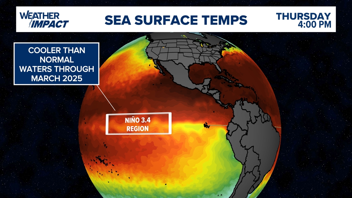
Whether our climate pattern is in El Niño or La Niña, it all has to do with the sea-surface temperatures in the tropical Pacific Ocean - specifically in a distinct region along the equator. NOAA uses the Oceanic Niño Index (ONI) to monitor if we are heading into an El Niño or La Niña period. The ONI is the 3-month average sea surface temperatures in the Niño 3.4 region. The Niño 3.4 region is in the east-central tropical Pacific between 120˚-170˚W, near the International Dateline. Whether temperatures in this region are warmer or cooler than average ultimately determines if we are in an El Niño or La Niña period.
If ocean temperatures are above average, we are in El Niño. Below-average ocean temperatures in the equatorial Pacific Ocean indicate that we are in La Niña.

What period are we in as of September 2024?
NOAA’s Climate Prediction Center says that we have been in a “neutral” period during the month of August, therefore we are not in an El Niño or La Niña period. This means that sea surface temperatures in the tropical Pacific Ocean are around the near-normal averages.
NOAA climatologists rely on computer model guidance to predict and forecast if we are heading into a La Niña or La Niño period. NOAA says that their team has been relying on the latest North American Multi-Model Ensemble (NMME), which is predicting La Niña to emerge in the next couple of months and continue through the Northern Hemisphere winter.
How does La Niña affect weather patterns in the continental U.S?
Being that La Niña will be in the picture through the Northern Hemisphere winter, this means that waters in the eastern Pacific Ocean are expected to be cooler than average for the next few months. For the U.S, this means that the northern half of the U.S. can expect a colder and wetter pattern.
For the southern U.S. which includes Houston and Texas, we can expect warmer and drier conditions through the fall and winter season.

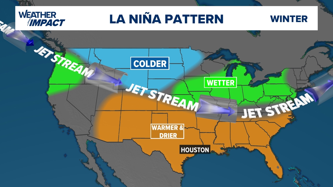
We can also expect more tropical activity during the months of hurricane season while the La Niña phase is ongoing. As a reminder, hurricane season lasts until November 30.
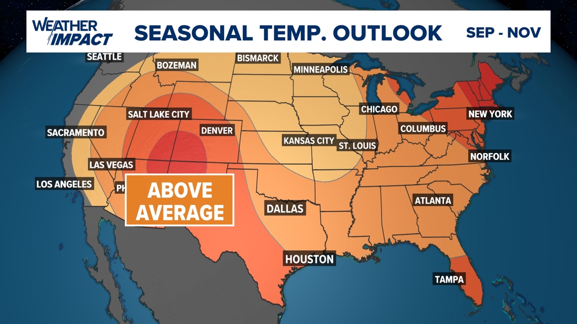
As we head into the beginning of fall on September 22, the Climate Prediction Center's seasonal temperature outlook is calling for above-average temperatures through the next 90 days.