HOUSTON — Conditions have to be perfect for a hurricane to reach Cat. 5 intensity. That's what happened on Monday as Hurricane Beryl's winds strengthened to 165 mph.
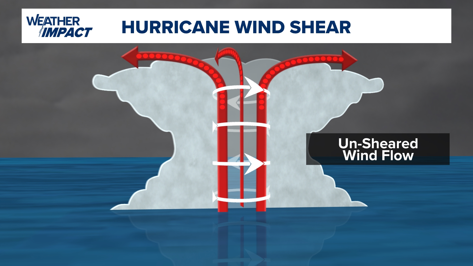
To get this strong, the storm must be in an un-sheared environment with light upper-level winds. This allows the storm to become perfectly symmetrical and vertically stacked through the vertical atmosphere, with cyclonic inflow at the surface and un-disturbed anti-cyclonic outflow at the top of the system.


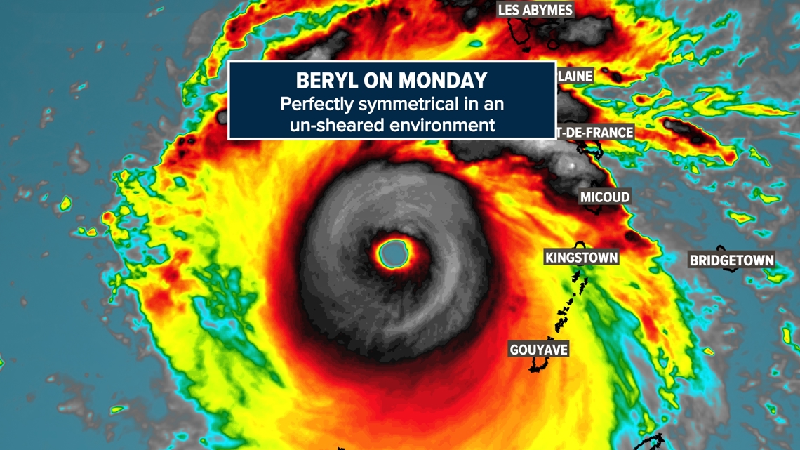
Here's what that looks like, as Beryl was intensifying in an un-sheared environment on Monday. The storm is 'standing' straight up and down with no upper level wind shear to disturb the circulation.

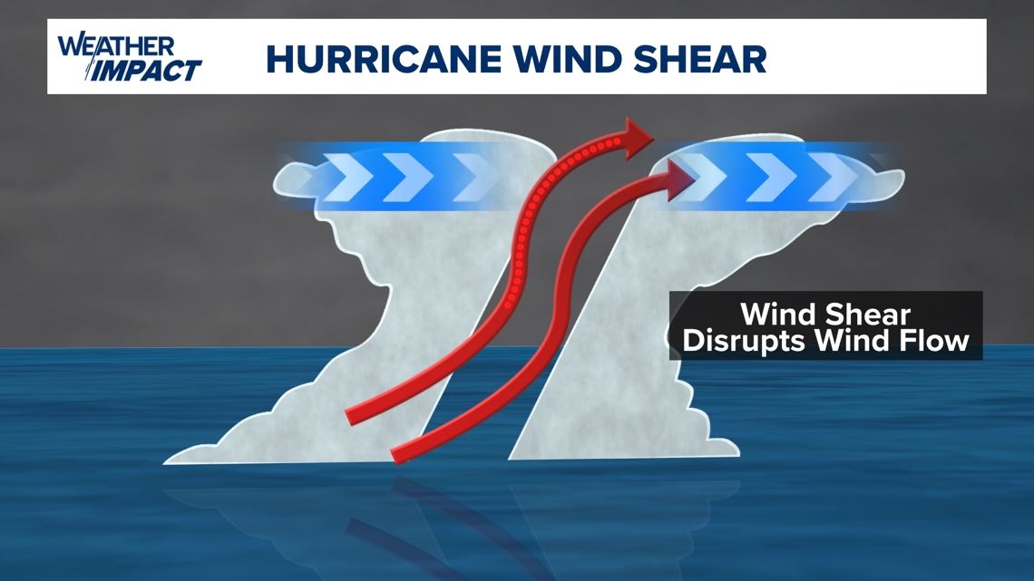
When hurricanes enter an environment in which the upper-level winds begin to blow, the system tilts and the circulation is disrupted.

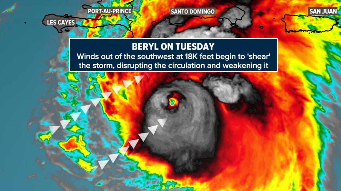
This process began on Tuesday as the storm moved into an area where the upper-level winds began to blow in from the southwest. This southwesterly 'wind shear' is already disrupting the circulation and weakening the storms' intensity. Pretty amazing how different Beryl looks on satellite Tuesday compared to Monday.