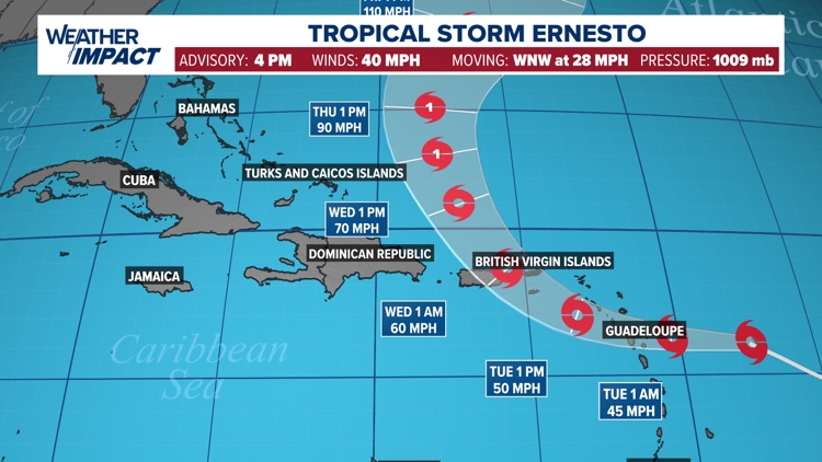
HOUSTON — The National Hurricane Center upgraded Potential Tropical Cyclone Five to Tropical Storm Ernesto Monday afternoon. Impacts are expected to begin across the Leeward Islands later Monday night into Tuesday, with heavy rain and breezy conditions likely.
Tropical Storm Warnings are posted for several of the islands, including Puerto Rico. Ernesto will strengthen on approach to the Antilles, with 60 mph winds expected Tuesday night as it passes Puerto Rico. From there, the storm will turn north and pass to the east of the Turk and Caicos. Category 1 hurricane status is possible around this time as it continues to move north. By Friday and Saturday, Ernesto may reach category 2 status on approach to Bermuda before going out to sea.

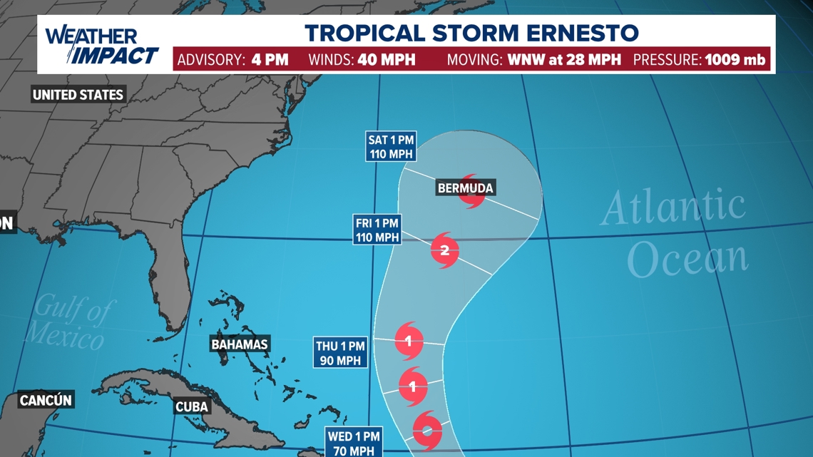


Beyond Ernesto, nothing is expected to develop in the Atlantic or Gulf over the next five to seven days. However, we are beginning to move into the peak of hurricane season, so make sure plans are in place in case a storm threatens.

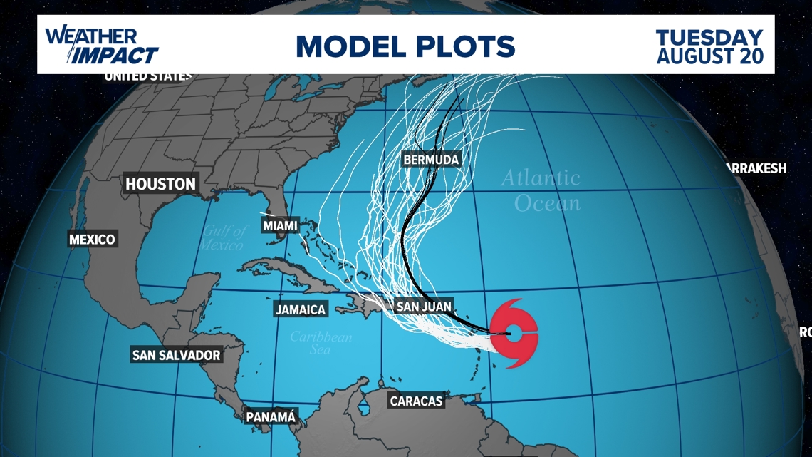
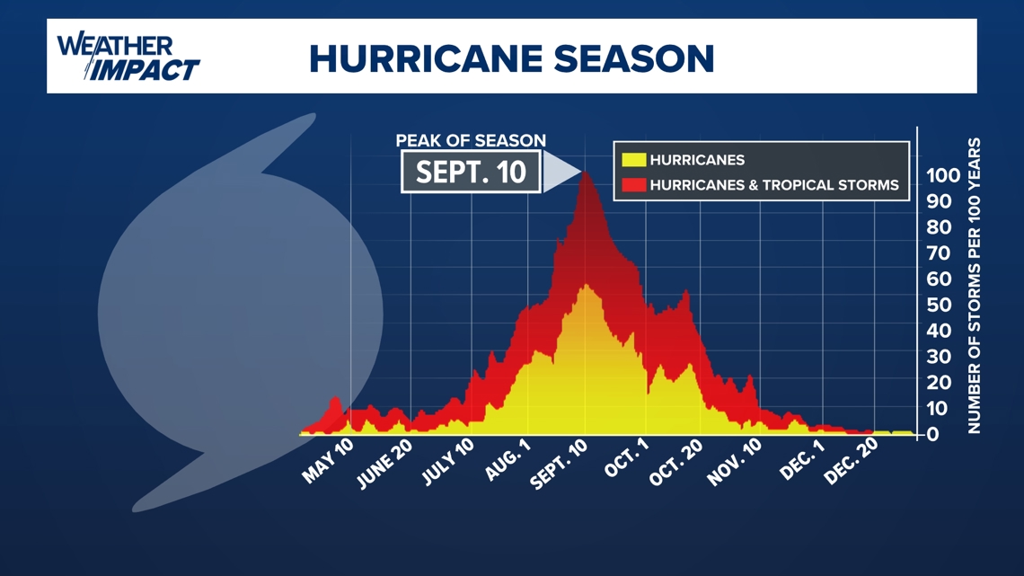
As we are heading toward mid-August, keep in mind that we are getting closer to the peak of hurricane season. August is when things usually start to ramp up, leading to a statistical peak of September 10. Storm activity peaks at this time because by then, sea surface temperatures have had several summer months to warm up, dust from the Sahara subsides and stronger tropical waves emerge off the west coast of Africa.

Live tropical tracker

