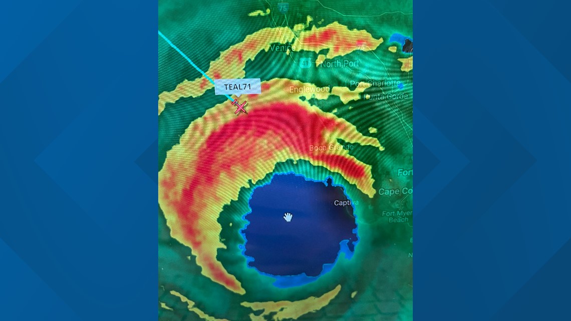
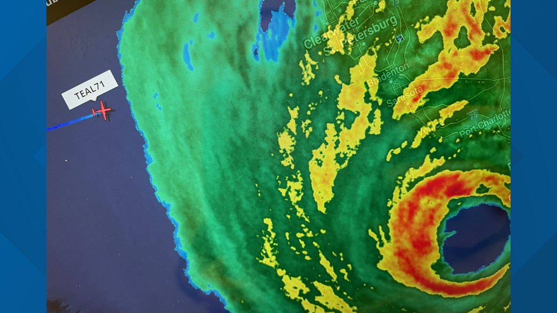
KHOU 11 Meteorologist Chita Craft and photojournalist Ivan Gibson flew into Category 4 storm Ian Wednesday on a Hurricane Hunter as it made landfall on Florida's West Coast.
The crews on board were collecting critical data from inside the storm to help track this monster hurricane's wind strength, location and more for NOAA and the National Hurricane Center.
In all, the Chita and Ivan flew and the Hurricane Hunter crew flew through the eye four times!
Below is a time-lapse of their journey through Hurricane Ian.
Chita describes what it was like to be on the Hurricane Hunter
Updates of their journey are below:
Wednesday, Sept. 28, 2022, 4:40 p.m.
TEAL71 lands in Biloxi, Mississippi after completing its trip through Hurricane Ian.
Wednesday, Sept. 28, 2022, 3:26 p.m.
TEAL71 officially flies out of Hurricane Ian.
Wednesday, Sept. 28, 2022, 2:17 p.m.
Hurricane Ian makes landfall as a dangerous Category 4 hurricane near Cayo Costa, Florida with winds at 150 mph.
Wednesday, Sept. 28, 2022, 12:15 p.m.
TEAL71 enters the eye. The plane has done four passes in the eye.
Wednesday, Sept. 28, 2022, 12:05 p.m.
TEAL71 is about to enter the outer eye.


Wednesday, Sept. 28, 2022, 11:30 a.m.
Chita and Ivan are onboard TEAL71 and about 15 minutes away from entering the outer edge of Hurricane Ian.


Wednesday, Sept. 28, 2022, 10:50 a.m.
Wednesday, Sept. 28, 2022, 10:30 a.m.
TEAL71 is airborne. This will be no easy flight for Chita, Ivan and the Hurricane Hunters. An engineer for one of the Hurricane Hunter planes described his flight into Ian as the "roughest flight" of his career.
Wednesday, Sept. 28, 2022, 8:58 a.m.
Checking in from Keesler Air Force Base in Biloxi!
Wednesday, Sept. 28, 2022, 6:45 a.m.
KHOU 11 Meteorologist Chita Craft is in Biloxi, Mississippi where she will soon lift off to fly into the eye of Hurricane Ian with hunters.
Tuesday, Sept. 27, 2022, at 10 p.m.
One of the important tools meteorologists use in determining a storm's strength and movement is the amazing Hurricane Hunters that fly right into the middle of a storm.
How do they do that, and what are they doing while inside the storm? It's all about science.
Hurricane Hunters provide a lot of information about a storm, but how are they even getting inside?
They're flying a plane called a WC-130J. It's a modified version of the C-130 plane that you might see dropping that red stuff on a fire out west.
The planes are tough. They can fly for longer periods of time and they can really take a beating.
These airborne science missions are run by the 53rd Weather Reconnaissance squadron which has been flying into storms since 1944.
In the cargo section of the plane, there are two different pallets of computer systems that take all of the data from the sensors on the plane's exterior to help determine what's going on inside the storm.
The Hunters also drop parachute-type sensors -- called Sondes -- which float through the storm relaying info about a storms pressure, wind speed, and direction.
That information all comes together, gets processed and is then shared through the National Hurricane Center for us to share with all of you.
Background
While millions of residents along Florida's Gulf Coast evacuate to escape Hurricane Ian, a few brave pilots and their passengers will fly directly into the eye of the monster storm.
KHOU 11 Meteorologist Chita Craft and photojournalist Ivan Gibson will be onboard one of the Hurricane Hunters Wednesday as crews gather key data to help experts understand the structure of the storm and the winds that steer it. The information helps the National Hurricane Center develop computer models that predict the storm's power and likely landfall.
NOAA's Hurricane Hunter fleet includes two P-3 turboprop aircraft and a Gulfstream IV jet. As they fly through a storm, they can encounter extremely powerful winds over 150 miles per hour. And while they're inside one of the most destructive forces of nature, they're flying blind.
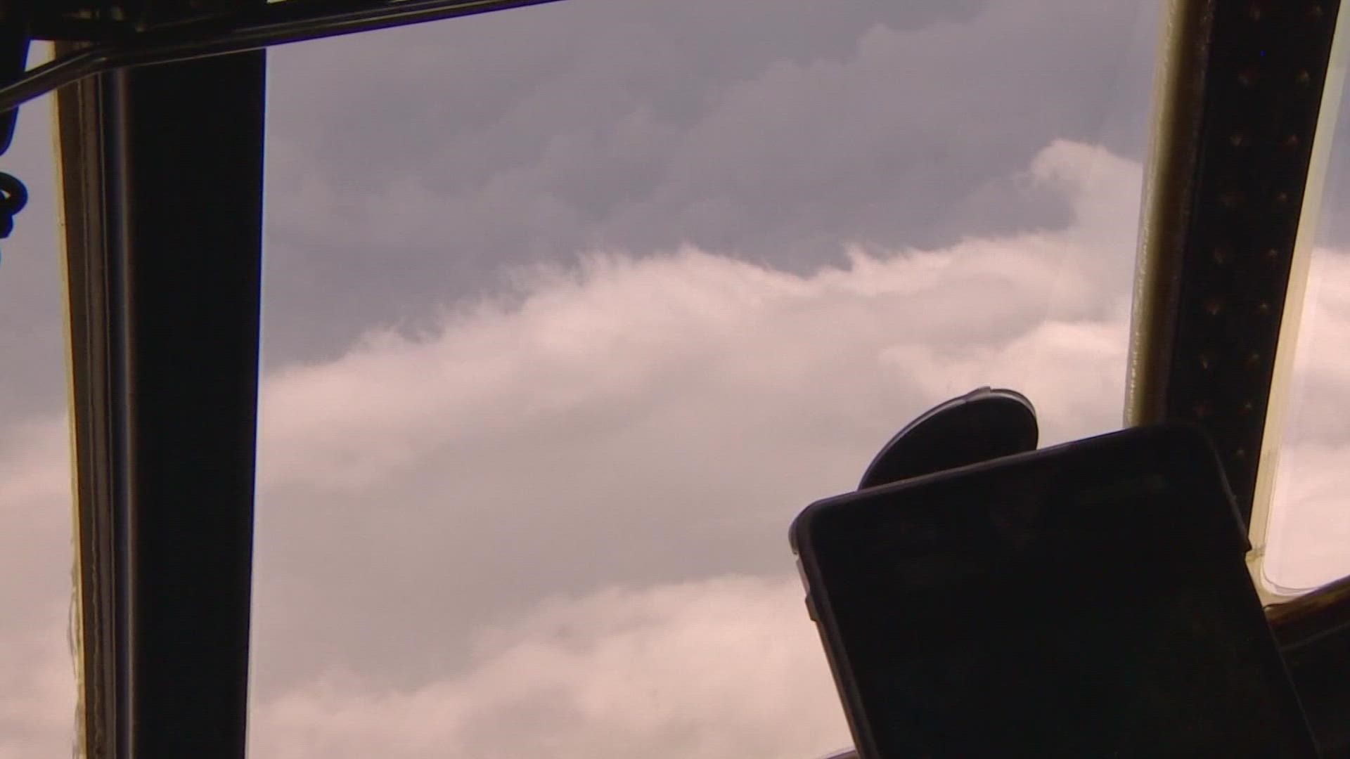
"Well, the best way I could describe it is it's sort of like riding a roller coaster through a car wash because you can't see anything out the windows in the eyewall," Hurricane Hunter Flight Director Richard Henning said in an interview on the NOAA website.
The high-tech equipment includes a device that parachutes through the hurricane to the ocean surface while feeding back data on pressure, temperature, humidity and wind.
Henning said they fly twice a day.
"This airplane will just go day, night, day, night, day, night for six days in a row. And the missions last anywhere between eight and nine hours."
According to Chita, the turboprops are a modified version of the C-130 planes used over wildfires.
"These planes are tough! They can fly for longer periods of time, and they can really take a beating!" Chita explained.
Fast facts about Hurricane Hunters
- NOAA's WP-3D turboprop aircraft fly into the eye between 8,000 and 10,000 feet above sea level. At that level, they avoid turbulent air below and icing or hail above.
- The Gulfstream jet flies over and around the storm with a cruising altitude of 45,000 feet.
- They pass through the storm at least four times each mission.
- Hurricanes can be 50,000 feet high and around 125 miles across or more. The eye diameter varies and can be around 5 to 30 miles wide.
- The information provided by the Hurricane Hunters make forecasting 30% more accurate, according to NOAA.
- The aircraft are deployed from the NOAA Aircraft Operations Center in Lakeland, Florida, or from airports in the Caribbean if needed to reach developing storms.
- These critical missions are run by the 53rd Weather Reconnaissance squadron which has been flying into storms since 1944.
- NOAA calls their hurricane hunters Miss Piggy, Kermit and Gonzo after the Muppet characters.

