

HOUSTON — Hurricane Season is around the corner and changes might be coming on how you see if you are going to be impacted by an impending tropical cyclone or hurricane.
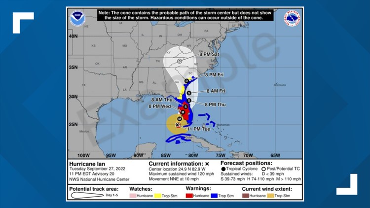
In the past, a great amount of emphasis was placed on the forecast cone, or "cone of uncertainty" published by the National Hurricane Center 3-5 days out. In prior hurricane seasons, you might have thought being in the cone meant "danger" and being outside the cone meant "safety".
For the upcoming 2024 Hurricane Season, the National Hurricane Center wants you to focus less on the cone and more on the watches and warnings of impending tropical storms or hurricanes.
The NHC says in a press release, "a recent unpublished study found that the inclusion of inland wind risk information on the cone graphic decreased focus on the storm track and increased focus on wind hazard information compared to the versions of the cone without inland watches and warnings".
Therefore, around August 15, 2024, the National Hurricane Center will begin issuing an experimental version of the forecast cone graphic for that includes inland tropical storm and hurricane watches and warnings for the continental United States.
What will the difference be with hurricane and tropical storm watches and warnings?
In prior hurricane seasons, when a tropical storm or hurricane is threatening the U.S, watches and warnings were issued along U.S coastlines for counties bordering coastal bodies of water. They did not include inland counties.

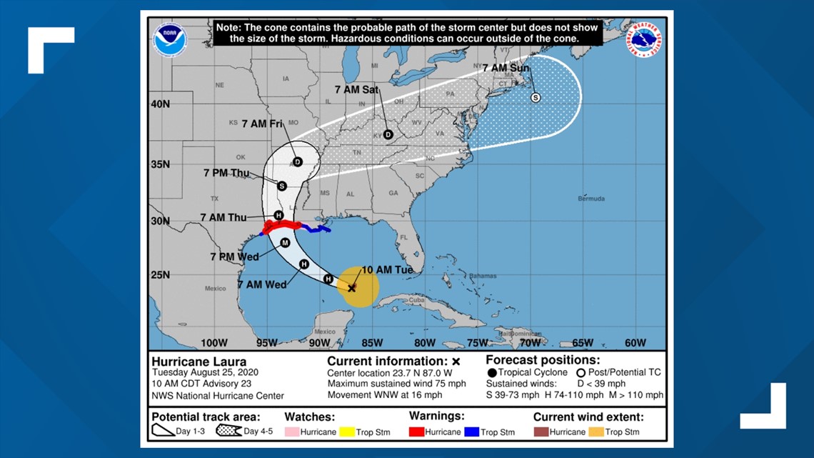
As tropical storm and hurricane conditions can very much be felt inland after a storm makes landfall, the National Hurricane Center will now issue tropical storm and hurricane watches and warnings for inland counties away from the immediate coast.
Will there be a difference in the forecast cone, or "cone of uncertainty"?
When a forecast cone shows a tropical cyclone heading over land, you will see more of an emphasis on counties that are included in tropical storm and hurricane watches and warnings.
The National Hurricane Center says that watch and warning depiction will be predominate on the forecast graphic and the goal is to stress the location of watches and warnings rather than the location of the forecast cone.
