
HOUSTON — With tropical systems, your location does matter when it comes to what kind of effects you’ll see from the storm and what kind of damage you can expect.
You may hear us say something about the “dirty side” of the storm. So what is that and why is it different?
Depending on where Beryl makes its final landfall, the Houston area could see impacts from the "dirty side."
The dirty of a storm refers to the area of a hurricane or tropical system where you’ll find the highest winds, highest storm surge and the greatest tornado threat.
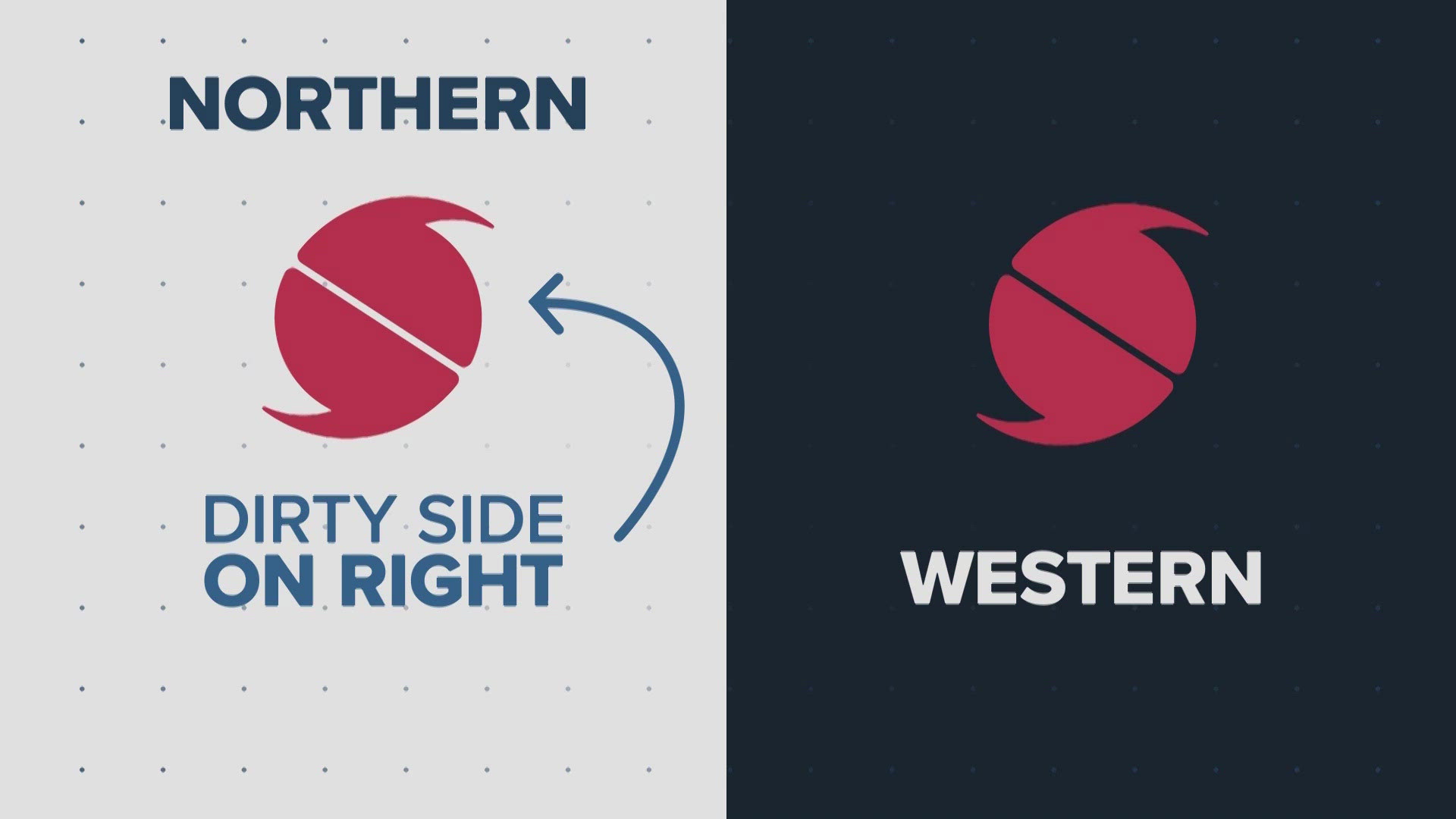
Generally, the dirty side of a storm is the northeast side, or more simply put, the right side of the storm. It also depends on which direction the storm is moving.
If it’s traveling in a northern direction, the dirty side will be more on the direct right-hand or eastern side. If the storm is traveling in a more western direction, the dirty side will be more on top of it or the northern side.
So, what makes it so “dirty”?
It’s all about the wind direction and a little math. For example, if a storm is moving north at 30 mph and has wind speeds of 100 mph, then the storm will produce winds of 130 mph on the right “dirty” side, while on the left side, winds move in the opposite direction of the storm’s movement, so they’ll be slower at 70 mph.
It’s important to remember, though, as a storm grows stronger, every side becomes dangerous.