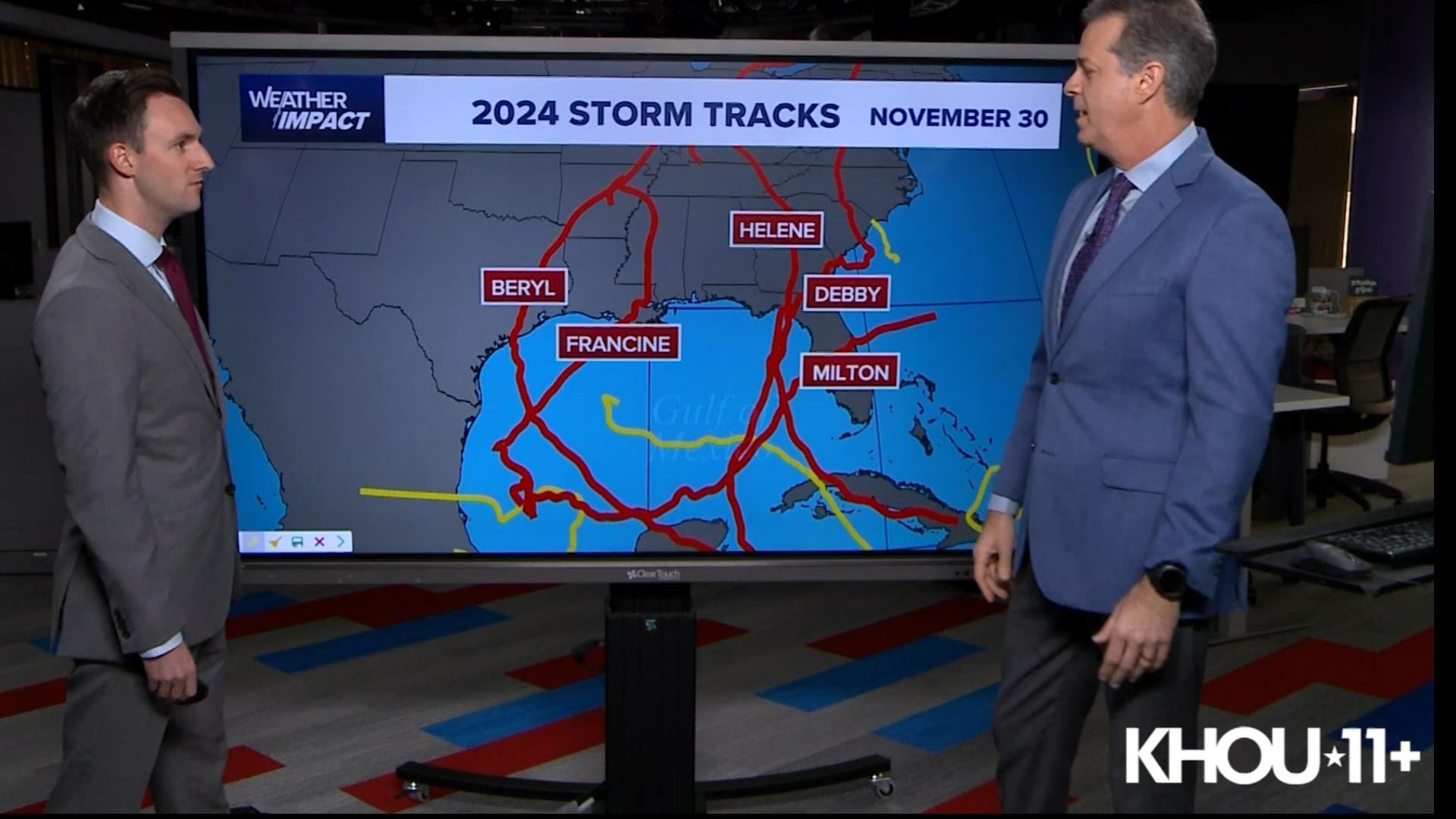
HOUSTON — At the time of this writing, I've just finished the live Friday evening update on Beryl. I am not pleased that the track has been adjusted to take aim on the middle Texas coast. This puts all forms of coastal and inland tropical threats right on the doorstep of my hometown. Stress has ramped up a few notches today for everyone.
Tropical weather forecasting is a humbling exercise in patience, uncertainty and change. Texas residents are watching this exercise in real time as the forecast track from the hurricane center took a big jump to the north on Friday. What is most frustrating for me is this: I want to be able to walk out and tell everyone exactly what the track of the storm will be and exactly what the impacts will be at your house. It doesn't work that way.
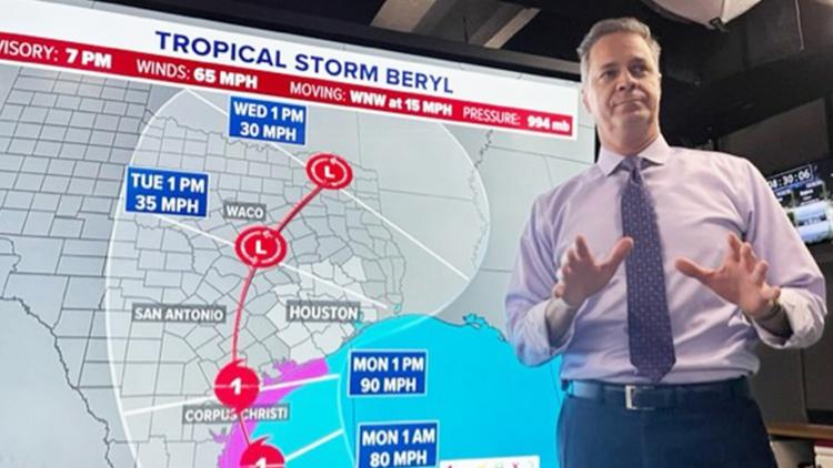
TRACKING BERYL: Latest forecast cone and models for Beryl
What I am telling my family and my extended Houston/Galveston family is this. We are going to feel impacts from Beryl, either from a glancing blow or a direct hit. I want us to be prepared for anything. For this one, staying safe means planning to just stay home Monday and Tuesday. Stay close to the forecast over the weekend and during the storm. And with a little luck, we can return to business as usual later in the week.