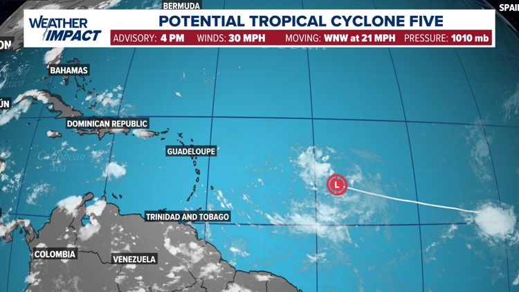
HOUSTON — On Sunday evening, National Hurricane Center designated Invest 98-L as Potential Tropical Cyclone Five (PTC 5). This designation basically allows the NHC to issue watches and warnings for a system that hasn't formed yet but is expected to form and impact land within the next 48 to 72 hours.

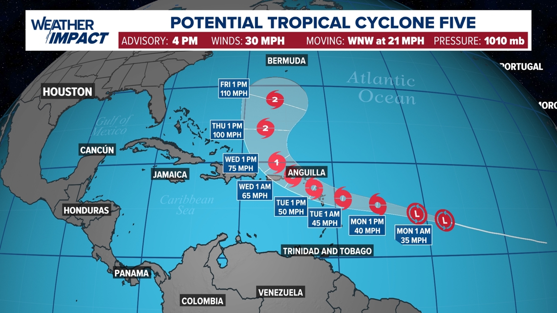
Once this system forms it will take on the name Ernesto. The official forecast from the NHC takes PTC 5 through the Greater Antilles and eventually north, towards Bermuda and out to sea. By the middle of this week, the storm is forecasted to reach hurricane status as it passes east of the Bahamas.

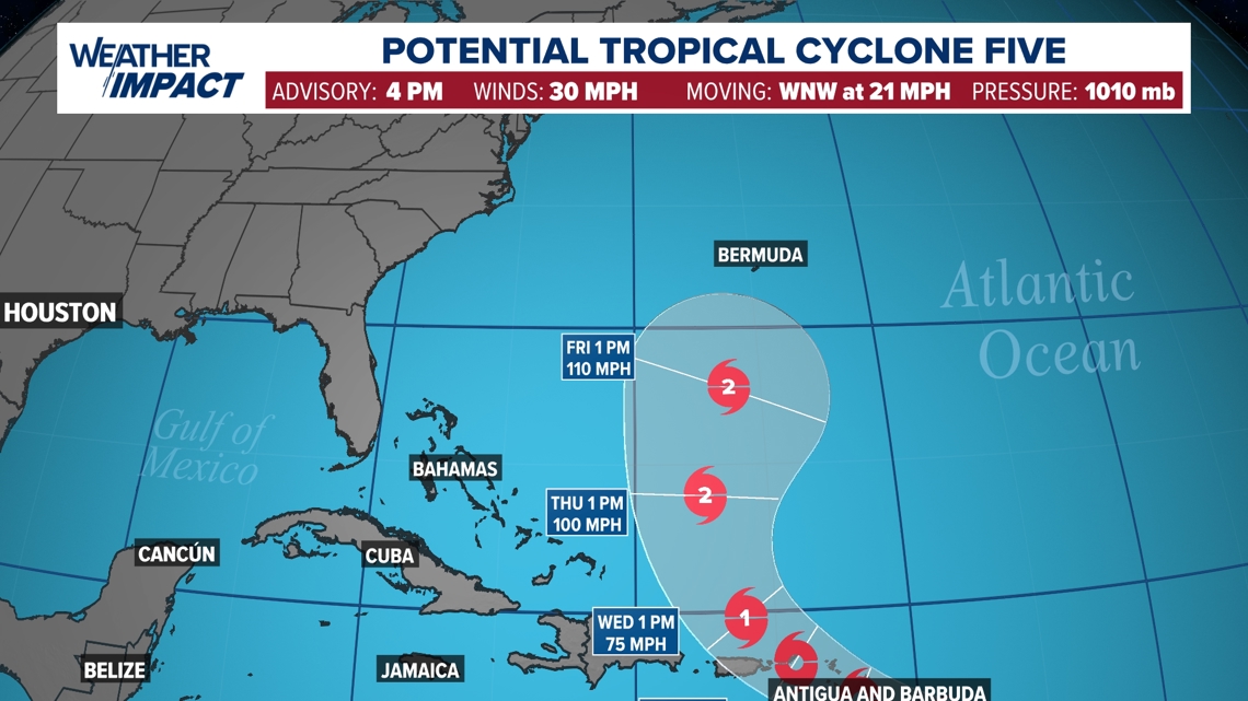
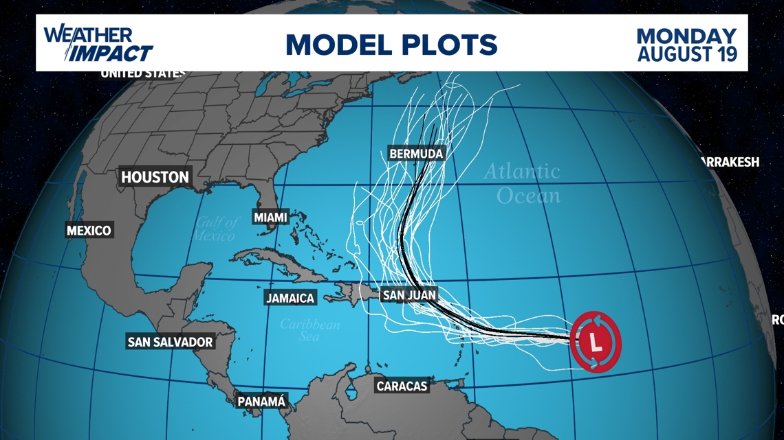
Areas that could be impacted by Invest 98-L include The Bahamas, Puerto Rico, and the island of Hispaniola. Majority of the weather models, especially the GFS (American) and the European model are in solid agreement that this system will stay in the Atlantic offshore the east coast U.S. This storm is not expected to enter the Gulf of Mexico.

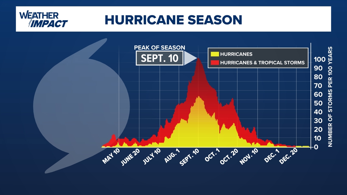
As we are heading towards mid-August, keep in mind that we are getting closer to the peak of hurricane season. The peak of hurricane season in the Atlantic basin is on September 10.