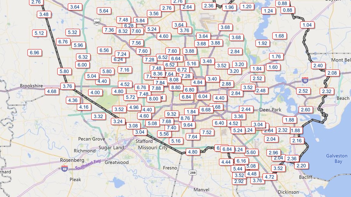
HOUSTON — As of Tuesday evening, rainfall amounts totaled anywhere from only an inch (on Harris County's northeast side) to more than 12 inches (on the southeast side) as Tropical Depression Beta continued to move slowly through the Houston area.
Most of the overnight flooding into Tuesday morning has been limited to roadways on Houston's south side, especially southeast where they also have storm surge impacts, but areas north can't let their guard down yet.
Harris County Meteorologist Jeff Lindner told KHOU 11 this morning that we will have to closely watch the impacts from Beta throughout the day and overnight into Wednesday mid-day because the grounds are already very saturated. Heavier rainfall could eventually pick up north of Houston, creating roadway problems there as well.
BETA UPDATE: Get the latest on the Beta's path here
HIGH WATER ROADS: View the list
APP ALERTS: Download the KHOU 11 mobile app
And of course areas on the south side that are already saturated will continue to be a problem as more rain comes. It just depends on where the heaviest rainfall occurs and how long it will last.
Monitoring these areas:
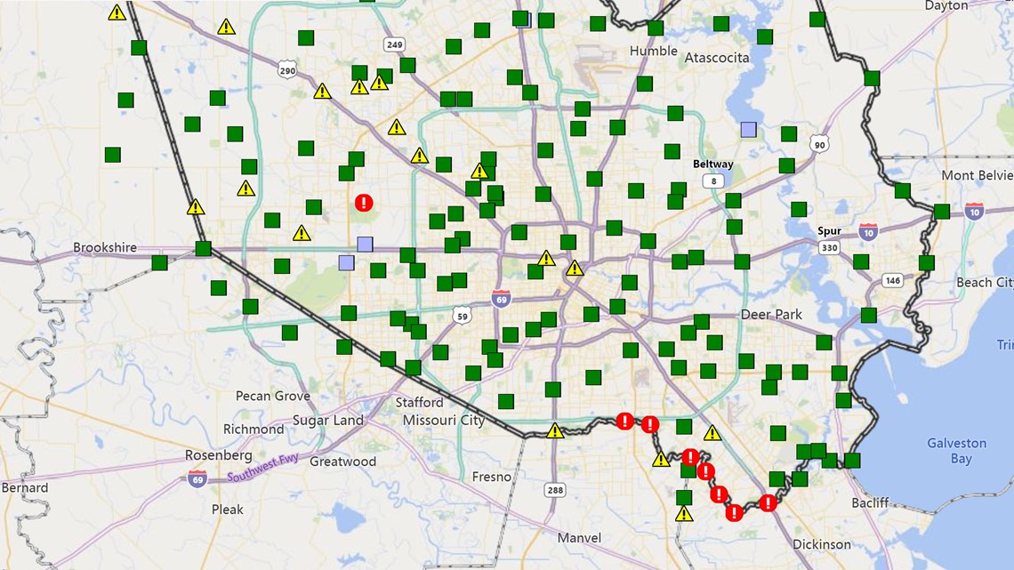
As of 9:00 p.m. Tuesday the Harris County Flood Warning System indicated these were the areas of concern:
FAR NW. HARRIS COUNTY
- Flooding possible 1195 Mound Creek at FM 362 near the Waller Co. line
- Flooding possible 2050 Cane Island Branch at Clay Road
- Flooding possible 1230 Little Cypress Creek at Becker Road
NORTHWEST HARRIS COUNTY
- Flooding possible 555 White Oak Bayou at Jones Road
- Flooding possible 550 White Oak Bayou at Lakeview Drive
- Flooding possible 540 White Oak Bayou at Alabonson Road
- Flooding possible 1170 Cypress Creek at Huffmeister Road
- Flooding possible 1175 Cypress Creek at US 290
- Flooding possible 1165 Cypress Creek at Eldridge Parkway N.
W. HARRIS COUNTY
- Flooding possible 2150 South Mayde at Greenhouse Road (Mayde Creek)
- Flooding possible 2190 South Mayde Creek at Peek Road
- Flooding likely 2115 Langham Creek at Clay Rd
CENTRAL HOUSTON
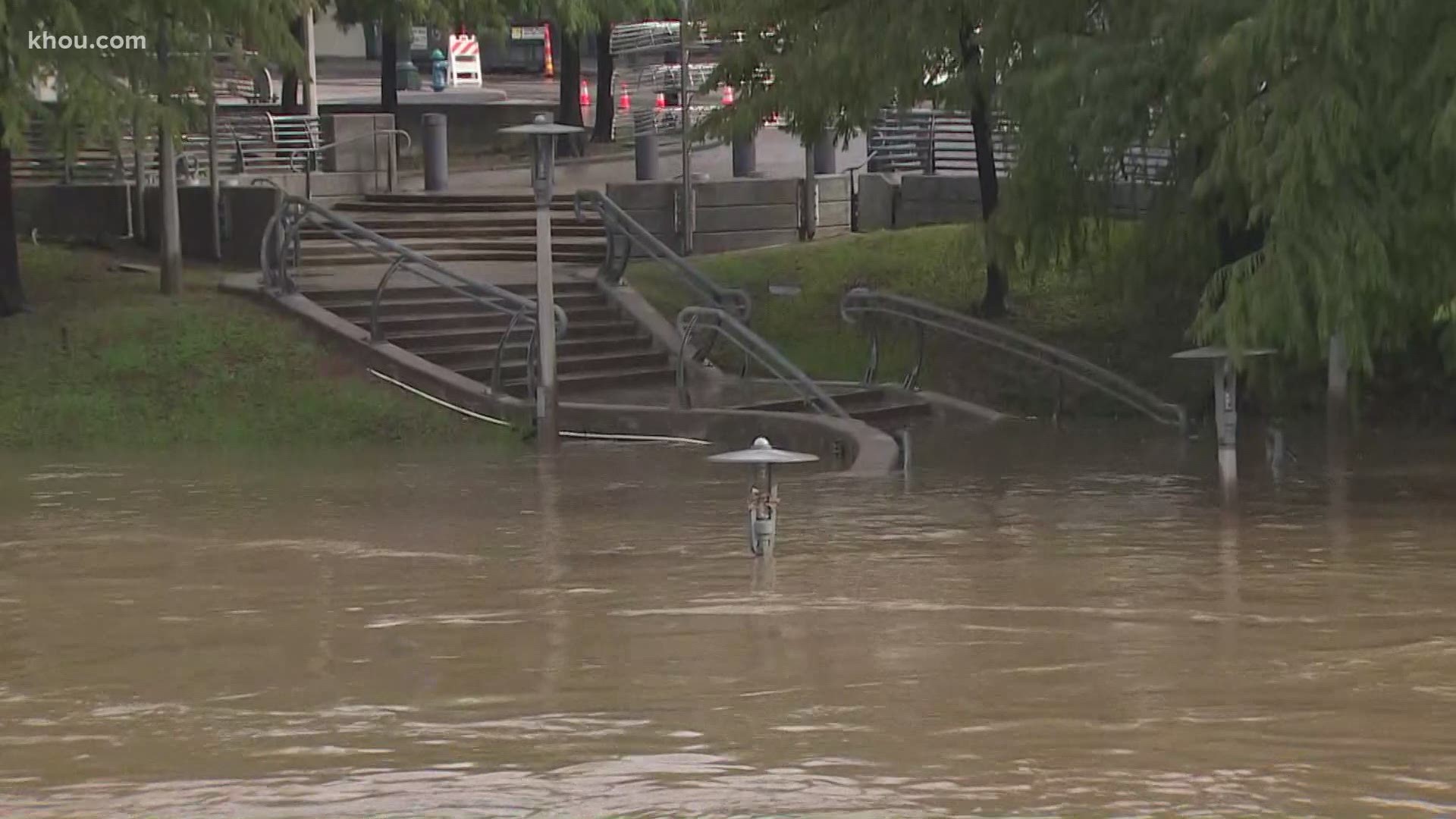
- Flooding possible Buffalo Bayou at Milam Street (downtown Houston)
- Flooding possible 520 White Oak Bayou at Heights Boulevard
E. HARRIS COUNTY
- Flooding possible San Jacinto River at Rio Villa (Highlands, TX)
S. AND SE. HARRIS COUNTY
- Flooding possible & likely along Clear Creek from Pearland, Friendswood, Webster, League City, Nassau Bay, Clear Lake/NASA area (Jeff Lindner reports some homes have flooded in Friendswood)
- Brays Bayou is still within its banks, but there are concerns in nearby neighborhoods due to drainage issues - especially along 288 in the construction area inside the 610 Loop
- Flooding possible 160 Beamer Ditch at Hughes Road
- Flooding possible 140 Turkey Creek at FM 1959
- Flooding occurring Brays Bayou at Spurlock Park
- Flooding possible 610 Taylors Bayou at Shoreacres Boulevard
- Flooding possible 125 Chigger Creek @ Windsong Lane
Green icons = "No Flooding reported"; Yellow = "Flooding Possible"; Red = "Flooding likely"


"Corridor of training feeder bands likely to continue for several hours yielding additional heavy rainfall on areas that have already been hard hit. Flash flooding will continue," tweeted Lindner, Harris County's meteorologist.
24-hour rainfall totals as of 9:00 p.m. Tuesday in Harris County:


Southeast of Houston early Tuesday, KHOU 11's Michelle Choi visited the Shoreacres community where residents were closely watching the water just outside their homes. That area is impacted not just by the heavy rainfall but also the storm surge.
As of 9 a.m. Tuesday we had plenty of reports of stalled and flooded cars in the Houston area but so far no confirmation of water getting into homes or businesses. One of the worst impacts to Houston's traffic this morning was along Highway 288 at Brays Bayou where all lanes were shut down in both directions:

