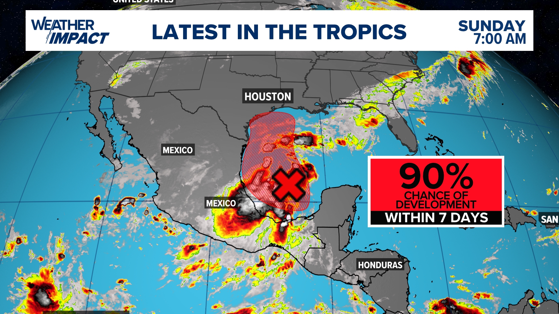
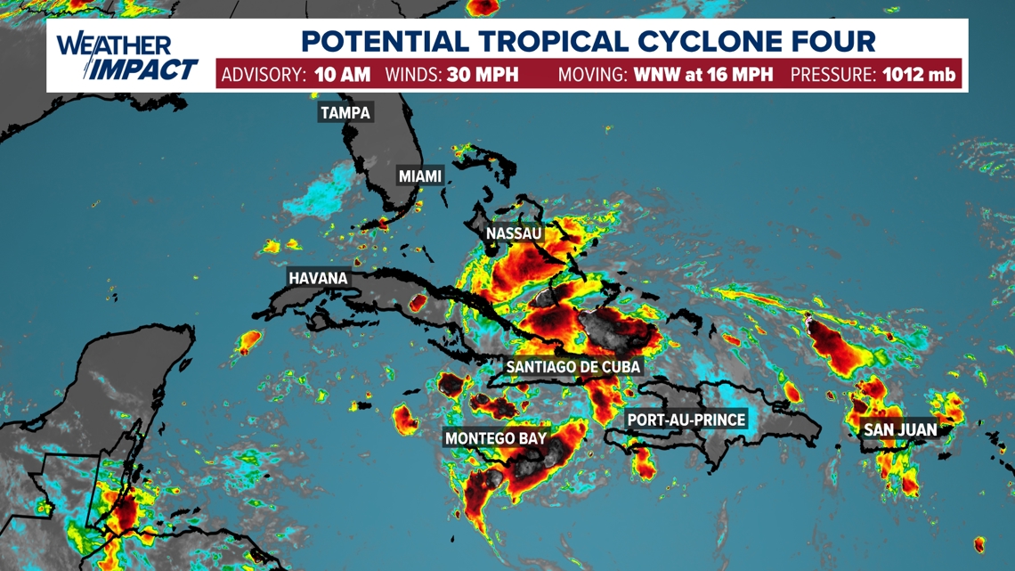
HOUSTON — Potential Tropical Cyclone Four is a tropical wave drifting across Cuba has been highlighted by the National Hurricane Center (NHC) for potential development. The disturbance now has a 90% chance of development into a tropical depression within the next seven days. If it does become a tropical storm, it will take on the name Debby.
The tropical wave is over the Bahamas and nearing Cuba right now- it is heading towards Florida.

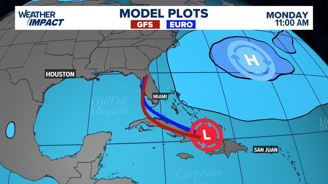
The first forecast track has been released by the National Hurricane Center and it takes the disturbance north of Cuba. Once over open water, PTC Four is expected to strengthen into a tropical storm and head towards the western Florida coast. Landfall will likely be late Sunday evening. This system will bring torrential rain to the Florida peninsula and south Georgia. The storm could bring downpours as far north as the Carolinas.

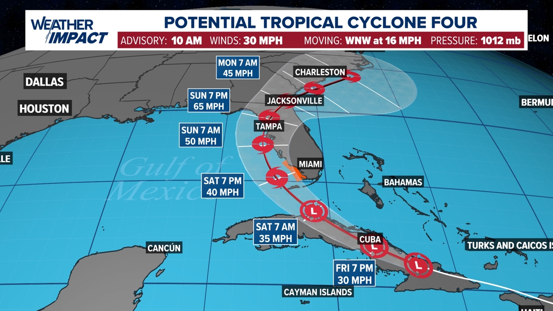
Right now, the GFS (American) and European weather models are in agreement that PTC Four will move into the western Florida coast. However, everyone along the Gulf coast should be watching the developments of this system closely within the next few days.

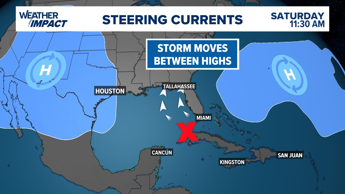
As of Friday, a high-pressure system is dominating over Texas bringing hot and sunny conditions through the end of the work week. Tropical systems usually avoid high-pressure systems and they serve as "steering mechanisms. We are expecting the tropical system to emerge north of Cuba Saturday night and Sunday morning. At this point, the storm will take the path of least resistance and likely head into northwest Florida.
This system will not impact southeast Texas.

Typically, July features a lull in tropical activity across the Atlantic Basin, and that is exactly what we have seen over the last three weeks. Following Hurricane Beryl's landfall in Southeast Texas on July 8, there hasn't been a single tropical disturbance anywhere in the Atlantic or Western Pacific. For some, this may be surprising considering the dire forecasts for a hyperactive season made in May and June.
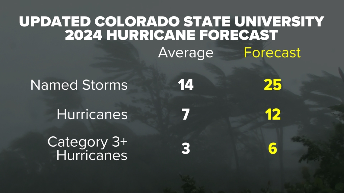
RELATED: Colorado State University releases hurricane season forecast update, maintains it will be a busy one

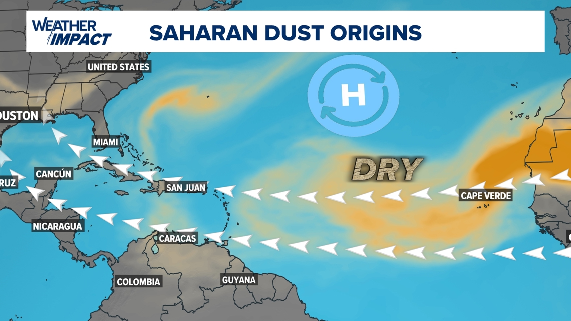
The Saharan Air Layer (SAL) typically dominates the Atlantic in July. This dry and dusty airmass provides a hostile environment for any tropical systems to develop. As a result, when the layer becomes a key player during the month of July, tropical activity goes on hiatus before the peak of the season arrives later in August and September.