
HOUSTON — After record-breaking triple-digit heat this past summer, could the first real fall cold front be right around the corner?
The KHOU 11 Weather Team is tracking the first cold front of the season. After a long, long, hot, drought-filled summer, our first fall cold front can't come fast enough.
Here is a look at the potential timeline of this change in our weather pattern. We could see area-wide showers and thunderstorms by Thursday and maybe into Friday.
It’s a timeline we are going to track closely since we are still several days out, but it will have a big impact on our temperatures across Texas. At this time, it’s tough to forecast how much of a significant change our temperatures will be at this point.
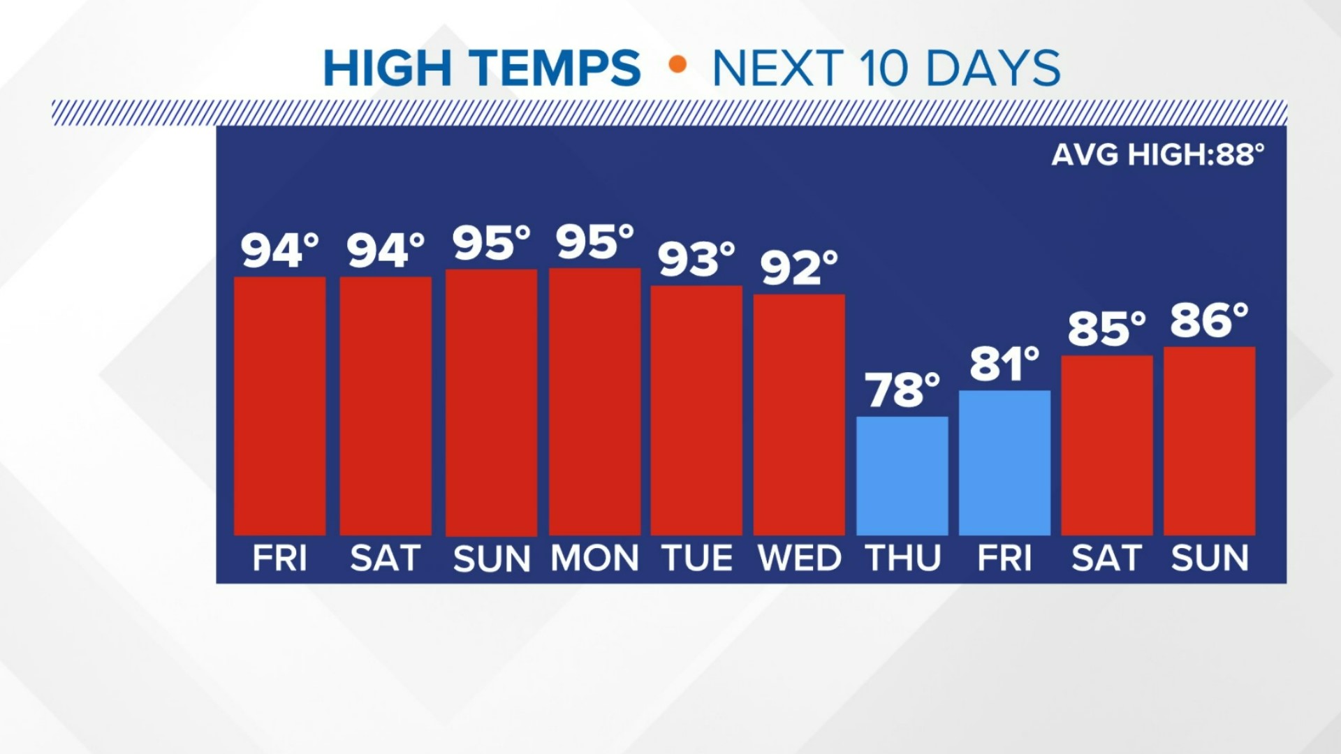
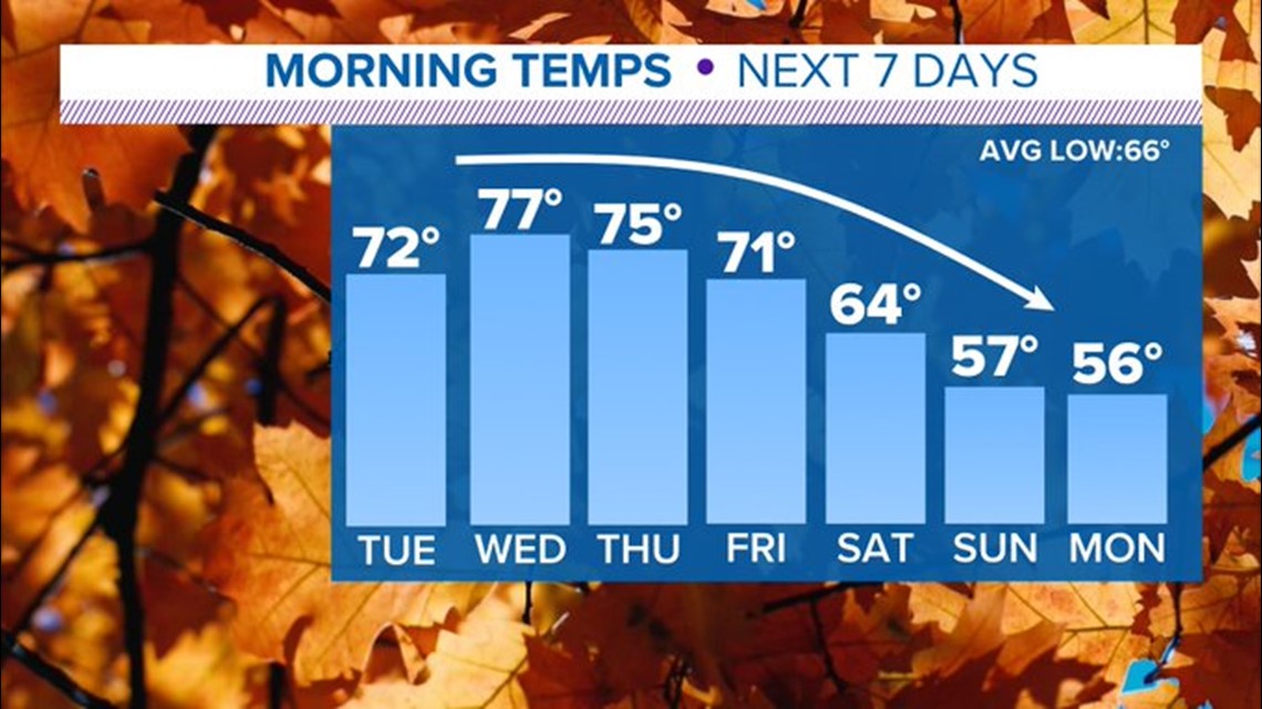
For the first half of the week, we're going to see highs in the mid-90s with lots of humidity before we see a full-blown summer drop-off with much lower humidity and much more comfortable temperatures going into the end of next week and the weekend.

There is chilly air beginning to mass in the Klondike in northern Canada. What we need is a mechanism to pull it south, and that mechanism is a dip or a trough in the upper-level winds in the jet stream.
As we head into Monday, we've got a trough beginning to build, so that would open the door to pull cold air out of Canada and bring it into the lower 48 states.
A look at the pattern heading into Thursday shows the jet stream where that cold air is in the Klondike and then pulling it south. That would help to push a surface cold front into Houston going into early Thursday morning.

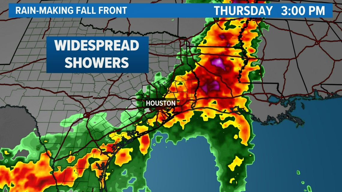
We are expecting to get some rain and a wind shift early Thursday morning. Then that would blow on through.
Finally, finally, we would get a taste of fall. It’s not going to get cold but be much more comfortable. It would feel like an October fall day in Houston.
The front will begin hitting Dallas in the morning on Wednesday. The Houston area will see it on Thursday morning.
According to the latest model run, the front should arrive around 6 a.m. Thursday with a north breeze pushing offshore as the front, the leading edge of the much more comfortable air mass, comes in later Thursday morning.
Then Friday looks gorgeous.
The center of a surface high with a clockwise flow will be sitting over San Angelo and we will be on the cool dry side with a northerly flow going into Friday. We would stay that way going into the following weekend.
That would be the first really nice weekend we've had in a long time.
Follow the KHOU 11 Weather Team for updates: