

HOUSTON — As Beryl moves through Southeast Texas, expect torrential downpours that could lead to street flooding.
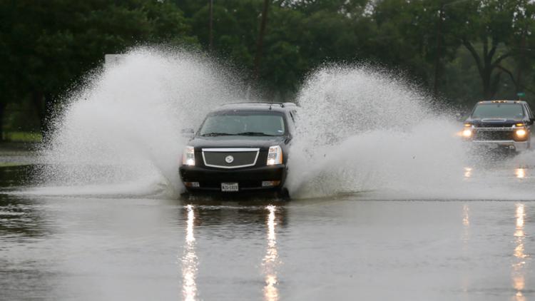
Here in Houston, it doesn’t take a lot of standing water to damage your car.
You can lose control or stall in less than six inches of water. In just a foot of water, your car can start to float. In only two feet of water, your car can easily be carried away while you’re still in it.
If you encounter any high-water spots, remember the saying: "Turn around, don't drown." If floodwaters rise around your car, abandon the vehicle and move to higher ground.
Below is a list of high-water spots, as reported by Houston TranStar. These are not all of the water-covered roads. Please check with your local officials for high water spots before getting on the road.
Houston, Harris County
Precinct 4
The Harris County Precinct 4 Constable's Office reported these flooded roadways:
- North Freeway and FM 1960 Road
- Cypresswood Drive and Champion Drive
Fred Hartman Bridge closed
The Fred Hartman Bridge is shut down in both directions due to overturned 18-wheelers. Motorists need to seek an alternate route,
Fort Bend County
The Fort Bend County Office of Homeland Security and Emergency Management has put out the following list of roadway issues.
- Feeder on SH 6 from McKeever to FM 521- flooded NB & SB lanes
- 21500 Westheimer Pkwy - high water; at least one vehicle stuck
- WB US 90 at NB SH 99 - high water and at least one vehicle stuck
- SH 99 / BAYHILL - high water
- SH 99 NB/COUNTY LINE - high water; not passable
- SH 6 exit to FM 521- flooded
- SH 99 / BAYHILL - high water
- SH 99 NB/COUNTY LINE - high water; not passable
- SH 6 exit to FM 521- flooded
- SIENNA RIVER PKWY / SIENNA PKWY - high water
- FM 359/RICHMOND FOSTER -down trees
- FARMER RD/MITCHELL LAKE DR, RIC - down trees
- 10000 BLK WESTMOOR - down trees
- FM 762 / GOLFVIEW - traffic signal out
- FM 1464/ FM 1093 - High water
- Brightwater Dr & Waterview Ct, Missouri City - high water
- Glenn Lakes Ln & Masters Ln, Missouri City - high water
- MAGNOLIA / SABINE in Orchard - tree on powerlines
- Turtle Creek Dr, Missouri City - high water
- US 59 SB BTWN RICHMOND PKWY / FM 762- down tree
- 4319 S Shadow Mist Ln, Sugar Land- debris in roadway
- SH 99 over RIVERPARK DR - down tree in roadway
- FM 1092 at 5th St - high water
- Hwy 6 & Colony Lakes Dr. - Debris in Roadway (Blocking 2 Lanes)
- FM 1092 at Lexington - high water
- 3000 Cypress Point Dr, Missouri City, - high water
- WESTHEIMER PKWY / WILLOWFORK DR - high water
- Staffordshire Rd & Independence Blvd, Missouri City- high water
- Masters Ln & Glenn Lakes Ln, Missouri City- high water
- El Dorado Blvd & Bermuda Dunes Dr, Missouri City - high water
- 1700 JACKSON ST, RIC - underpass is not passable due to high water
