

The much advertised rain event for Wednesday and Thursday is still on track and the latest thinking hasn't deviated much from previous forecasts. If I were you, I'd hunt for the umbrella. If you don't have one, buy one -- or steal it from your buddy.


What We Know:
In the words of Ollie Williams, ''it's gon' rain!" In fact, your umbrella may be inside out, two miles away if the severe weather aspect of it all comes to fruition.
A cold front working its way through Texas will ooze through the state like stone cold molasses allowing ample moisture to pool out ahead of it. As the front moves in, it will force all that moisture up and what goes up must come down -- this time in the form of very heavy rain and isolated severe storms.

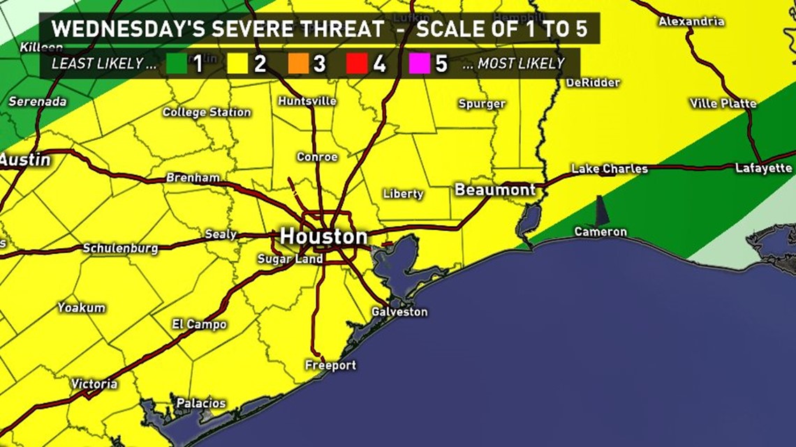
The Storm Prediction Center out of Norman, Oklahoma has placed all of southeast Texas in a 'Slight Risk' or 2 out of 5 for severe weather for Wednesday. A slight risk designation still represents a higher than average chance of seeing severe storms so don't let your guard down!
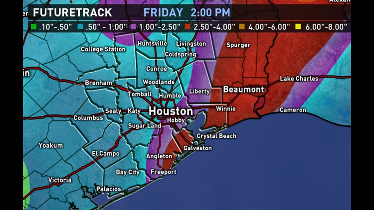
The National Weather Service continues to indicate that our area will average between 2 to 4 inches with isolated amounts a bit higher. Thankfully, widespread flooding will not be an issue. There's two things working in our favor: 1. the ground is dry. While we're not officially in drought conditions, anecdotal evidence would suggest things are drying out. 2. It's spring and everything has woken up from winter's slumber. Trees and plants that are now awake will absorb a lot more moisture this go around than what we saw with the last 3 to 4 inch rain event this past winter where the bayous came up much further than anybody imagined they would.
TIMING:
For areas north and west of Houston, this rain event will kick off as early as Tuesday afternoon. We could see some storms moving into the Houston area late Tuesday night but the main event for the I-10 corridor will be Wednesday evening into early Thursday morning. For those living along the coast, it'll be a scooch later.
Skies will slowly dry out and clear from northwest to southeast during the day Thursday. In fact, it's not totally out of the question that we could see some peeks of sun as you get ready to head home from work Thursday afternoon -- mainly north of I-10. For those along the coast, the clouds and even a few showers will be possible throughout most of the day Thursday.
WHAT TO EXPECT:
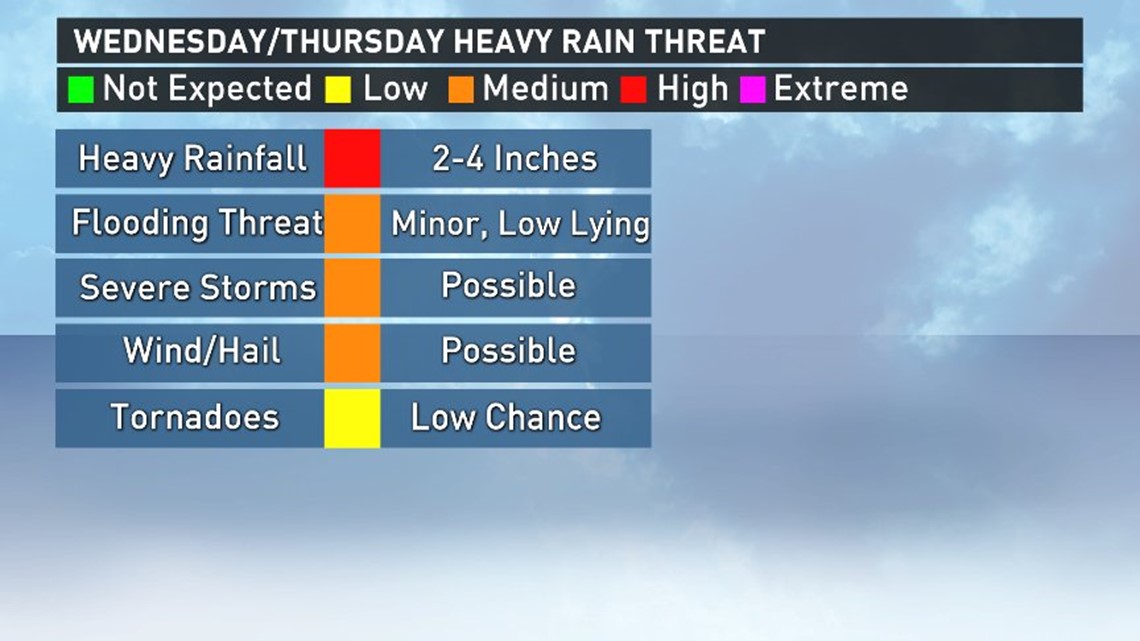
In a word: rain. The rain will likely be heavy at times as well. Generally 2-4 inches can be anticipated. The atmosphere will be plenty unstable so hail and gusty winds and an outside shot at a quick spin up tornado will be possible.
When it comes to forecasting rain amounts, movent of the system will be key. If the front comes through faster than anticipated, expect lower amounts of rain. If it comes through slower, expect higher amounts. As of this entry, the highest rainfall totals are still expected to be north and east of Houston.
We'll continue to monitor the situation closely and send out updates on twitter, facebook, facebook live and on-air as necessary.
By Thursday evening, the rain is done and will set the stage for a nice, sunny weekend with drier, cooler air in its wake.
