(SEE Wednesday, 8/31/16 UPDATE AT BOTTOM)
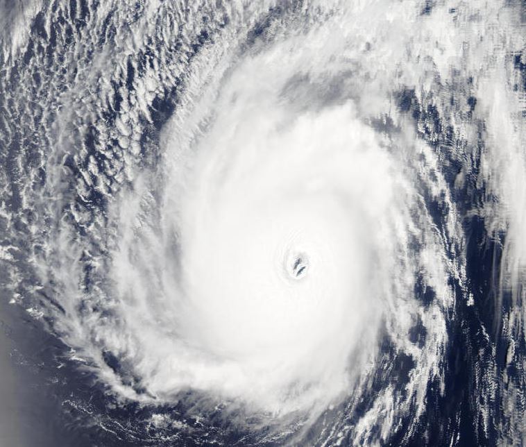
If you know your cinema history, you know that during the filming of Jurassic Park on the Island of Kauai, near the northern tip of the Hawaiian chain, a powerful Category 4 hurricane nearly destroyed the entire production. It had winds of 145mph and is considered the most powerful storm to hit the State of Hawaii in recorded history. While the 8-Island chain sits squarely in the tropical Pacific, hurricanes there are actually pretty rare thanks to the surrounding cool ocean waters. At least in recorded history, some islands have never experienced a full fledged hurricane! The most southerly island, "Hawaii", known as the, "Big Island" is one of those, but that's about to change and it's a big deal!

Hurricane Madeline is forecast to brush the southern end of that island tomorrow, likely bringing winds of over 75 mph with gusts over 100 mph at elevation on the volcano. If the track changes just a hair, that heavy wind could slam the island's biggest city of Hilo. At the least, heavy tree damage will occur in the parks and wild lands of the volcano-area on the south side of the island. Mud slides on the volcano are possible. Storm surge and battering waves will likely damage the beaches. As this has never happened to The Big Island, no one truly knows what will happen.
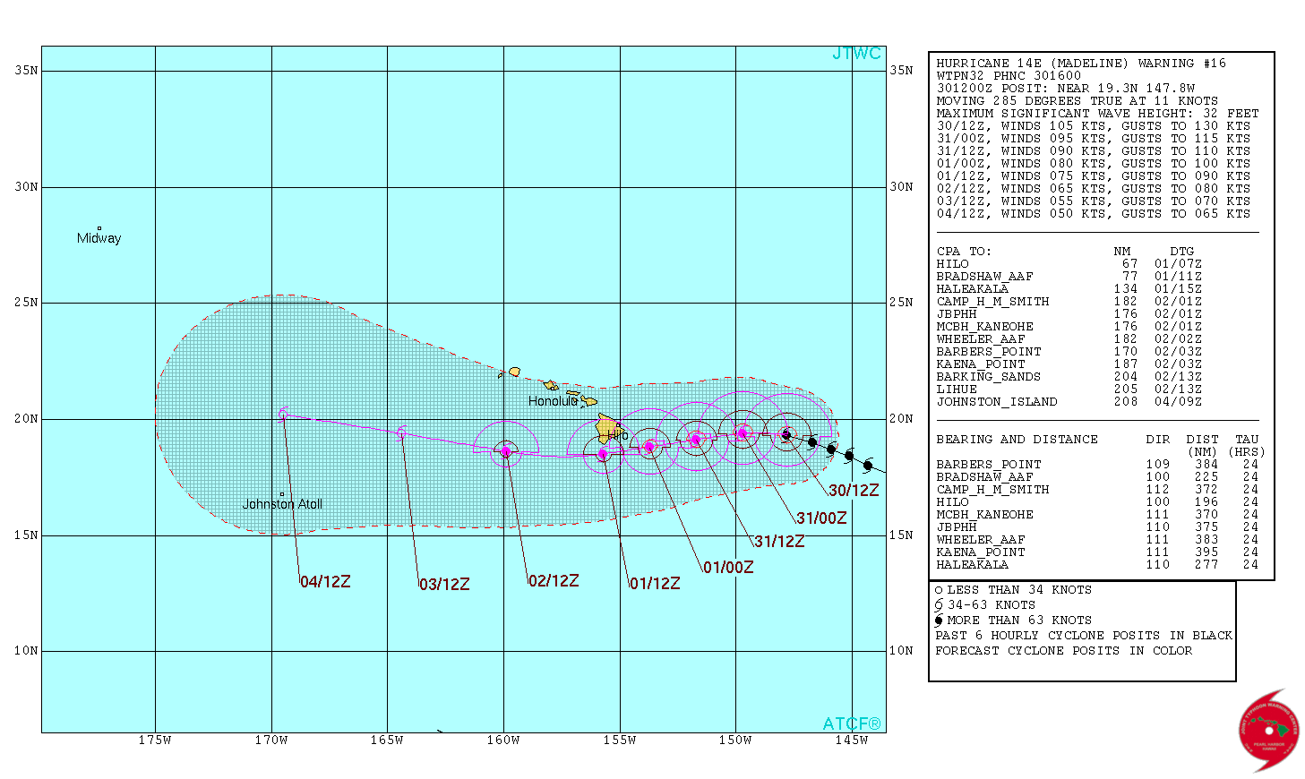
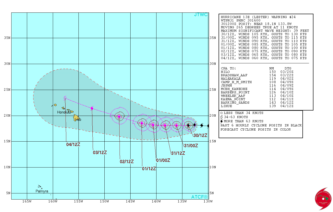
Making matters worse, Madeline is accompanied by major Hurricane Lester to its east. Lester could track just north of the Island chain in another rare event. (Two major hurricanes threatening Hawaii in the same week is a huge deal and extremely rare, if not unheard of.) To make matters more complicated, Lester and Madeline may begin to interact with each other, changing their current forecast tracks by rotating around each other. When two well-developed tropical cyclones get close to one another (usually within 700 miles) they can start to rotate around a common point between the two systems in a binary phenomena known as the Fujiawhara Effect. An otherwise straight path can curve! Madeline could be shunted safely south at the last minute, while Lester could conceivably, "unexpectedly" veer right toward Honolulu, instead of passing safely north.
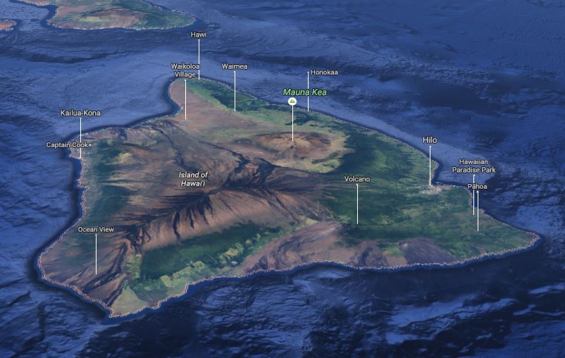
Regarding the Big Island: If history teaches us anything, it's that Madeline may weaken rapidly before making landfall. There have been four previous major hurricanes threatening in the Island of Hawaii's history: 1982's Hurricane Daniel, 1991's Hurricane Fefa, 1993's Hurricane Eugene and 2014's Hurricane Iselle. All were major hurricanes but all dissipated before making it to the Big Island. (Iselle hit hardest as a tropical storm, but the others were barely tropical depressions.) This was due to largely to cool ocean currents, which typically surround the Island. This pulls the rug from under the 'heat engine' of a tropical cyclone, causing it to collapse. But, this year the Pacific is several degrees warmer than normal around the islands and significant weakening may not happen.
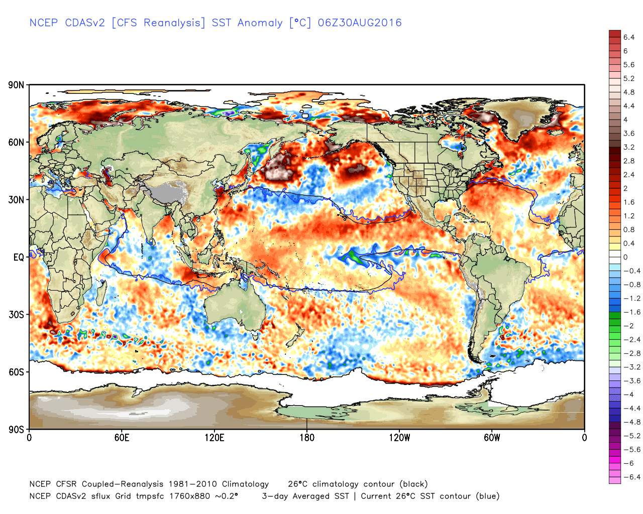
If you have vacation plans to Hawaii this week, you have friends/family there, or like me you find this stuff fascinating, be sure to stay close to the weather forecast.----------------------
UPDATE 8/31/16: The record of, "no hurricanes in recorded history" for the, "Big Island" may hold! Official forecasts from the CPHC now veer Hurricane Madeline just south of Hawaii, weakening it to nearly tropical storm strength on its approach. There may still be heavy rains and gusty winds for Hilo, but officially the system looks to be a miss, maintaining their status as, "hurricane free". Major hurricane Lester, which is several hundred miles behind Madeline, is forecast to weaken to a Cat 1 and track just north of the Hawaiian Islands.


