Despite the heavy rain that fell across much of the area on Monday, drought conditions remain split across the area.

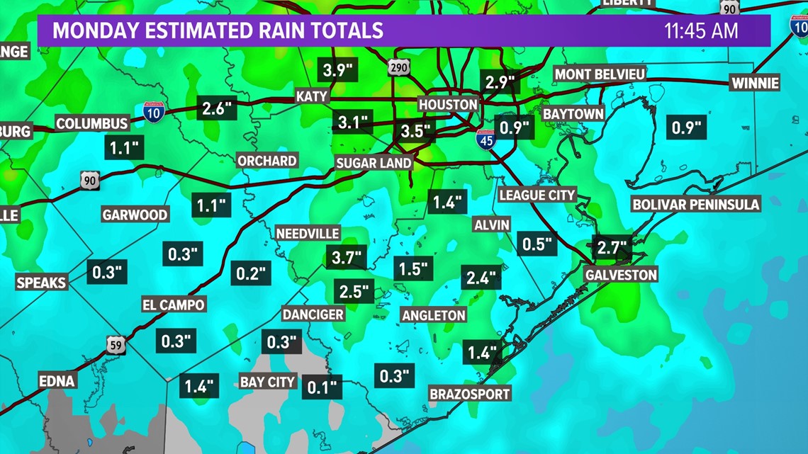
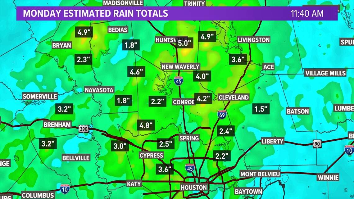
Locations that needed the most rain (i.e. Matagorda, Brazoria, Galveston, Fort Bend and Wharton counties) saw the least as the line of downpours and thunderstorms sped up and weakened as they pushed south.

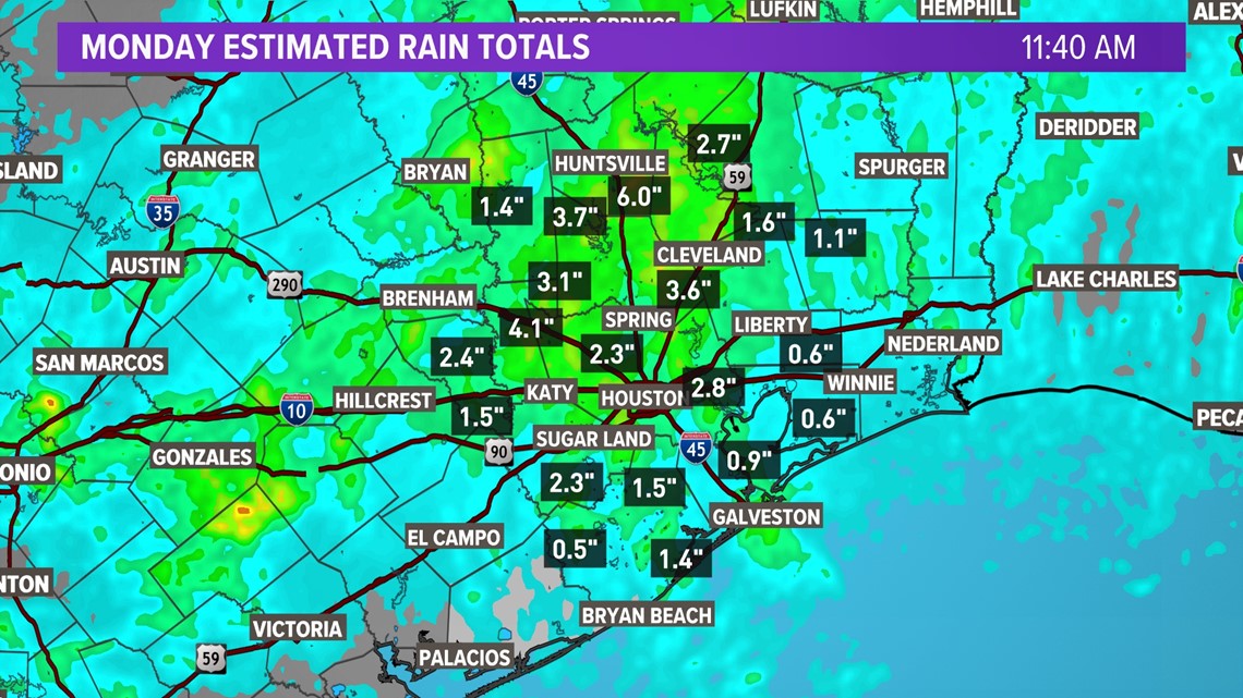
While isolated spots in these counties saw pockets of heavy rain that totaled 1-2 inches, the overall area south of I-10 saw totals around or just under an inch.

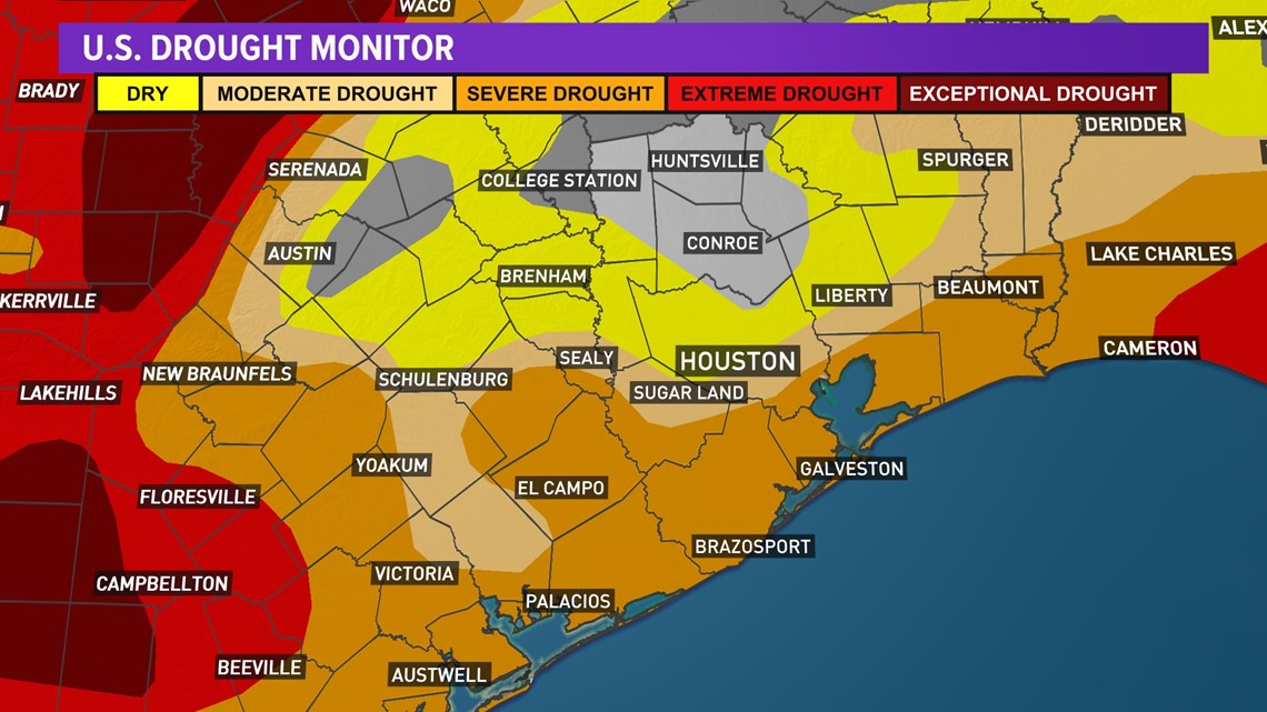
As a result, Severe drought conditions remain and even spread a bit north and west, now encompassing nearly all of Wharton and Matagorda counties.
On the flip side, areas north of I-10 saw widespread totals over 2 inches, with some spots even receiving as much as 5 to 6 inches. As a result, low end drought and dry conditions have been completely erased from Walker and most of San Jacinto and Montgomery counties.

State wide also saw little relief from higher end drought conditions. While North Texas saw enough rain to create flash flooding conditions near Dallas, much of Central and West Texas remain under extreme to exceptional drought.

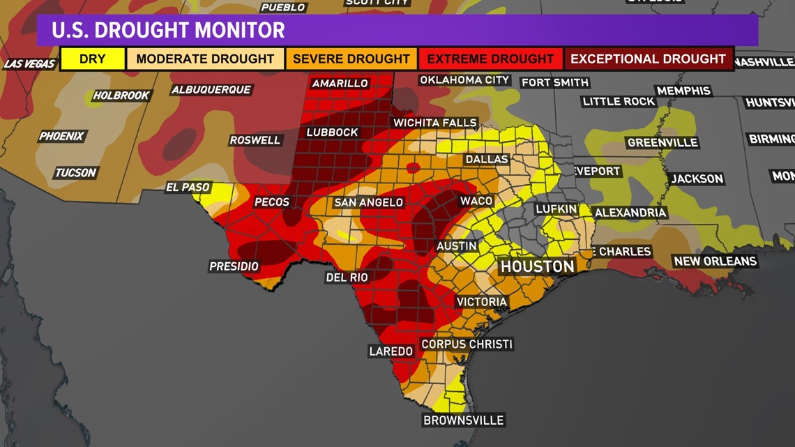
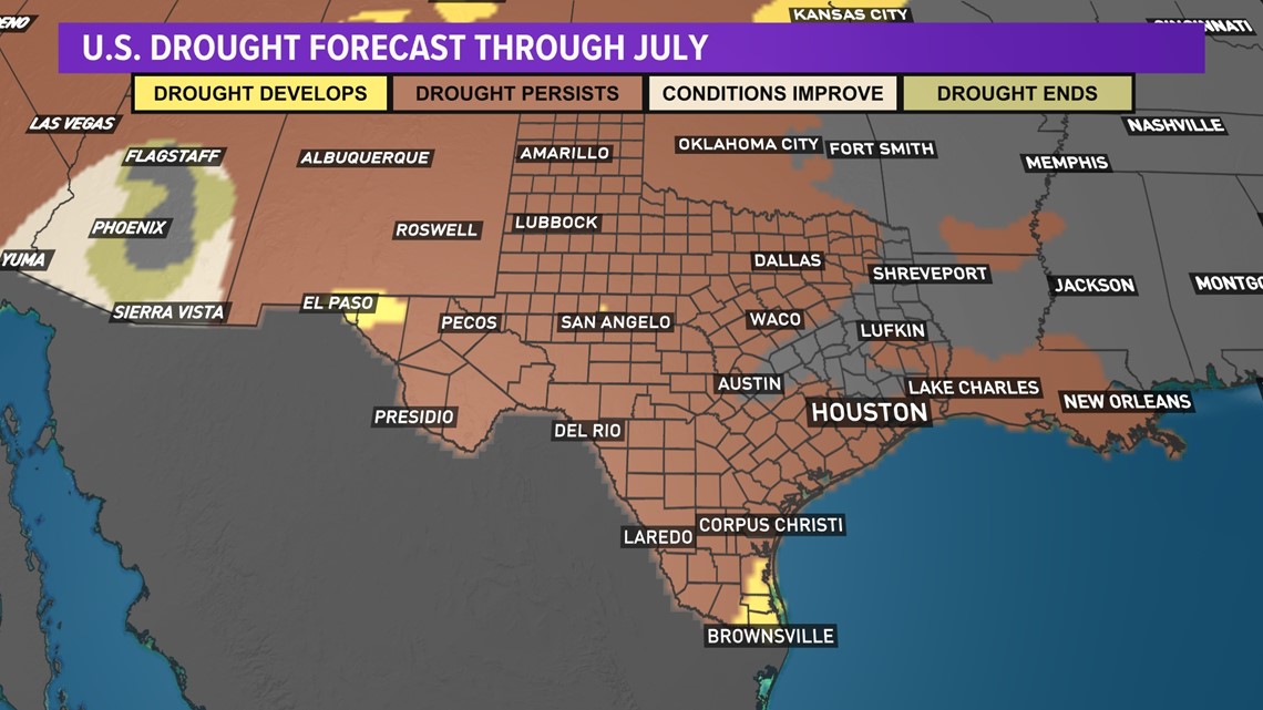
In order to see any significant changes to drought conditions across Texas, several days worth of soaking rain would need to fall across the worst affected areas. Unfortunately, the Climate Prediction Center is forecasting drought conditions to persist through the end of July for much of the state as below normal rainfall is expected.

