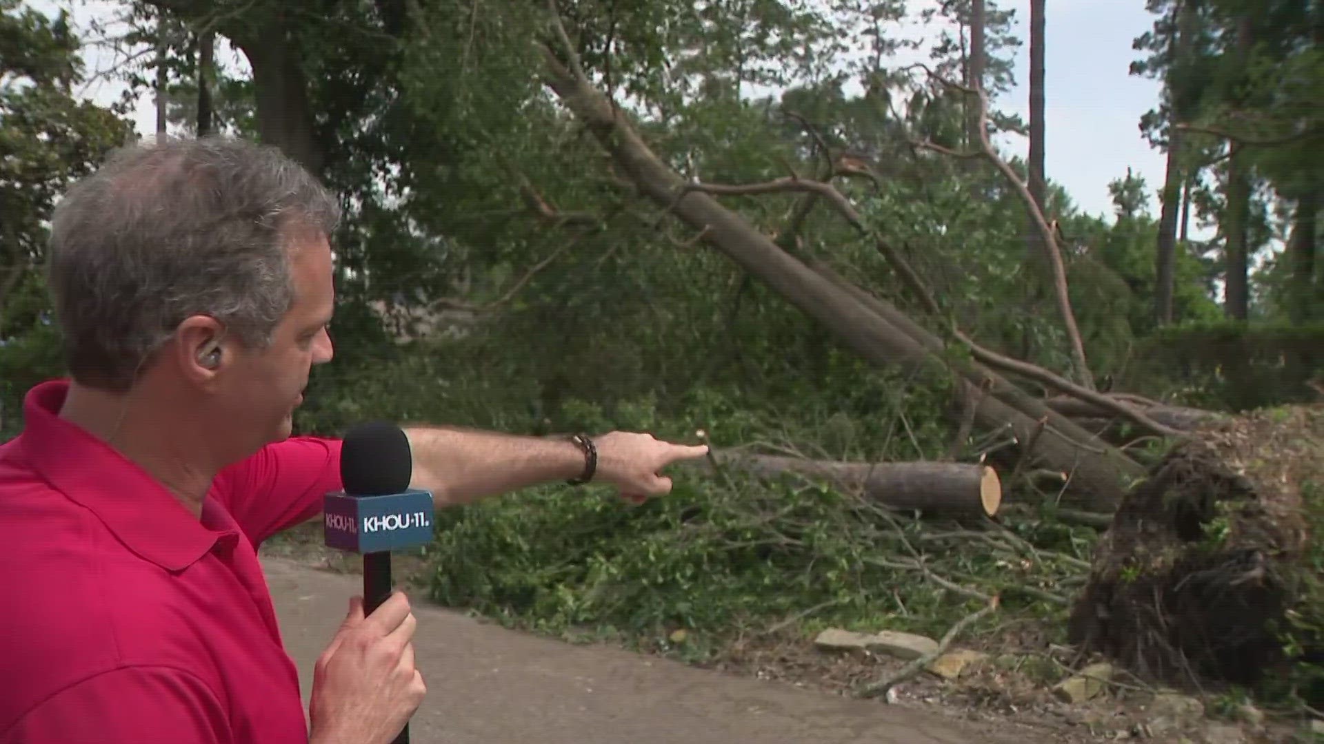
HOUSTON — Straight-line winds consistent with a microburst caused Tuesday's storm damage in the Huntsville and Willis areas, according to the National Weather Service's assessment team.
This was determined by investigating the debris pattern.
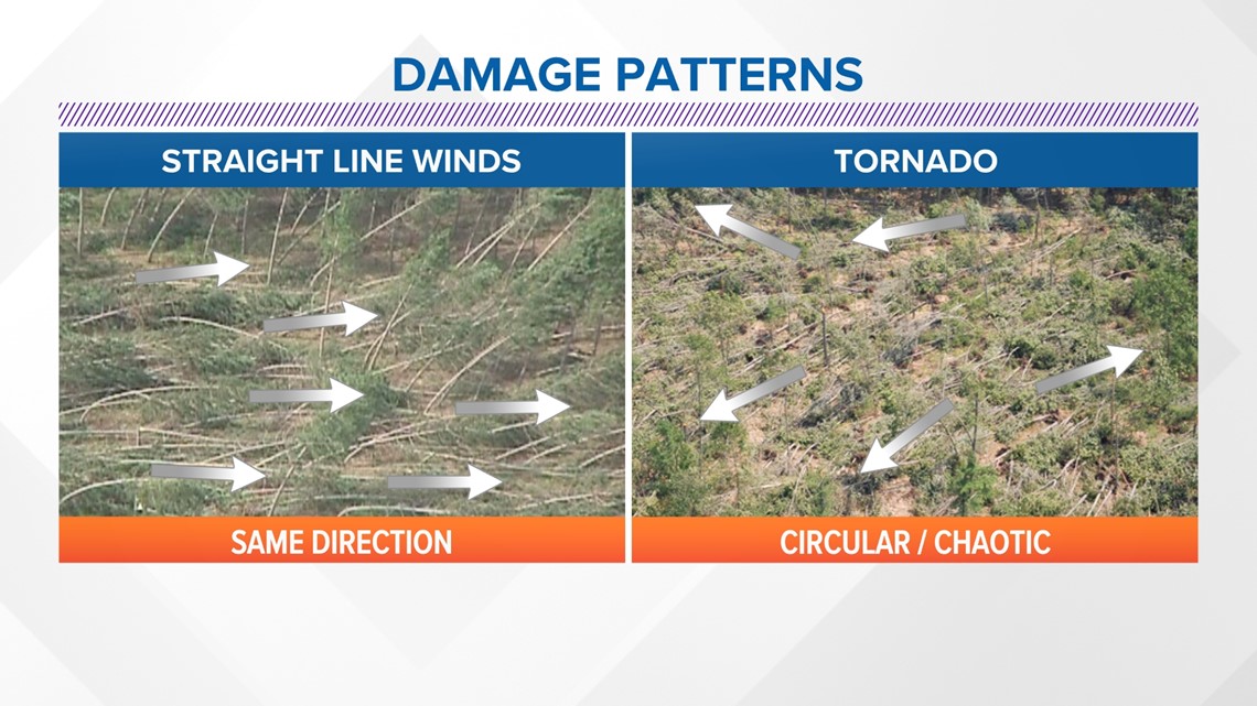
A tornado in Walker County was ruled out because if a tornado was to occur, debris would have been spread in all directions. Straight-line wind debris pattern is more confined and usually lands in the same direction, which is what was found near Huntsville and near Willis in Montgomery County.

The storms that barreled through areas north of Houston Tuesday afternoon fired up quickly, becoming strong and even severe in a matter of minutes.
A complex atmospheric setup enabled quick intensification.
Ridging via an area of high pressure in South Texas directed the storm track along the northern periphery of the high-diving southeast. The positioning was just right to set the trajectory along the I-45 corridor, almost directly from north to south.

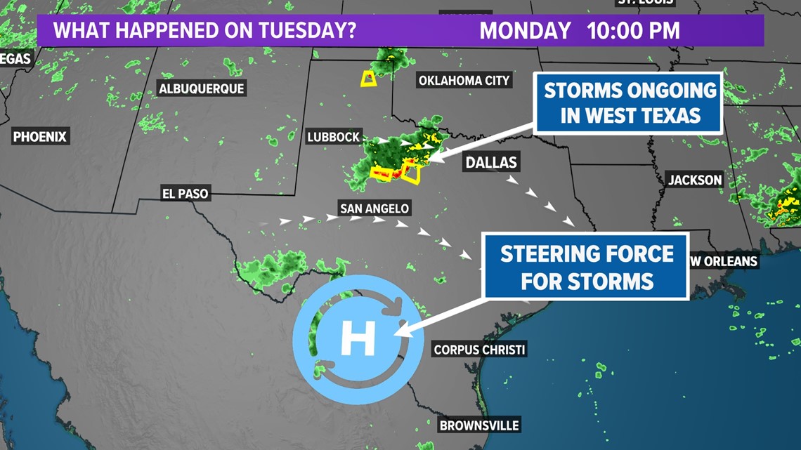
A boundary set up on the northeast edge of the ridge also provided additional lift, facilitating isolated storms to take full advantage of favorable conditions.
Multiple severe thunderstorm warnings and a single tornado warning were the results of the strong storms. Several damage reports came in from Walker and Montgomery counties.

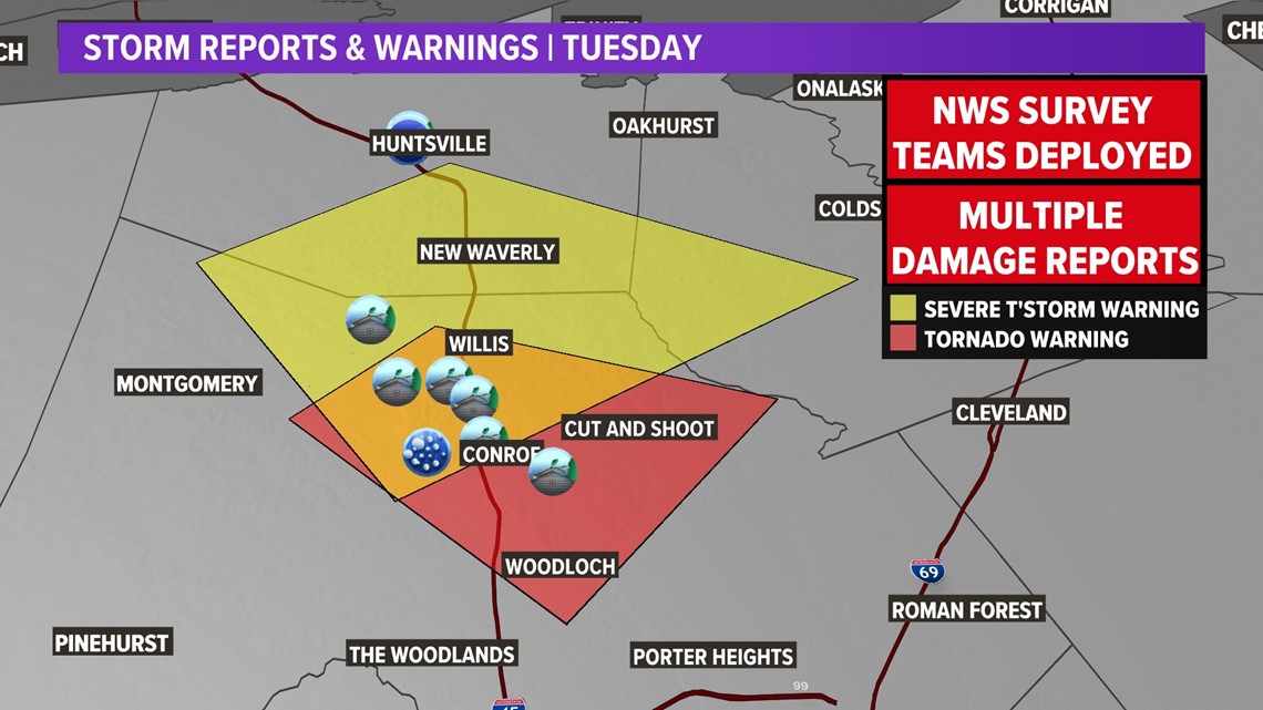
The cell that moved through the Conroe area was tornado warned. The velocity signature indicated a potential tornado. Damage reports from the surrounding areas may corroborate that claim.

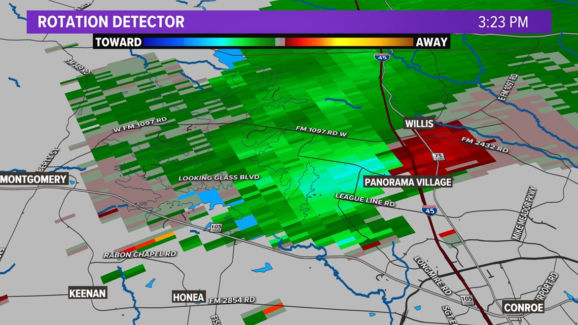
Teams will go to Montgomery County in the Conroe/Willis area to assess more widespread damage there.
Power issues continue
As of 4:30 p.m. Wednesday, Entergy Texas said it had restored power to 70% of customers affected by the storms.
Approximately 6,600 customers were still without power, down from a peak of about 22,000 Tuesday afternoon.
Extensive equipment damage in Conroe and Huntsville is adding to the challenge for more than 60 crews working to identify alternative sources of power while the damage is being repaired.

